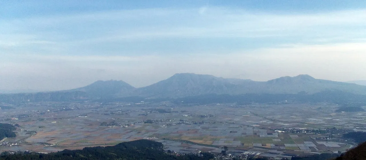
The Aso area covers seven municipalities: Aso City, Minami-Aso Village, Takamori Town, Oguni Town, Minami-Oguni Town, Ubuyama Village and Nishihara Village. Inside the caldera (25 km from north to south and 18 km from east to west) and on the outer rim around it, roads run through grassland, with viewpoints, springs and waterfalls scattered along them. This page sets out the roads and stops as a one-day or half-day route, and lists every road and place to stop.
Map of the Aso area
- Views and nature
- Roadside stations
- 1Daikanbo
- 2Kusasenri
- 3Komezuka
- 4Shiroyama viewpoint
- 5Koga Falls
- 6Oshitoishi Hill
- 7Nabegataki Falls
- 8Shirakawa Spring
- 9Tawarayama Pass viewpoint
- 10Yo-Myuru viewpoint
- 11Michi-no-eki Aso
- 12Michi-no-eki Namino
- 13Michi-no-eki Oguni
- 14Michi-no-eki Kugino
Line: Kumamoto Airport → 9 → 8 → 2 → 11 → 1 → Kumamoto Airport
The map could not be loaded. Use the junction-by-junction directions below.
The line on the map is the route described below under "First visit: one day through Minami-Aso, Kusasenri and Daikanbo". The numbers are places to stop: green for views and nature, blue for roadside stations (michi-no-eki). Hover over or tap a number to see its name.
Recommended drives
First visit: one day through Minami-Aso, Kusasenri and Daikanbo
Leave Kumamoto Airport and stop at Tawarayama Pass Observatory, Shirakawa Spring, Kusasenri-ga-hama, Michi-no-Eki Aso and Daikanbo, in that order, then return to Kumamoto Airport. You see the south of the caldera (Minami-Aso) and the northern outer rim in one day, which suits a first visit to Aso.
| Section | Distance and time | Time to spend |
|---|---|---|
| Kumamoto Airport → Tawarayama Pass Observatory | About 14 km, about 20 minutes | 20 minutes |
| Tawarayama Pass Observatory → Shirakawa Spring | About 17 km, about 20 minutes | 20 minutes |
| Shirakawa Spring → Kusasenri-ga-hama | About 17 km, about 20 minutes | 45 minutes |
| Kusasenri-ga-hama → Michi-no-Eki Aso | About 13 km, about 15 minutes | 30 minutes |
| Michi-no-Eki Aso → Daikanbo | About 15 km, about 23 minutes | 30 minutes |
| Daikanbo → Kumamoto Airport | About 40 km, about 54 minutes | — |
In all it is about 116 km and about 2 hours 30 minutes of driving, or about 5 hours with the stops. Distances are calculated from map data. Times are the official estimates where there is one for a section and calculated values where there is not. Traffic and rest breaks are not included.
Half a day: Michi-no-Eki Aso to Kusasenri and Daikanbo
Park at Michi-no-Eki Aso and take a break, then go out and back to Kusasenri-ga-hama and Daikanbo. It is about 57 km and about 1 hour of driving. Because it covers only the two best-known views of Aso, you can do it in a morning or an afternoon. The car park at Michi-no-Eki Aso has 164 spaces, and the roadside station's website shows how many are free right now.
Going on to Kuju: take the Yamanami Highway
After Kusasenri and Daikanbo, join the Yamanami Highway at Shiroyama Observatory, cross Makinoto Pass and drive on to Chojabaru. It is about 106 km from Kumamoto Airport to Chojabaru.
Roads you can drive
| Road | What it is | Length and toll | Rules |
|---|---|---|---|
| Milk Road | A road through the grassland of the northern outer rim, using Prefectural Routes 339, 12 and 45 and continuing towards the Yamanami Highway | About 45 km in total | Closed during certain hours on the grass-burning (noyaki) days every March |
| Yamanami Highway (Prefectural Route 11) | A highland road from Ichinomiya in Aso City through Kuju into Oita Prefecture | Free | Closed during certain hours on grass-burning days in Aso City |
| Aso Panorama Line | The road up to the summit area and Kusasenri, with the Bochu line on the north side and the Yoshida line on the south side | — | Closed on grass-burning days. Roads towards the summit can be restricted depending on volcanic activity |
| Aso-san Park Road | A toll road from the summit plaza up to Nakadake Crater | Standard car ¥1,000 | Closed, and the crater cannot be viewed for the time being |
| National Route 57 Northern Restoration Road | An expressway-standard road between Ozu IC and Aso-Nishi IC; the entrance from the Kumamoto side | About 13 km | Closed from 21:00 to 6:00 the next morning every night from the night of 28 October to the morning of 31 October (with spare days) |
| National Route 57 Takimuroza Road | An expressway-standard road between Namino IC and Ichinomiya IC; the entrance from the Oita side | 6.3 km, free | Opens at 16:30 on 28 November. The existing Takimuroza road closes at 200 mm of continuous rain |
| Tawarayama Tunnel Route (Prefectural Route 28) | The road into Minami-Aso from the Kumamoto Airport side. It reopened along its whole length on the pre-earthquake route on 14 September 2019 | — | — |
| Aso Suzukaze Road | A route of country roads linking Nishihara Village, Minami-Aso Village and Takamori Town with Yamato Town and Mifune Town | — | — |
Places to stop
Views and nature
The numbers are the numbers on the map.
| No. | Place | Parking | Fee and hours | When to go and notes |
|---|---|---|---|---|
| 1 | Daikanbo | 100 spaces, free, 8:00–17:00 | — | Sea of clouds in the early morning from autumn to winter. The viewpoint is about 2 minutes on foot from the car park |
| 2 | Kusasenri-ga-hama | Kusasenri car park, about 300 spaces | Standard car ¥500 (the same ticket covers the Aso-san summit car park on the same day) | Miyama-kirishima azaleas in mid to late May. Horses graze here, so keep away from them |
| 3 | Komezuka | — | — | The slope is all green from spring to summer, and covered in pampas grass in October and November |
| 4 | Shiroyama Observatory | 15 spaces, free, open 24 hours | — | The sea of clouds over the Aso valley can sometimes be seen in the early morning from spring to autumn |
| 5 | Koga Waterfall | 6 spaces, free, open 24 hours | — | Frozen waterfall in January and February. The road from the main road to the car park is narrow |
| 6 | Oshitoishi Hill | 10 spaces, free | ¥300 for high school age and over | — |
| 7 | Nabegataki Park | 123 spaces | Adults ¥300, 9:00–17:00 | On long weekends and in the Obon holidays some days need a reservation. About 3 minutes on foot from the car park to the waterfall |
| 8 | Shirakawa Spring | Free | Environmental conservation contribution ¥100 for high school age and over | You can drink the water as it is |
| 9 | Tawarayama Pass Observatory | 25 spaces, free, open 24 hours | — | Sea of clouds in September to November when conditions are right. A footpath of about 150 m climbs from the car park |
| 10 | Shin-Aso Bridge Observatory Yo-Myuru | On the observatory side and on the other side of the road. The observatory side closes at night | The observatory is always open | You can walk across the new Aso Bridge |
| — | Kabutoiwa Observatory | The car park of the shop | — | On the Milk Road. Toilets open 24 hours |
| — | Ikeyama Spring | 30 spaces | Free | The entrance is coloured with autumn leaves in autumn |
| — | Yamabuki Spring | 15 spaces | Free | About 10 minutes on foot along a forest path from the car park |
| — | Tsukimawari Park | 300 standard cars, free, open 24 hours | — | There is a lawn |
Roadside stations
| No. | Roadside station | Parking | Hours | Closed |
|---|---|---|---|---|
| 11 | Michi-no-Eki Aso | 164 spaces (10 for motorcycles) | 9:00–18:00 (changes with the season) | Open all year |
| 12 | Michi-no-Eki Namino | 144 spaces | Shop 8:00–18:00 | Second Wednesday (except August), 1 January |
| 13 | Michi-no-Eki Oguni (Yu Station) | 45 spaces | 8:30–17:00 | Open all year |
| 14 | Michi-no-Eki Aso Nozomi no Sato Kugino | 260 spaces | Local products hall 9:00–17:00 | Irregular |
Michi-no-Eki Aso and Michi-no-Eki Oguni have toilets open 24 hours and fast chargers for electric cars.
Best seasons and crowds
| When | What to see and watch for |
|---|---|
| January to February | Frozen waterfall at Koga Waterfall. Frost-coated trees at Kusasenri usually last until around mid-February |
| March | Grass burning. On some days the Milk Road, the Aso Panorama Line and other roads are closed during certain hours |
| Mid-May to early June | Miyama-kirishima azaleas. Mid to late May at Kusasenri, late May to early June at the summit |
| September to November | The season when a sea of clouds is most likely. Tawarayama Pass Observatory in September to November, Daikanbo in the early morning from autumn to winter |
| October to November | Pampas grass at Komezuka and Kabutoiwa |
A sea of clouds is most often seen from around 6:00 to 8:00 in the morning. The Aso real-time sea of clouds camera shows what it looks like now.
Nabegataki Park has days during long weekends such as Golden Week and during the Obon holidays when you cannot enter without a reservation. You can see how busy the Kusasenri car park and Michi-no-Eki Aso are right now on live cameras.
Closed roads and restrictions (as of 24 October)
- Mt. Aso is at volcanic alert level 2. You cannot go within about 1 km of Nakadake First Crater, and Aso-san Park Road is closed, so you cannot view the crater. You can still reach Kusasenri-ga-hama and the summit plaza.
- The National Route 57 Northern Restoration Road (Aso-Nishi IC to Ozu IC) is closed from 21:00 to 6:00 the next morning every night from the night of 28 October to the morning of 31 October. Spare days run until the morning of 14 November.
- The National Route 57 Takimuroza Road (Namino IC to Ichinomiya IC) opens at 16:30 on 28 November.
- Nabegataki Park is closed on 26 October and on 13, 14, 17, 24, 25 and 28 November.
- On the grass-burning days every March, the Milk Road, the Aso Panorama Line, the Yamanami Highway and other roads are closed during certain hours.
Getting there and fuel
| From | Time to Aso Station | Roads |
|---|---|---|
| Kumamoto Airport | About 50 minutes | From Ozu IC, the National Route 57 Northern Restoration Road |
| Kumamoto IC (Kyushu Expressway) | About 50 minutes | National Route 57 |
| Kumamoto Station | About 1 hour 40 minutes | Prefectural Route 22 and National Route 57 |
| Kokonoe IC (Oita Expressway) | About 1 hour 10 minutes | National Routes 387 and 212 |
| Hita IC (Oita Expressway) | About 1 hour 25 minutes | National Route 212 |
Check how much fuel you have before you drive onto the highland roads.
If you don't have a car
You can pick up a car at Kumamoto Airport, and on the one-day loop you can return it to the same shop you rented from. Driving in Japan on a foreign licence needs a 1949 Geneva international driving permit or an official Japanese translation; see Driving in Japan on a Foreign License. For how pickup and return work at an airport, see Renting a Car at Haneda, Narita or Kansai Airport: Pickup and Return.
Frequently asked questions
How long does it take to drive around Aso?
Going from Kumamoto Airport through Minami-Aso, Kusasenri and Daikanbo and back is about 116 km and about 2 hours 30 minutes of driving. Allow about 5 hours with the stops.
Where should I go if I only have half a day?
Go out and back from Michi-no-Eki Aso to Kusasenri-ga-hama and Daikanbo: about 57 km and about 1 hour of driving.
Can I see the crater of Mt. Aso?
Not as of 24 October 2026. At volcanic alert level 2 you cannot go within 1 km of the crater, and Aso-san Park Road, which climbs to the crater, is closed. You can still reach Kusasenri-ga-hama and the summit plaza.
Where and when can I see the sea of clouds?
You can sometimes see it from Daikanbo in the early morning from autumn to winter, from Tawarayama Pass Observatory in September to November, and from Shiroyama Observatory in the early morning from spring to autumn. It is most often there from around 6:00 to 8:00 in the morning.
Is there a viewpoint where I can park at night?
The car parks at Shiroyama Observatory and Tawarayama Pass Observatory are open 24 hours. The car park at Daikanbo is open from 8:00 to 17:00.
Nearby areas and guides
Sources & verification
Last verified: 2026-10-24
- Kumamoto Prefecture Tourism Site (official page, in Japanese) · 2026-10-24
- Kumamoto Prefecture Aso Regional Promotion Bureau (official page, in Japanese) · 2026-10-24
- Japan Meteorological Agency (official page, in Japanese) · 2026-10-24
- Aso Volcano Disaster Prevention Council (official page, in Japanese) · 2026-10-24
- Aso City (official page, in Japanese) · 2026-10-24
- Kumamoto Tourism Federation (official page, in Japanese) · 2026-10-24
- Kumamoto Prefecture Aso Regional Promotion Bureau (official page, in Japanese) · 2026-10-24
- MLIT Kyushu Regional Development Bureau, Kumamoto River and National Highway Office (official page, in Japanese) · 2026-10-24
- Kumamoto Prefecture Road Conservation Division (guide to JARTIC) (official page, in Japanese) · 2026-10-24
- Kumamoto Tourism Federation (official page, in Japanese) · 2026-10-24
- Kumamoto Tourism Federation (official page, in Japanese) · 2026-10-24
- Kumamoto Tourism Federation (official page, in Japanese) · 2026-10-24
- Kumamoto Tourism Federation (official page, in Japanese) · 2026-10-24
- Aso Regional Tourism Federation (official page, in Japanese) · 2026-10-24
- Night closures of the National Route 57 Northern Restoration Road (Kyushu Regional Development Bureau, in Japanese) · 2026-10-24
- Opening of the National Route 57 Takimuroza Road (Kyushu Regional Development Bureau, in Japanese) · 2026-10-24
- Temporary closures of Nabegataki Park (Oguni Town, in Japanese) · 2026-10-24
- Temporary closures of Nabegataki Park (Oguni Town, in Japanese) · 2026-10-24
- Grass-burning day closures, every year (Aso City, in Japanese) · 2026-10-24
- Aso City (official page, in Japanese) · 2026-10-24
- Kumamoto Prefecture Tourism Site (official page, in Japanese) · 2026-10-24
- Milk Road: length (source page, in Japanese) · 2026-10-24
- Yamanami Highway (Prefectural Route 11): through route (source page, in Japanese) · 2026-10-24
- Yamanami Highway (Prefectural Route 11): section (source page, in Japanese) · 2026-10-24
- Yamanami Highway (Prefectural Route 11): toll (source page, in Japanese) · 2026-10-24
- Aso Panorama Line: through route (source page, in Japanese) · 2026-10-24
- National Route 57 Northern Restoration Road: through route (source page, in Japanese) · 2026-10-24
- National Route 57 Northern Restoration Road: vehicles allowed (source page, in Japanese) · 2026-10-24
- National Route 57 Takimuroza Road: current restrictions (source page, in Japanese) · 2026-10-24
- Tawarayama Tunnel Route (Prefectural Route 28): through route (source page, in Japanese) · 2026-10-24
- Aso Suzukaze Road: crowds (source page, in Japanese) · 2026-10-24
- Daikanbo: parking (source page, in Japanese) · 2026-10-24
- Daikanbo: when to go (source page, in Japanese) · 2026-10-24
- Daikanbo: when to go (source page, in Japanese) · 2026-10-24
- Kusasenri-ga-hama: parking (source page, in Japanese) · 2026-10-24
- Kusasenri-ga-hama: parking (source page, in Japanese) · 2026-10-24
- Kusasenri-ga-hama: parking fee (source page, in Japanese) · 2026-10-24
- Kusasenri-ga-hama: parking fee (source page, in Japanese) · 2026-10-24
- Kusasenri-ga-hama: when to go (source page, in Japanese) · 2026-10-24
- Kusasenri-ga-hama: when to go (source page, in Japanese) · 2026-10-24
- Kusasenri-ga-hama: current restrictions (source page, in Japanese) · 2026-10-24
- Komezuka: when to go (source page, in Japanese) · 2026-10-24
- Shiroyama Observatory: parking (source page, in Japanese) · 2026-10-24
- Shiroyama Observatory: when to go (source page, in Japanese) · 2026-10-24
- Shiroyama Observatory: when to go (source page, in Japanese) · 2026-10-24
- Koga Waterfall: parking (source page, in Japanese) · 2026-10-24
- Koga Waterfall: when to go (source page, in Japanese) · 2026-10-24
- Oshitoishi Hill: parking (source page, in Japanese) · 2026-10-24
- Oshitoishi Hill: fee (source page, in Japanese) · 2026-10-24
- Nabegataki Park: parking (source page, in Japanese) · 2026-10-24
- Nabegataki Park: parking (source page, in Japanese) · 2026-10-24
- Shirakawa Spring: parking (source page, in Japanese) · 2026-10-24
- Shirakawa Spring: parking (source page, in Japanese) · 2026-10-24
- Shirakawa Spring: fee (source page, in Japanese) · 2026-10-24
- Tawarayama Pass Observatory: parking (source page, in Japanese) · 2026-10-24
- Tawarayama Pass Observatory: parking fee (source page, in Japanese) · 2026-10-24
- Shin-Aso Bridge Observatory Yo-Myuru: parking (source page, in Japanese) · 2026-10-24
- Shin-Aso Bridge Observatory Yo-Myuru: parking (source page, in Japanese) · 2026-10-24
- Kabutoiwa Observatory: parking (source page, in Japanese) · 2026-10-24
- Ikeyama Spring: parking (source page, in Japanese) · 2026-10-24
- Ikeyama Spring: parking (source page, in Japanese) · 2026-10-24
- Yamabuki Spring: parking (source page, in Japanese) · 2026-10-24
- Yamabuki Spring: parking (source page, in Japanese) · 2026-10-24
- Tsukimawari Park: parking (source page, in Japanese) · 2026-10-24
- Tsukimawari Park: parking fee (source page, in Japanese) · 2026-10-24
- Michi-no-Eki Aso: parking (source page, in Japanese) · 2026-10-24
- Michi-no-Eki Aso: parking (source page, in Japanese) · 2026-10-24
- Michi-no-Eki Aso: crowds (source page, in Japanese) · 2026-10-24
- Michi-no-Eki Aso: opening hours (source page, in Japanese) · 2026-10-24
- Michi-no-Eki Namino: parking (source page, in Japanese) · 2026-10-24
- Michi-no-Eki Namino: fee (source page, in Japanese) · 2026-10-24
- Michi-no-Eki Namino: opening hours (source page, in Japanese) · 2026-10-24
- Michi-no-Eki Oguni (Yu Station): parking (source page, in Japanese) · 2026-10-24
- Michi-no-Eki Oguni (Yu Station): parking (source page, in Japanese) · 2026-10-24
- Michi-no-Eki Oguni (Yu Station): fee (source page, in Japanese) · 2026-10-24
- Michi-no-Eki Oguni (Yu Station): through route (source page, in Japanese) · 2026-10-24
- Michi-no-Eki Aso Nozomi no Sato Kugino: parking (source page, in Japanese) · 2026-10-24
- Michi-no-Eki Aso Nozomi no Sato Kugino: fee (source page, in Japanese) · 2026-10-24
- Michi-no-Eki Aso Nozomi no Sato Kugino: opening hours (source page, in Japanese) · 2026-10-24
- Michi-no-Eki Aso Nozomi no Sato Kugino: opening hours (source page, in Japanese) · 2026-10-24
- OpenStreetMap (map positions and route; © OpenStreetMap contributors, ODbL; route calculated with OSRM) · 2026-10-24