This drive covers the southern Boso Peninsula in Chiba Prefecture, from Kanaya and Mount Nokogiri in Futtsu through Kyonan, Minamiboso, Tateyama and Kamogawa. Follow the coast from Uchibo on Tokyo Bay, around Tateyama and Shirahama at the peninsula's tip, to Sotobo on the Pacific.
Below is a one-day route from Hota in Kyonan through Tateyama and Shirahama to Kamogawa, with roads, stops and parking along the way.
Map of the Boso area
- Views and nature
- Roadside stations
- 1Michi-no-Eki Hota Shogakko
- 2Michi-no-Eki Tomiura Biwa Club
- 3Gake Kannon (Daifukuji)
- 4Shiroyama Park and Tateyama Castle
- 5Okinoshima
- 6Sunosaki Lighthouse
- 7Nojimazaki Lighthouse
- 8Michi-no-Eki Chikura Shiokaze Okoku
- 9Michi-no-Eki Wadaura WA-O!
- 10Niemonjima
- 11Kamogawa Sea World
- 12Mt. Nokogiri (ropeway, Nihonji)
- 13Kanaya Port (Tokyo Bay Ferry)
- 14Oyama Senmaida rice terraces
Line: 1 → 2 → 3 → 4 → 5 → 6 → 7 → 8 → 9 → 10 → 11
The map could not be loaded. Use the junction-by-junction directions below.
The line follows the route described under “A first visit: Hota to Kamogawa via Tateyama and Shirahama.” Numbered markers show the stops: green for sights and nature, blue for roadside stations. Tap a number to see its name.
Recommended drives
A first visit: Hota to Kamogawa via Tateyama and Shirahama
Start at Hota Shogakko roadside station and head south on National Route 127. Visit Tomiura Biwa Club roadside station and Gake Kannon before Shiroyama Park in Tateyama. Continue past Okinoshima and Sunosaki Lighthouse, then take the Boso Flower Line to Nojimasaki Lighthouse at the southern tip. Stop at the roadside stations in Chikura and Wadaura, then follow National Route 128 along the Pacific coast to Niemonjima Island and Kamogawa Sea World.
The route is about 100km, with around 2 hours 20 minutes of driving. Distance and time are calculated from map data and exclude traffic delays.
From Umihotaru Parking Area, Kamogawa Sea World is about 1 hour 10 minutes away via Kimitsu IC, the Boso Skyline and Prefectural Route 24.
Use Futtsu-Kanaya or Kyonan-Hota IC for Mount Nokogiri
National Route 127 is closed between Kanaya and Motona following a cliff collapse caused by Typhoon 25. Until it reopens, the Futtsu-Tateyama Road is toll-free between Futtsu-Takeoka or Futtsu-Kanaya IC and Kyonan-Hota IC.
For the Mount Nokogiri Ropeway, leave at Futtsu-Kanaya IC and drive about 5 minutes. For the vehicle entrance to Nihonji Temple, leave at Kyonan-Hota IC and head back towards Tokyo.
Sunset at Okinoshima or Nojimasaki
At Okinoshima, Mount Fuji and the sunset can be seen across Tateyama Bay. You can drive as far as the beach that connects the island to the mainland. There are sunset-viewing benches around Nojimasaki Lighthouse.
Sunset in Chiba is at 16:46 on October 31 and 16:33 on November 15.
Roads you can drive
| Road | What it connects | Length and tolls | Hours and restrictions |
|---|---|---|---|
| National Route 127 | Kanaya in Futtsu to Tateyama via Kyonan and Tomiura in Minamiboso | Free | Kanaya–Motona is closed after a cliff collapse; reopening date undecided. The Koura section in Tomiura and the Motona section close when continuous rainfall reaches 200mm |
| Tateyama Expressway and Futtsu-Tateyama Road | Kisarazu JCT and Kimitsu IC to Tomiura IC via Futtsu-Takeoka, Futtsu-Kanaya and Kyonan-Hota | Tolled. Travel between Futtsu-Takeoka or Futtsu-Kanaya IC and Kyonan-Hota IC is free until National Route 127 reopens | Use Tomiura IC for Tateyama and Minamiboso |
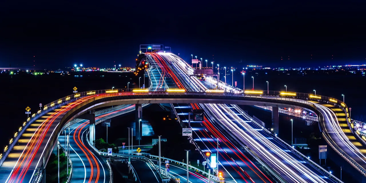
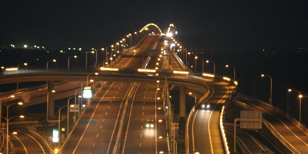
| Tokyo Bay Aqua-Line | Kawasaki-Ukishima JCT to Kisarazu-Kaneda IC via Umihotaru | Standard car with ETC: ¥800 on weekdays. Weekend and holiday rates vary by time; Kawasaki-bound travel from 13:00 to 19:00 costs ¥1,600 | May close in strong winds |
| Boso Flower Line | Shimomachi intersection in Tateyama to Wada in Minamiboso via Heisaura | About 46km; free | Rapeseed flowers from January into spring; marigolds in summer |
| National Route 128 | Wada in Minamiboso to Futomi and Kamogawa Sea World in Kamogawa | Free | Coastal road along Sotobo |
| Mount Nokogiri Tozan Motor Road and Kanko Motor Road | The west entrance near the summit and east entrance near the Great Buddha | Tozan Motor Road is tolled; Kanko Motor Road is free | Currently approach from Kyonan-Hota IC |
| Prefectural Route 34, Nagasa Kaido | Kyonan-Hota IC towards Oyama Senmaida in Kamogawa | Free | Fully closed at Ichibara in Kyonan. As of October 25, repairs were expected to take around 2 weeks |
Places to stop
Views and nature
Numbers match the map.
| No. | Place | Parking | What to know |
|---|---|---|---|
| 3 | Gake Kannon, Daifukuji Temple | — | Vermilion Kannon hall on the slopes of Mount Funakata. Open 8:00–16:30 daily |
| 4 | Shiroyama Park and Tateyama Castle | 130 spaces; standard cars free; open 24 hours | Combined castle and museum admission: adults ¥400. Castle closed Mondays |
| 5 | Okinoshima | Free parking; a contribution is requested in summer | Mount Fuji and sunset across Tateyama Bay |
| 6 | Sunosaki Lighthouse | Private paid parking only | Lighthouse at the entrance to Tokyo Bay; exterior viewable 24 hours |
| 7 | Nojimasaki Lighthouse | No lighthouse car park; free municipal parking nearby | Climbable lighthouse at the peninsula's southern tip. Admission ¥300 for junior-high-school age and above; disability certificate holders and one companion enter free. Morning hours: weekdays 9:00–12:00, weekends, holidays and certain other days 8:30–12:00. October–February afternoon hours: 13:00–16:00 |
| 10 | Niemonjima Island | No island car park; use nearby parking | About 5 minutes by boat. Adult admission ¥1,350 includes return boat fare. Open 9:00–16:00 |
| 11 | Kamogawa Sea World | 1,200 spaces; standard cars ¥1,200 per day, cash only | Adult admission ¥3,300. |
| 12 | Mount Nokogiri: ropeway and Nihonji Temple | Ropeway: 200 paid spaces. Nihonji east entrance: 50 free spaces | Ropeway return fare ¥1,200; closes at 16:00 from November 16. Nihonji admission ¥700; last entry 15:00 |
| 13 | Kanaya Port, Tokyo Bay Ferry | 60 spaces; ¥600 per entry per day | About 40 minutes to Kurihama. Standard cars under 6m long: ¥5,400 one way, including one driver |
| 14 | Oyama Senmaida | 30 free spaces; rice-terrace owners have priority on weekends | 375 rice terraces. “Tanada no Akari” illuminations run for 3 hours from sunset daily until January 11 |
Nihonji's Omotesando walking path is closed because of rockfall. At Shiroyama Park, the path from Shiki no Oka to the castle is closed following a landslide.
Roadside stations
| No. | Roadside station | Parking | What to know |
|---|---|---|---|
| 1 | Hota Shogakko | 107 standard-car spaces | Former elementary school, open 9:00–17:00. EV charger available 24 hours |
| 2 | Tomiura Biwa Club | 80 spaces | Loquat products. Open 9:15–17:00 daily; EV rapid charger available |
| 8 | Chikura Shiokaze Okoku | 177 spaces | Seafront lawn and fishing boat. Open 9:00–17:00; closed Wednesdays except January–March and August |
| 9 | Wadaura WA-O! | 75 spaces | Full blue-whale skeleton. Farm shop open 9:00–17:30 daily |
Best seasons and crowds
| Season | Highlights and cautions |
|---|---|
| Mid-December–late January | Narcissus flowers in Kyonan |
| Late December–mid-March | Chikura flower fields; flower picking from early January to mid-March |
| January–spring | Rapeseed flowers along the Boso Flower Line |
| July 18–August 23 | Attendants direct parking at Okinoshima, where contributions are collected |
| October 24–January 11 | “Tanada no Akari” illuminations at Oyama Senmaida |
Where and when it gets busy
- On weekends and holidays, Kawasaki-bound Aqua-Line traffic from Kisarazu peaks around 17:00. The return journey is quieter after 20:00.
- The Shiramazu flower fields in Chikura get very busy on holidays.
- There may be a wait for parking at Kamogawa Sea World on weekends and holidays.
- Oyama Senmaida parking is sometimes unavailable because owners use it for work on weekends and schools use it for activities on weekdays.
Road closures and restrictions as of October 26
- The roughly 1.5km section of National Route 127 between Kanaya and Motona has been closed since September 21. A reopening date has not been set.
- The Futtsu-Tateyama Road is toll-free between Futtsu-Takeoka or Futtsu-Kanaya IC and Kyonan-Hota IC until National Route 127 reopens.
- Prefectural Route 34, Nagasa Kaido, is fully closed at Ichibara in Kyonan. As of October 25, repairs were expected to take around 2 weeks.
- Prefectural Route 185 is closed at Otsu, Tomiura, Minamiboso.
Getting there and fuel
| Starting point | Approximate journey |
|---|---|
| Tokyo | 90 minutes to Tomiura IC via the Tateyama Expressway and Futtsu-Tateyama Road |
| Umihotaru Parking Area | About 1 hour 10 minutes to Kamogawa Sea World via Kimitsu IC, the Boso Skyline and Prefectural Route 24 |
| Kurihama Port | About 40 minutes to Kanaya Port by Tokyo Bay Ferry |
| Futtsu-Kanaya IC, Futtsu-Tateyama Road | About 5 minutes to the Mount Nokogiri Ropeway |
| Tomiura IC, Futtsu-Tateyama Road | About 5 minutes to Biwa Club and Gake Kannon, 20 minutes to Shiroyama Park, or 30 minutes to Nojimasaki Lighthouse |
| Kimitsu IC, Tateyama Expressway | About 60 minutes to Niemonjima via National Route 128 |
Fill up in central Kisarazu, Kimitsu or Tateyama before setting out. EV charging is available at Hota Shogakko and Tomiura Biwa Club roadside stations.
If you don't have a car
Find pickup locations in the Chiba car-rental directory. Check the driving licence and IDP guide and airport car-rental pickup guide before booking.
Frequently asked questions
Which route works for a day in Boso?
Drive from Hota to Tateyama on National Route 127, pass Okinoshima and Sunosaki Lighthouse, then take the Boso Flower Line to Nojimasaki Lighthouse. Continue through Chikura and Wadaura to Kamogawa. The route is about 100km, with around 2 hours 20 minutes of driving.
Is National Route 127 open?
The Kanaya–Motona section has been closed since September 21. Until it reopens, the Futtsu-Tateyama Road is toll-free between Futtsu-Takeoka or Futtsu-Kanaya IC and Kyonan-Hota IC.
How much is the Aqua-Line?
Standard cars with ETC pay ¥800 on weekdays. Weekend and holiday rates vary by time: Kawasaki-bound travel costs ¥1,600 from 13:00 to 19:00 and ¥400 from 20:00 to 24:00. Without ETC, the fare is ¥3,140.
How do I drive to Mount Nokogiri?
For the ropeway, leave at Futtsu-Kanaya IC and drive about 5 minutes. For Nihonji's vehicle entrance, leave at Kyonan-Hota IC and head back towards Tokyo.
Can I buy petrol in Boso?
Fill up in central Kisarazu, Kimitsu or Tateyama before setting out.
Nearby areas and guides
Sources & verification
Last verified: 2026-10-26
- MLIT Kanto Regional Development Bureau (official page, in Japanese) · 2026-10-26
- MLIT Kanto Regional Development Bureau (official page, in Japanese) · 2026-10-26
- Mount Nokogiri Ropeway (official page, in Japanese) · 2026-10-26
- Chiba Prefecture tourism guide (official page, in Japanese) · 2026-10-26
- MLIT Road Information System (official page, in Japanese) · 2026-10-26
- MLIT Kanto Regional Development Bureau (official page, in Japanese) · 2026-10-26
- MLIT Kanto Regional Development Bureau (official page, in Japanese) · 2026-10-26
- MLIT Kanto Regional Development Bureau (official page, in Japanese) · 2026-10-26
- Tokyo Bay Ferry (official page, in Japanese) · 2026-10-26
- Nihonji Temple (official page, in Japanese) · 2026-10-26
- Tokyo Bay Ferry (official page, in Japanese) · 2026-10-26
- Minamiboso Tourism Association (official page, in Japanese) · 2026-10-26
- NEXCO East (Drive Plaza) (official page, in Japanese) · 2026-10-26
- NEXCO East (Drive Plaza) (official page, in Japanese) · 2026-10-26
- Chiba Prefecture tourism guide (official page, in Japanese) · 2026-10-26
- Oyama Senmaida Preservation Association (official page, in Japanese) · 2026-10-26
- Chiba Prefecture tourism guide (official page, in Japanese) · 2026-10-26
- Umihotaru (official page, in Japanese) · 2026-10-26
- Chiba Prefecture (official page, in Japanese) · 2026-10-26
- Chiba Prefecture tourism guide (official page, in Japanese) · 2026-10-26
- NEXCO East Japan (official page, in Japanese) · 2026-10-26
- Chiba Prefecture (official page, in Japanese) · 2026-10-26
- NEXCO East (Drive Plaza) (official page, in Japanese) · 2026-10-26
- Tateyama Tourism Association (official page, in Japanese) · 2026-10-26
- Chiba Prefecture (official page, in Japanese) · 2026-10-26
- Chiba Prefecture (official page, in Japanese) · 2026-10-26
- Chiba Prefecture tourism guide (official page, in Japanese) · 2026-10-26
- Chiba Prefecture tourism guide (official page, in Japanese) · 2026-10-26
- Chiba Prefecture tourism guide (official page, in Japanese) · 2026-10-26
- Niemonjima Island (official page, in Japanese) · 2026-10-26
- Chiba Prefecture tourism guide (official page, in Japanese) · 2026-10-26
- Chiba Prefecture tourism guide (official page, in Japanese) · 2026-10-26
- Chiba Prefecture (official page, in Japanese) · 2026-10-26
- Nihonji Temple (official page, in Japanese) · 2026-10-26
- Chiba Prefecture tourism guide (official page, in Japanese) · 2026-10-26
- Nihonji Temple (official page, in Japanese) · 2026-10-26
- Mount Nokogiri Ropeway (official page, in Japanese) · 2026-10-26
- Chiba Prefecture tourism guide (official page, in Japanese) · 2026-10-26
- Mount Nokogiri Ropeway (official page, in Japanese) · 2026-10-26
- Nihonji Temple (official page, in Japanese) · 2026-10-26
- Tokyo Bay Ferry (official page, in Japanese) · 2026-10-26
- Tokyo Bay Ferry (official page, in Japanese) · 2026-10-27
- Chiba Prefecture tourism guide (official page, in Japanese) · 2026-10-26
- Tokyo Bay Ferry (official page, in Japanese) · 2026-10-26
- Chiba Prefecture tourism guide (official page, in Japanese) · 2026-10-26
- Tateyama Tourism Association (official page, in Japanese) · 2026-10-26
- Chiba Prefecture tourism guide (official page, in Japanese) · 2026-10-26
- Tateyama City (official page, in Japanese) · 2026-10-26
- Tateyama City (official page, in Japanese) · 2026-10-27
- Tateyama Castle (official page, in Japanese) · 2026-10-26
- Tateyama Tourism Association (official page, in Japanese) · 2026-10-26
- Tokokai Lighthouse Association (official page, in Japanese) · 2026-10-27
- Kanto Michi-no-Eki Association (official page, in Japanese) · 2026-10-26
- Kamogawa Sea World (official page, in Japanese) · 2026-10-26
- Kamogawa Sea World (official page, in Japanese) · 2026-10-27
- Kamogawa Sea World (official page, in Japanese) · 2026-10-26
- Niemonjima Island (official page, in Japanese) · 2026-10-26
- Chiba Prefecture tourism guide (official page, in Japanese) · 2026-10-26
- Oyama Senmaida Preservation Association (official page, in Japanese) · 2026-10-26
- Oyama Senmaida Preservation Association (official page, in Japanese) · 2026-10-26
- Oyama Senmaida Preservation Association (official page, in Japanese) · 2026-10-26
- Hota Shogakko roadside station (official page, in Japanese) · 2026-10-26
- Kanto Michi-no-Eki Association (official page, in Japanese) · 2026-10-26
- Kanto Michi-no-Eki Association (official page, in Japanese) · 2026-10-26
- Tomiura Biwa Club roadside station (official page, in Japanese) · 2026-10-26
- Minamiboso Tourism Association (official page, in Japanese) · 2026-10-26
- Chiba Prefecture tourism guide (official page, in Japanese) · 2026-10-26
- Kanto Michi-no-Eki Association (official page, in Japanese) · 2026-10-26
- Chikura Shiokaze Okoku roadside station (official page, in Japanese) · 2026-10-26
- Kanto Michi-no-Eki Association (official page, in Japanese) · 2026-10-26
- Chiba Prefecture tourism guide (official page, in Japanese) · 2026-10-26
- Kanto Michi-no-Eki Association (official page, in Japanese) · 2026-10-26
- MLIT Kanto Regional Development Bureau (official page, in Japanese) · 2026-10-26
- Minamiboso Tourism Association (official page, in Japanese) · 2026-10-26
- National Astronomical Observatory of Japan (official page, in Japanese) · 2026-10-26
- National Astronomical Observatory of Japan (official page, in Japanese) · 2026-10-26
- National Astronomical Observatory of Japan (official page, in Japanese) · 2026-10-26
- Japan Meteorological Agency (official page, in Japanese) · 2026-10-26
- Japan Meteorological Agency (official page, in Japanese) · 2026-10-26
- OpenStreetMap (map positions and route; © OpenStreetMap contributors, ODbL; route calculated with OSRM) · 2026-10-26