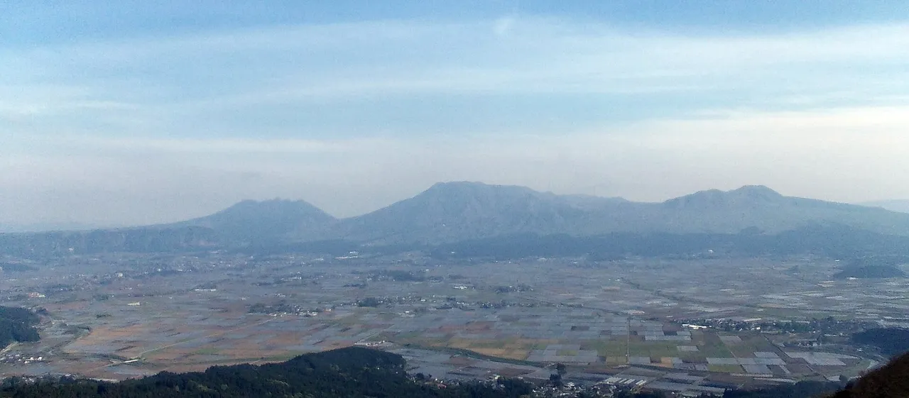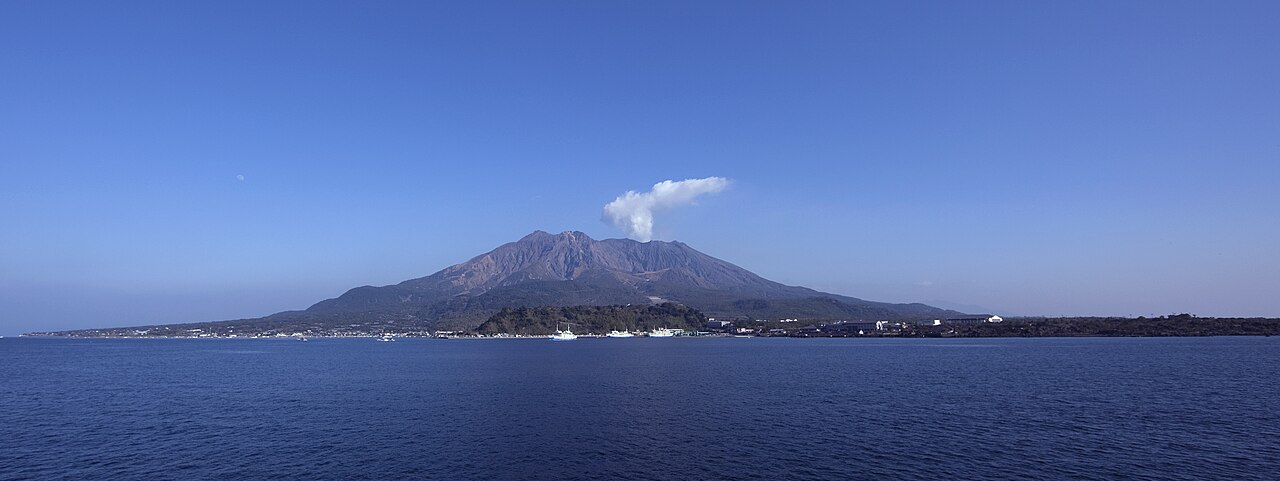
The Kirishima and Sakurajima area runs from the north-east of Kagoshima Prefecture down to Kinko Bay. It covers the foot of the Kirishima mountains in Kirishima, Ebino Plateau in Ebino in Miyazaki Prefecture, Sakurajima in Kagoshima City, and Tarumizu. In the north you can climb from Kirishima Jingu via Takachihogawara and Kirishima Onsen to Ebino Plateau. In the south you can loop Sakurajima past its lava viewpoints. Sakurajima and central Kagoshima are about 15 minutes apart by the Sakurajima Ferry.
This guide follows a day around Kirishima and along Kinko Bay to Sakurajima, with roads and places to stop listed below.
Map of Kirishima and Sakurajima
- Views and nature
- Roadside stations
- 1Kirishima Jingu
- 2Michi-no-Eki Kirishima
- 3Takachiho-gawara
- 4Maruo Falls
- 5Kirishima Onsen
- 6Ebino Plateau
- 7Michi-no-Eki Sakurajima
- 8Yunohira Observatory
- 9Kurokami buried torii
- 10Arimura Lava Observatory
- 11Sakurajima Visitor Center
- 12Michi-no-Eki Tarumizu
- 13Michi-no-Eki Ebino
Line (north): 1 → 2 → 3 → 4 → 5 → 6. Line (south): 7 → 8 → 9 → 10 → 7
The map could not be loaded. Use the junction-by-junction directions below.
The two lines follow the route under "First visit: one day around Kirishima and a loop of Sakurajima" below: Kirishima in the north and the Sakurajima loop in the south. Numbers mark the stops: green for scenery and nature, blue for roadside stations. Tap a marker to see its name.
Recommended drives
First visit: one day around Kirishima and a loop of Sakurajima
From Kirishima Jingu and Michi-no-Eki Kirishima, a roadside station, climb to Takachihogawara, then pass Maruo Falls and Kirishima Onsen to Ebino Plateau. This part is about 41 km, with around 40 minutes of driving.
From Kokubu IC, follow Route 220 along Kinko Bay towards Sakurajima Port (about 60 minutes by road). From Michi-no-Eki Sakurajima, loop the island via Yunohira Observatory, Kurokami Buried Torii and Arimura Lava Observatory. The loop is about 41 km, with around 1 hour 10 minutes of driving. You can return by Sakurajima Ferry to Kagoshima Port.
Distances and times are calculated from map data and exclude traffic.
Volcano restrictions
Sakurajima is at volcanic alert level 3 (do not approach the volcano). You cannot enter within 2 km of Minamidake summit crater and Showa crater.
Shinmoedake is at level 2. You cannot enter within about 2 km of the crater, and most climbing routes are closed. Prefectural Routes 480 and 104 up to Takachihogawara are open.
Mt Io on Ebino Plateau is at level 1, but Prefectural Route 1 near Mt Io is closed. During provisional weekend opening, only roofed vehicles can pass, from 09:00 to 17:00, and volcanic activity or weather can close the road. The most recent notice covered 31 October and 1 November 2026. You can reach Ebino Plateau from both the Kirishima side and the Ebino side.
If ash falls
Avoid driving when 1 mm or more of ash has fallen. With 0.1 mm to less than 1 mm, white lines become hard to see, so slow down. With less than 0.1 mm, still clear the ash from your windscreen before you drive. On Sakurajima, Route 224 from Kagata-Shindo to Akagi-cho (11.2 km) closes when debris flows or explosions are a danger.
Roads you can drive
| Road | What to expect | Length and cost | Hours and restrictions |
|---|---|---|---|
| Kyushu Expressway | Kagoshima IC via Mizobe-Kagoshima-Kuko IC and Yokogawa IC to Ebino IC | Tolled | — |
| Hayato Road and Higashi-Kyushu Expressway | Kajiki Junction to Hayato-Higashi IC and Kokubu IC | Hayato Road 7.3 km; tolled | — |
| Route 223 | Hayato via Makizono and Kirishima Onsen to Kirishima Jingu | Free | Fully closed at Kareigawa; alternating one-way traffic at Shukukubota |
| Prefectural Route 1, Kobayashi–Ebino Kogen–Makizono Line | Maruo via Ebino Plateau and Mt Io to Kobayashi | Free | Closed near Mt Io (during provisional weekend opening, roofed vehicles only, 09:00–17:00; volcanic activity or weather can close it). Chains needed in winter |
| Route 224 and the Sakurajima loop road | Sakurajima Port around the south of the island to Kagata in Tarumizu. The full loop is about 36 km | Free | Explosions or debris flows can close it |
| Sakurajima Ferry | Kagoshima Port to Sakurajima Port, about 15 minutes | Cars under 6 m, including the driver, ¥1,280–2,630 one way; each adult passenger ¥250 | From Kagoshima Port 04:30–23:30; from Sakurajima Port 04:00–23:00 |
| Route 220 | Kokubu via Fukuyama and Ushine to Tarumizu, along Kinko Bay | Free | Ushine-zakai closes at 200 mm of continuous rainfall |
Places to stop
Views and nature
Numbers match the map.
| No. | Place | Parking | What to know |
|---|---|---|---|
| 1 | Kirishima Jingu | 500 spaces; free | Open for worship at all hours. Amulet office 08:00–17:00. Autumn colours in late November |
| 3 | Takachihogawara | 200 spaces (¥500 for ordinary cars) | Visitor centre free, 09:00–17:00, closed Mondays (the next day if a holiday). Autumn colours in early November. Near the Shinmoedake 2 km restriction |
| 4 | Maruo Falls | — | Lit from sunset until 21:30. Autumn colours in mid-November |
| 5 | Kirishima Onsen (Kirishima Onsen Market) | 52 spaces; free | Shops 08:30–18:00 |
| 6 | Ebino Plateau | Ashiyu-no-Eki foot-bath stop 8 spaces, free; Eco-Museum Centre ¥500 per day | Foot-bath stop 09:00–17:00. No entry around Mt Io |
| 8 | Yunohira Observatory | About 30 spaces | Viewpoint at 373 m above sea level. Open all year |
| 9 | Kurokami Buried Torii | 7 spaces; free | A torii gate buried by an eruption. Free to view |
| 10 | Arimura Lava Observatory | 30 spaces; free | A walking path of about 1 km. Open all year |
| 11 | Sakurajima Visitor Center | 19 ordinary cars; free | Free entry, 09:00–17:00, open all year |
Roadside stations
| No. | Roadside station | Parking | What to know |
|---|---|---|---|
| 2 | Michi-no-Eki Kirishima | About 250 spaces; free, 24 hours | Kirishima Shinwa-no-Sato Park. Shop 09:00–17:00, open daily |
| 7 | Michi-no-Eki Sakurajima | 89 spaces; free | Near Sakurajima Port. 09:00–17:00. Closed 16 November |
| 12 | Michi-no-Eki Tarumizu | 140 spaces | On Kinko Bay. 09:00–19:00. Hot spring 13:00–20:00 (closed Wednesdays, open on holidays). Closed 18 November |
| 13 | Michi-no-Eki Ebino | — | Right beside Ebino IC. Direct-sales shop 09:00–18:00, closed third Tuesdays (the next day if a holiday), and also 1–2 January |
Best seasons and crowds
| Season | Highlights and cautions |
|---|---|
| Early November | Autumn colours on Route 1 and at Takachihogawara |
| Mid-November | Autumn colours at Maruo, Onami Pond and on Route 480 |
| Late November | Autumn colours at Kirishima Jingu and along Route 223 |
| Late December to late February | Chains often needed on Routes 1, 30 and 104 |
On the Kirishima City update of 28 October, autumn colours on Route 1 and at Maruo and Takachihogawara were just beginning.
On 15 November, sunset in Kagoshima is at 17:19.
Busy places and times
- In the autumn-colour season, more cars park at the roadside around Kirishima Jingu and near the Onami Pond trailhead.
- The Sakurajima Ferry can have waits of 30 minutes or more.
Roads and restrictions checked on 2 November 2026
- Sakurajima is at volcanic alert level 3 and Shinmoedake at level 2.
- Route 1 near Mt Io is closed. During provisional weekend opening, roofed vehicles can pass from 09:00 to 17:00. Volcanic activity or weather can close it.
- Route 223 is fully closed at Kareigawa, with alternating one-way traffic at Shukukubota.
Getting there and fuel
| Starting point | Approximate drive |
|---|---|
| Central Kagoshima | Mizobe-Kagoshima-Kuko IC 40 minutes |
| Mizobe-Kagoshima-Kuko IC | Kirishima Jingu and Maruo Falls about 40 minutes; Takachihogawara about 50 minutes |
| Takaharu IC, Miyazaki Expressway | Takachihogawara about 40 minutes; Ebino Plateau about 55 minutes |
| Ebino IC, Kyushu Expressway | Ebino Plateau about 30 minutes |
| Kagoshima Airport | Ebino Plateau about 50 minutes; Sakurajima via the ferry about 70 minutes |
| Kokubu IC | Michi-no-Eki Tarumizu 30 minutes on Route 220 |
Refuel in Kirishima or Kagoshima city before heading into the Kirishima mountains or the east side of Sakurajima.
In winter, chains are often needed on Routes 1, 30 and 104, and chain controls can apply on the roads to Ebino Plateau. Fit winter tyres for winter travel.
If you don't have a car
Use the Kagoshima rental-car listings to find a pickup location. Before booking, check the driving-permit requirements.
Frequently asked questions
Can I see Kirishima and Sakurajima in one day?
Yes. It is about 41 km from Kirishima Jingu via Takachihogawara and Kirishima Onsen to Ebino Plateau, about 60 minutes by road from Kokubu on Route 220 towards Sakurajima Port, and about 41 km around Sakurajima. You can return by Sakurajima Ferry to Kagoshima Port.
How much is the Sakurajima Ferry?
Cars under 6 m, including the driver, cost ¥1,280–2,630 one way, and each adult passenger pays ¥250. It runs 04:30–23:30 from Kagoshima Port and 04:00–23:00 from Sakurajima Port, and the crossing takes about 15 minutes.
Can eruptions on Sakurajima stop me driving?
Sakurajima is at level 3, so you cannot enter within 2 km of the craters. Route 224 from Kagata-Shindo to Akagi-cho closes when explosions or debris flows are a danger. Avoid driving when 1 mm or more of ash has settled.
Can I drive to Ebino Plateau?
Yes, from both the Kirishima and Ebino sides. Route 1 near Mt Io is closed. During provisional weekend opening, roofed vehicles can pass from 09:00 to 17:00, and volcanic activity or weather can close it.
Can I drive here in winter?
Chains are often needed on Routes 1, 30 and 104 from late December to late February.
Nearby areas and guides
Sources & verification
Last verified: 2026-11-02
- Kagoshima City (official page, in Japanese) · 2026-10-27
- Kirishima City (official page, in Japanese) · 2026-10-27
- Ebino City (official page, in Japanese) · 2026-10-27
- Kagoshima Prefecture (official page, in Japanese) · 2026-10-27
- Kirishima City Tourism Association (official page, in Japanese) · 2026-10-27
- Kagoshima Prefecture (official page, in Japanese) · 2026-10-27
- MLIT Kyushu Regional Development Bureau (official page, in Japanese) · 2026-10-27
- Kagoshima Prefecture (official page, in Japanese) · 2026-11-02
- Kirishima City (official page, in Japanese) · 2026-11-02
- MLIT Kyushu Regional Development Bureau (official page, in Japanese) · 2026-10-27
- Kirishima City Tourism Association (official page, in Japanese) · 2026-10-27
- Ebino City (official page, in Japanese) · 2026-10-27
- Kirishima City (official page, in Japanese) · 2026-10-27
- Ebino City (official page, in Japanese) · 2026-10-27
- Miyazaki Prefecture (official page, in Japanese) · 2026-11-02
- Ebino City (official page, in Japanese) · 2026-10-27
- Kirishima City Tourism Association (official page, in Japanese) · 2026-11-02
- Miyazaki Prefecture (official page, in Japanese) · 2026-10-27
- MLIT Kyushu Regional Development Bureau (official page, in Japanese) · 2026-11-02
- Sakurajima Visitor Center (official page, in Japanese) · 2026-10-27
- Sakurajima tourism portal (official page, in Japanese) · 2026-10-27
- Japan Meteorological Agency (official page, in Japanese) · 2026-10-27
- Kirishima City (official page, in Japanese) · 2026-10-27
- Kagoshima City (official page, in Japanese) · 2026-10-27
- Kagoshima City (official page, in Japanese) · 2026-10-27
- Kagoshima City (official page, in Japanese) · 2026-10-27
- Kagoshima City (official page, in Japanese) · 2026-10-27
- Kagoshima City (official page, in Japanese) · 2026-10-27
- Kagoshima Prefecture (official page, in Japanese) · 2026-10-27
- Kagoshima City (official page, in Japanese) · 2026-10-27
- Kagoshima City (official page, in Japanese) · 2026-10-27
- Kagoshima City (official page, in Japanese) · 2026-11-02
- Kagoshima City (official page, in Japanese) · 2026-10-27
- Kagoshima City (official page, in Japanese) · 2026-10-27
- Kagoshima City (official page, in Japanese) · 2026-10-27
- Kagoshima Prefecture (official page, in Japanese) · 2026-10-27
- Kirishima Jingu (official page, in Japanese) · 2026-10-27
- Kagoshima Prefecture (official page, in Japanese) · 2026-10-27
- Kirishima City (official page, in Japanese) · 2026-10-27
- Kirishima Jingu (official page, in Japanese) · 2026-10-27
- Kirishima Jingu (official page, in Japanese) · 2026-10-27
- Kirishima City (official page, in Japanese) · 2026-10-27
- Kirishima City Tourism Association (official page, in Japanese) · 2026-10-27
- Kirishima City Tourism Association (official page, in Japanese) · 2026-10-27
- Kagoshima Prefecture (official page, in Japanese) · 2026-10-27
- Miyazaki Prefecture (official page, in Japanese) · 2026-10-27
- Kagoshima Prefecture (official page, in Japanese) · 2026-10-27
- Kagoshima Prefecture (official page, in Japanese) · 2026-10-27
- Japan Meteorological Agency (official page, in Japanese) · 2026-11-02
- Kagoshima City (official page, in Japanese) · 2026-10-27
- Kagoshima Prefecture (official page, in Japanese) · 2026-10-27
- Kagoshima City (official page, in Japanese) · 2026-10-27
- Kagoshima Prefecture tourism site (official page, in Japanese) · 2026-10-27
- Kagoshima Prefecture (official page, in Japanese) · 2026-10-27
- Kagoshima Prefecture (official page, in Japanese) · 2026-10-27
- Kagoshima Prefecture tourism site (official page, in Japanese) · 2026-10-27
- Sakurajima Visitor Center (official page, in Japanese) · 2026-10-27
- Kagoshima Prefecture (official page, in Japanese) · 2026-10-27
- Kagoshima Prefecture tourism site (official page, in Japanese) · 2026-10-27
- Sakurajima tourism portal (official page, in Japanese) · 2026-10-27
- Kagoshima Prefecture (official page, in Japanese) · 2026-10-27
- MLIT Kyushu Regional Development Bureau (official page, in Japanese) · 2026-11-02
- Kagoshima Prefecture (official page, in Japanese) · 2026-10-27
- Tarumizu City (official page, in Japanese) · 2026-10-27
- Tarumizu City (official page, in Japanese) · 2026-10-27
- Tarumizu City (official page, in Japanese) · 2026-10-27
- MLIT Kyushu Regional Development Bureau (official page, in Japanese) · 2026-10-27
- Japan Meteorological Agency (official page, in Japanese) · 2026-10-27
- Japan Meteorological Agency (official page, in Japanese) · 2026-10-27
- Sakurajima tourism portal (official page, in Japanese) · 2026-10-27
- MLIT Kyushu Regional Development Bureau (official page, in Japanese) · 2026-10-27
- NEXCO West Japan (official page, in Japanese) · 2026-10-27
- Miyazaki Prefecture road restriction information (official page, in Japanese) · 2026-10-27
- Japan Meteorological Agency (official page, in Japanese) · 2026-10-27
- MLIT Kyushu Regional Development Bureau (official page, in Japanese) · 2026-10-27
- Japan Meteorological Agency (official page, in Japanese) · 2026-10-27
- Japan Meteorological Agency (official page, in Japanese) · 2026-10-27
- Japan Meteorological Agency (official page, in Japanese) · 2026-11-02
- Japan Meteorological Agency (official page, in Japanese) · 2026-10-27
- National Astronomical Observatory of Japan (official page, in Japanese) · 2026-10-27
- National Astronomical Observatory of Japan (official page, in Japanese) · 2026-10-27
- Japan Meteorological Agency (official page, in Japanese) · 2026-10-27
- Japan Meteorological Agency (official page, in Japanese) · 2026-10-27
- OpenStreetMap (map positions and route; © OpenStreetMap contributors, ODbL; route calculated with OSRM) · 2026-10-27
- Kagoshima City (official page, in Japanese) · 2026-10-27