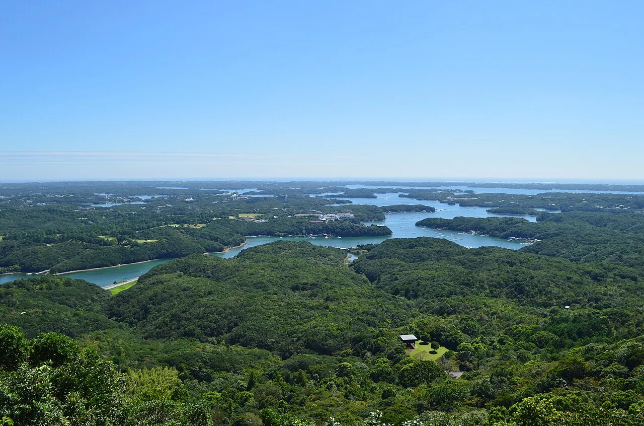
The Nanki and Kumano area lies in the south of Wakayama Prefecture. Shirahama, Susami, Kushimoto, Nachikatsuura and Shingu line the southern coast of the Kii Peninsula, with Hongu in Tanabe in the mountains inland. Heading south from Shirahama on the coastal Route 42 takes you past Cape Shionomisaki, the southernmost point of Honshu, and Hashigui-iwa to Nachikatsuura and Shingu, home to Nachi Falls and Kumano Hayatama Taisha. For Kumano Hongu Taisha, follow Route 168 up the Kumano River from Shingu.
This guide follows a day from Shirahama around Cape Shionomisaki to Shingu, with roads and places to stop listed below.
Map of Nanki and Kumano
- Views and nature
- Roadside stations
- 1Sandanbeki cliffs
- 2Senjojiki rock shelf
- 3Michi-no-Eki Susami
- 4Cape Shionomisaki
- 5Michi-no-Eki Kushimoto Hashigui-iwa
- 6Nachi Falls
- 7Kumano Hayatama Taisha
- 8Engetsuto Island
- 9Shirarahama Beach
- 10Shionomisaki Lighthouse
- 11Kashinozaki Lighthouse
- 12Kumano Nachi Taisha and Seigantoji
- 13Kumano Hongu Taisha
- 14Oyunohara
- 15Michi-no-Eki Mushikui-iwa
- 16Michi-no-Eki Oku-Kumano Kodo Hongu
- 17Michi-no-Eki Kumano Kodo Nakahechi
Line: 1 → 2 → 3 → 4 → 5 → 6 → 7
The map could not be loaded. Use the junction-by-junction directions below.
The line follows the route under "First visit: one day from Shirahama around Cape Shionomisaki to Shingu" below. Numbers mark the stops: green for scenery and nature, blue for roadside stations. Tap a marker to see its name.
Recommended drives
First visit: one day from Shirahama around Cape Shionomisaki to Shingu
From Sandanbeki and Senjojiki in Shirahama, take the free section of the Kisei Expressway to Michi-no-Eki Susami, a roadside station, then follow Route 42 and stop at Cape Shionomisaki (Boro-no-Shiba) and Michi-no-Eki Kushimoto Hashigui-iwa. Continue along the coast to Nachikatsuura for Nachi Falls, then on to Kumano Hayatama Taisha in Shingu.
The route is about 129 km, with around 1 hour 50 minutes of driving. Distance and time are calculated from map data and exclude traffic.
Kisei Expressway Nanki-Tanabe IC–Susami-Minami IC is free. Reaching the car park at the top of Nachisan costs ¥800 on the disaster-prevention road, parking included.
Touring the three Kumano shrines
Kumano Hongu Taisha is about 35 km and about 1 hour from Kumano Hayatama Taisha, and about 54 km and about 1 hour 30 minutes from Nachi Taisha. From the Shirahama side, it is about 65 km and 1 hour 15 minutes from Kamitonda IC via Routes 42, 311 and 168.
From Hongu to Ryujin, take Route 311 and Prefectural Route 198 through Nakahechi. Route 425 from Totsukawa to Ryujin is narrow and has rockfall, so do not use it even if your navigation suggests it.
Roads closed by rain and waves
Sections of Route 42 close at 250 mm of continuous rainfall. Kisei Expressway Nanki-Tanabe IC–Susami-Minami IC has the same 250 mm threshold but can close sooner in sudden heavy rain. Designated sections of Route 168 close at 240–550 mm, and Route 311 between Fukusada and Okawa closes at 600 mm.
Route 42 also has seven sections that close when waves break over the road and driving is judged dangerous. On 6–7 October 2026 a typhoon closed Igushi–Hime in Kushimoto.
Roads you can drive
| Road | What to expect | Length and cost | Hours and restrictions |
|---|---|---|---|
| Hanwa Expressway, Yuasa-Gobo Road and Kisei Expressway (to Nanki-Tanabe IC) | From the Osaka side to Nanki-Tanabe IC | Tolled | Widening to four lanes under way between Arida and Nanki-Tanabe |
| Kisei Expressway, Nanki-Tanabe IC–Susami-Minami IC | Expressway to Shirahama and Susami | Free | 250 mm of continuous rainfall is the threshold. Sudden heavy rain can close it sooner |
| Route 42 | Shirahama via Susami, Kushimoto and Nachikatsuura to Shingu, along the coast | Free | Designated sections in Shirahama, Susami and Kushimoto close at 250 mm of continuous rainfall. Wave restrictions also apply |
| Route 168 | Shingu up the Kumano River to Hongu | Free | Designated sections close at 240–550 mm of continuous rainfall |
| Route 311 | Kamitonda via Nakahechi to Hongu | Free | Fukusada–Okawa closes at 600 mm of continuous rainfall |
| Prefectural Kashino–Kushimoto Line (Kushimoto Bridge) | Kushimoto across to Kii-Oshima Island: a 386 m loop bridge and a 290 m main bridge | Free | Closes for high tides or strong wind. Bridge car park 6 spaces, free |
| Prefectural Nachisan–Katsuura Line | Nachikatsuura IC to Nachisan | Free (¥800 on the disaster-prevention road to the top) | Ichino-no closes at 460 mm of continuous rainfall |
The Susami-Kushimoto Road is scheduled to open in summer 2027.
Places to stop
Views and nature
Numbers match the map.
| No. | Place | Parking | What to know |
|---|---|---|---|
| 1 | Sandanbeki | Town car park, 30 ordinary cars; free | Clifftop views are free. Cave ¥1,500 for adults, 08:00–17:00 |
| 2 | Senjojiki | 70 spaces; free | Sunset views from the rock terraces. Can be very windy |
| 4 | Cape Shionomisaki (Boro-no-Shiba and Shionomisaki Tourist Tower) | About 100 ordinary cars; free | Southernmost point of Honshu. Tower ¥300 for adults, open all year |
| 6 | Nachi Falls (Hiro Shrine) | Nachisan Tourist Center, about 70 ordinary cars (26 in normal periods). Normal periods ¥500 for three hours with no daily maximum | Waterfall viewing platform ¥500 for adults. Reception about 08:00–16:30 |
| 7 | Kumano Hayatama Taisha | No. 1 car park, 31 ordinary cars; free | Gate open 06:00–17:00. Treasure hall ¥1,000 since 1 November (free for high-school students and younger) |
| 8 | Engetsu Island | Shirahama Rinkai Parking (paid) | In spring and autumn the sunset fits inside the hole in the island |
| 9 | Shirarahama | 60 and 30 spaces (charges in some seasons) | Swimming beach. Roads and car parks are busy in swimming season |
| 10 | Shionomisaki Lighthouse | 50 spaces, ¥300 per visit | Entry ¥300 for junior-high-school age and above (free for disability-certificate holders and one companion). October–February 09:00–12:00 and 13:00–16:30. Last entry 15 minutes before closing, morning and afternoon |
| 11 | Kashinozaki Lighthouse and Turkish Memorial Museum | 84 spaces; free | Eastern tip of Kii-Oshima Island. Lighthouse free. Museum closed Tuesdays |
| 12 | Kumano Nachi Taisha and Seigantoji | Shrine car park, 30 spaces (parking included in the ¥800 disaster-prevention road toll) | Seigantoji free, 07:00–16:30. Three-storey pagoda ¥300 |
| 13 | Kumano Hongu Taisha | Free car park available | Open for worship 08:00–17:00. Treasure hall open weekends and holidays only, 09:00–16:00 (closed 12:00–13:30). Adults ¥300 |
| 14 | Oyunohara | Use the Hongu Taisha car park | 10 minutes on foot from Hongu Taisha. The great torii is about 34 m high |
Roadside stations
| No. | Roadside station | Parking | What to know |
|---|---|---|---|
| 3 | Michi-no-Eki Susami | 132 spaces | Right beside Susami-Minami IC. Open all year. EV charging available |
| 5 | Michi-no-Eki Kushimoto Hashigui-iwa | 49 ordinary cars | In front of Hashigui-iwa. October–March 09:00–17:00, open daily. Toilets and parking 24 hours. Hashigui-iwa was illuminated on 30 October–1 November 2026 |
| 15 | Michi-no-Eki Mushikui-iwa | 32 ordinary cars | Kozagawa. 10:00–16:00, closed Tuesdays and Wednesdays. EV rapid charger |
| 16 | Michi-no-Eki Okukumano Kodo Hongu | 52 spaces | Hongu. 09:00–18:00. Closed 11 and 25 November |
| 17 | Michi-no-Eki Kumano Kodo Nakahechi | 27 spaces | On Route 311. Closed Thursdays in winter. EV charging available |
Best seasons and crowds
| Season | Highlights and cautions |
|---|---|
| Spring and autumn | The sunset fits inside the hole in Engetsu Island |
| Winter | Narcissus at Kashinozaki. At Cape Shionomisaki, in some periods the sun rises and sets on the same horizon |
| Golden Week to mid-September | Swimming at Shirarahama. Roads and car parks are busy |
| Typhoon season | Rain and waves can close Route 42 |
On 15 November, sunset is at 16:56 (Wakayama City).
Busy places and times
- Kumano Hayatama Taisha's car park can fill at weekends, New Year, Golden Week and Obon, when a temporary car park opens.
- Shirarahama's roads and car parks are busy in swimming season.
- Nachisan Tourist Center's car park costs ¥500 for three hours with no daily maximum in normal periods. In peak periods such as long weekends, New Year, Golden Week and Obon it costs ¥500 per car.
Roads and restrictions checked on 2 November 2026
- The closure of Route 42 at Igushi–Hime in Kushimoto during the typhoon of 6–7 October has been lifted.
- Michi-no-Eki Okukumano Kodo Hongu closes on 11 and 25 November.
- The treasure hall at Kumano Hayatama Taisha has cost ¥1,000 since 1 November (free for high-school students and younger).
Getting there and fuel
| Starting point | Approximate drive |
|---|---|
| Osaka (Matsubara Junction) | Nanki-Tanabe IC about 130 km; Kushimoto via Susami-Minami IC 195 km |
| Nanki-Shirahama IC | Shirahama Onsen 10 minutes; Sandanbeki, Senjojiki and Engetsu Island about 15 minutes |
| Nanki-Shirahama Airport | Kushimoto about 55 km, about 1 hour; Kumano Hongu Taisha 60 km, about 1 hour 40 minutes |
| Susami-Minami IC | Shionomisaki Lighthouse about 40 minutes |
| Shingu IC | Kumano Hayatama Taisha about 10 minutes |
| Nagoya | Nachikatsuura about 4 hours |
Hongu town has three filling stations, and some close on Sundays. Refuel in Shirahama, Kushimoto, Nachikatsuura or Shingu before entering the mountains of Hongu and Nakahechi. EVs can charge at Michi-no-Eki Susami, Mushikui-iwa and Kumano Kodo Nakahechi.
When heading into the mountains of Hongu or Nakahechi in winter, carry chains.
If you don't have a car
Use the Wakayama rental-car listings to find a pickup location. Before booking, check the driving-permit requirements.
Frequently asked questions
Where should I drive with one day in Nanki?
From Sandanbeki and Senjojiki in Shirahama, pass Cape Shionomisaki and Hashigui-iwa, then continue to Nachi Falls and Kumano Hayatama Taisha. The route is about 129 km, with about 1 hour 50 minutes of driving.
Is the Kisei Expressway free?
Nanki-Tanabe IC–Susami-Minami IC is free. The expressway from the Osaka side to Nanki-Tanabe IC is tolled.
Where do I park for Nachi Falls?
Nachisan Tourist Center's car park holds about 70 ordinary cars, 26 of them in normal periods. In normal periods it costs ¥500 for three hours with no daily maximum; in peak periods it costs ¥500 per car. Reaching the Kumano Nachi Taisha car park at the top costs ¥800 on the disaster-prevention road, parking included.
How do I reach Kumano Hongu Taisha?
From Shingu it is about 35 km and about 1 hour on Route 168. From the Shirahama side, it is about 1 hour 15 minutes from Kamitonda IC via Routes 42, 311 and 168.
Can I drive in the rain?
Designated sections of Route 42 in Shirahama, Susami and Kushimoto and Kisei Expressway Nanki-Tanabe IC–Susami-Minami IC have a 250 mm continuous-rainfall closure threshold. The expressway can also close sooner in sudden heavy rain. Designated sections of Route 168 close at 240–550 mm. In typhoon season, check road restrictions before you set out.
Nearby areas and guides
Sources & verification
Last verified: 2026-11-02
- Wakayama Prefecture (official page, in Japanese) · 2026-10-27
- Tanabe City Kumano Tourism Bureau (official page, in Japanese) · 2026-10-27
- Kumano Hongu Tourism Association (official page, in Japanese) · 2026-10-27
- Kushimoto Town (official page, in Japanese) · 2026-10-27
- MLIT Road Information System (official page, in Japanese) · 2026-10-27
- Kumano Hongu Tourism Association (official page, in Japanese) · 2026-10-27
- Tanabe City Kumano Tourism Bureau (official page, in Japanese) · 2026-10-27
- MLIT Kinki Regional Development Bureau (official page, in Japanese) · 2026-10-27
- MLIT Kinki Regional Development Bureau (official page, in Japanese) · 2026-11-02
- MLIT Kinki Regional Development Bureau (official page, in Japanese) · 2026-10-27
- MLIT Kinki Regional Development Bureau (official page, in Japanese) · 2026-10-27
- MLIT Kinki Regional Development Bureau (official page, in Japanese) · 2026-10-27
- MLIT Kinki Regional Development Bureau (official page, in Japanese) · 2026-10-27
- MLIT Kinki Regional Development Bureau (official page, in Japanese) · 2026-10-27
- MLIT Kinki Regional Development Bureau (official page, in Japanese) · 2026-10-27
- MLIT Kinki Regional Development Bureau (official page, in Japanese) · 2026-10-27
- MLIT Kinki Regional Development Bureau (official page, in Japanese) · 2026-10-27
- MLIT Kinki Regional Development Bureau (official page, in Japanese) · 2026-10-27
- MLIT Kinki Regional Development Bureau (official page, in Japanese) · 2026-10-27
- MLIT Kinki Regional Development Bureau (official page, in Japanese) · 2026-10-27
- MLIT Kinki Regional Development Bureau (official page, in Japanese) · 2026-10-27
- MLIT Kinki Regional Development Bureau (official page, in Japanese) · 2026-10-27
- MLIT Kinki Regional Development Bureau (official page, in Japanese) · 2026-10-27
- MLIT Kinki Regional Development Bureau (official page, in Japanese) · 2026-10-27
- Wakayama Prefecture (official page, in Japanese) · 2026-10-27
- Wakayama Prefecture Kumano Sanzan guide (official page, in Japanese) · 2026-10-27
- Wakayama Prefecture (official page, in Japanese) · 2026-10-27
- Kumano Hongu Tourism Association (official page, in Japanese) · 2026-10-27
- Wakayama Prefecture (official page, in Japanese) · 2026-10-27
- Kumano Hayatama Taisha (official page, in Japanese) · 2026-10-27
- MLIT Kinki Regional Development Bureau (official page, in Japanese) · 2026-10-27
- Kushimoto Town (official page, in Japanese) · 2026-10-27
- Kushimoto Town (official page, in Japanese) · 2026-10-27
- Seigantoji Temple, Nachisan (official page, in Japanese) · 2026-10-27
- Kumano Nachi Taisha (official page, in Japanese) · 2026-10-27
- Nanki-Shirahama Tourism Association (official page, in Japanese) · 2026-10-27
- Nanki-Shirahama Tourism Association (official page, in Japanese) · 2026-10-27
- Shirahama Town (official page, in Japanese) · 2026-10-27
- Nanki-Shirahama Tourism Association (official page, in Japanese) · 2026-10-27
- Shirahama Town (official page, in Japanese) · 2026-10-27
- Nanki-Shirahama Tourism Association (official page, in Japanese) · 2026-10-27
- Shirahama Town (official page, in Japanese) · 2026-10-27
- Shirahama Town (official page, in Japanese) · 2026-10-27
- Nanki-Shirahama Tourism Association (official page, in Japanese) · 2026-10-27
- Nanki-Shirahama Tourism Association (official page, in Japanese) · 2026-10-27
- Nanki-Shirahama Tourism Association (official page, in Japanese) · 2026-10-27
- Kushimoto Town (official page, in Japanese) · 2026-10-27
- Nachisan Tourist Center (official page, in Japanese) · 2026-10-27
- Nanki-Kushimoto Tourism Association (official page, in Japanese) · 2026-10-27
- Tokokai Lighthouse Association (official page, in Japanese) · 2026-10-27
- Kushimoto Town (official page, in Japanese) · 2026-10-27
- Kushimoto Town (official page, in Japanese) · 2026-10-27
- Kushimoto Town (official page, in Japanese) · 2026-10-27
- Nanki-Kushimoto Tourism Association (official page, in Japanese) · 2026-10-27
- Tokokai Lighthouse Association (official page, in Japanese) · 2026-10-27
- Nanki-Kushimoto Tourism Association (official page, in Japanese) · 2026-10-27
- Nanki-Kushimoto Tourism Association (official page, in Japanese) · 2026-10-27
- Kumano Nachi Taisha (official page, in Japanese) · 2026-10-27
- Nachisan Tourist Center (official page, in Japanese) · 2026-11-02
- Kumano Nachi Taisha (official page, in Japanese) · 2026-10-27
- Seigantoji Temple, Nachisan (official page, in Japanese) · 2026-10-27
- Nachikatsuura Tourism Organization (official page, in Japanese) · 2026-10-27
- Nachikatsuura Tourism Organization (official page, in Japanese) · 2026-10-27
- Nachikatsuura Tourism Organization (official page, in Japanese) · 2026-10-27
- Kumano Nachi Taisha (official page, in Japanese) · 2026-10-27
- Seigantoji Temple, Nachisan (official page, in Japanese) · 2026-10-27
- Kumano Hayatama Taisha (official page, in Japanese) · 2026-11-02
- Kumano Hayatama Taisha (official page, in Japanese) · 2026-10-27
- Kumano Hayatama Taisha (official page, in Japanese) · 2026-10-27
- Kumano Hongu Taisha (official page, in Japanese) · 2026-10-27
- Kumano Hongu Taisha (official page, in Japanese) · 2026-10-27
- Tanabe City Kumano Tourism Bureau (official page, in Japanese) · 2026-10-27
- Kumano Hongu Tourism Association (official page, in Japanese) · 2026-10-27
- Kumano Hongu Taisha (official page, in Japanese) · 2026-10-27
- Kumano Hongu Tourism Association (official page, in Japanese) · 2026-10-27
- Kumano Hongu Taisha (official page, in Japanese) · 2026-10-27
- Kumano Hongu Taisha (official page, in Japanese) · 2026-10-27
- Kumano Hongu Tourism Association (official page, in Japanese) · 2026-10-27
- Kinki Michi-no-Eki Association (official page, in Japanese) · 2026-10-27
- MLIT Kinki Regional Development Bureau (official page, in Japanese) · 2026-10-27
- Nanki-Kushimoto Tourism Association (official page, in Japanese) · 2026-10-27
- Kushimoto Town (official page, in Japanese) · 2026-11-02
- Kinki Michi-no-Eki Association (official page, in Japanese) · 2026-10-27
- MLIT Kinki Regional Development Bureau (official page, in Japanese) · 2026-10-27
- Wakayama Prefecture (official page, in Japanese) · 2026-11-02
- MLIT Kinki Regional Development Bureau (official page, in Japanese) · 2026-10-27
- Kinki Michi-no-Eki Association (official page, in Japanese) · 2026-10-27
- Kinki Michi-no-Eki Association (official page, in Japanese) · 2026-11-02
- Tanabe City Kumano Tourism Bureau (official page, in Japanese) · 2026-10-27
- Kinki Michi-no-Eki Association (official page, in Japanese) · 2026-10-27
- Kinki Michi-no-Eki Association (official page, in Japanese) · 2026-10-27
- Kinki Michi-no-Eki Association (official page, in Japanese) · 2026-10-27
- Kinki Michi-no-Eki Association (official page, in Japanese) · 2026-10-27
- Kinki Michi-no-Eki Association (official page, in Japanese) · 2026-10-27
- Kumano Hongu Tourism Association (official page, in Japanese) · 2026-10-27
- Kushimoto Town (official page, in Japanese) · 2026-10-27
- Wakayama Prefecture road restriction information (official page, in Japanese) · 2026-10-27
- Tanabe City Kumano Tourism Bureau (official page, in Japanese) · 2026-10-27
- MLIT Kinki Regional Development Bureau (official page, in Japanese) · 2026-10-27
- Tanabe City Kumano Tourism Bureau (official page, in Japanese) · 2026-10-27
- Nachikatsuura Tourism Organization (official page, in Japanese) · 2026-10-27
- Kumano Hongu Tourism Association (official page, in Japanese) · 2026-10-27
- National Astronomical Observatory of Japan (official page, in Japanese) · 2026-10-27
- National Astronomical Observatory of Japan (official page, in Japanese) · 2026-10-27
- Japan Meteorological Agency (official page, in Japanese) · 2026-10-27
- Japan Meteorological Agency (official page, in Japanese) · 2026-10-27
- OpenStreetMap (map positions and route; © OpenStreetMap contributors, ODbL; route calculated with OSRM) · 2026-10-27