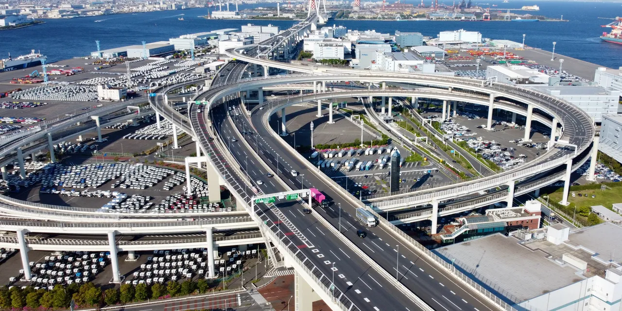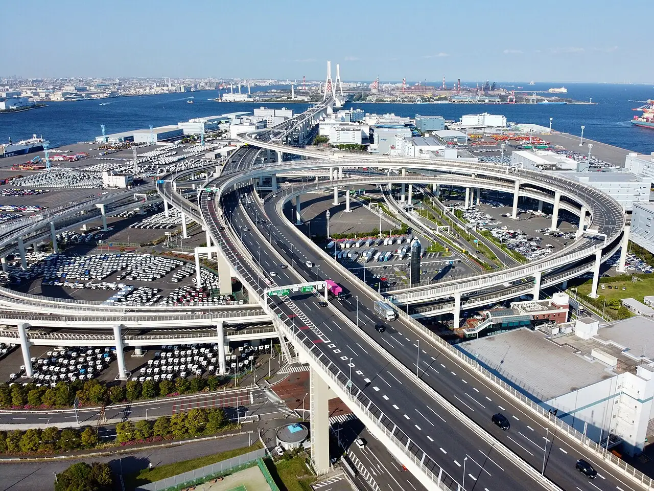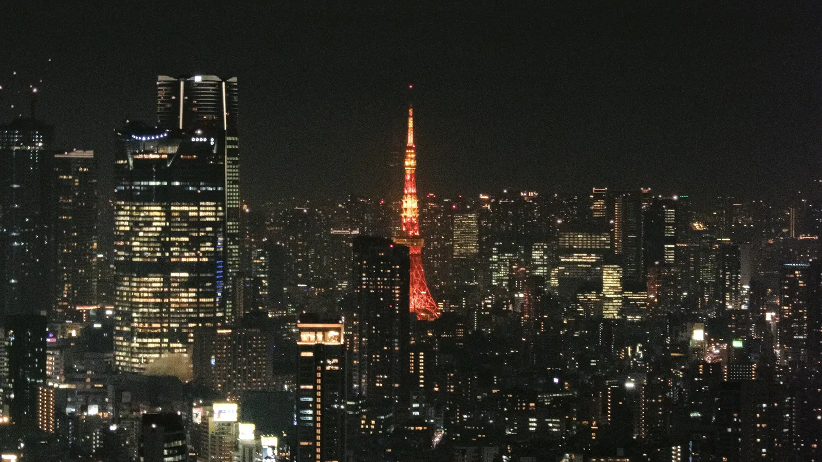
To see Tokyo and Yokohama at night from the driver's seat, take this loop on the Shutoko (Metropolitan Expressway). You get on at Ueno and get off at Ueno about two hours later, having passed Rainbow Bridge, Haneda Airport, Yokohama Bay Bridge, Tokyo Skytree and Tokyo Tower.
DSJ drove it on a weekday night in August 2026.
Who recommends this route
Shutoko at night is nothing like Shutoko by day. No complaints.
- City expressway
Read the full notes
- What was good
- At night Rainbow Bridge and Yokohama Bay Bridge are far more beautiful than by day. I especially like the row of Odaiba buildings ahead of you on Rainbow Bridge, and the spot where Tokyo Tower appears from the expressway. Along the Arakawa on the Central Circular Route, the view nearest Horikiri is my favourite. A car-share Yaris was plenty to enjoy it. 100 out of 100.
- The road
- Many junctions, few parking areas. On the Bayshore Route at night, fast cars come up in the right lane and trucks roll slowly in the left, so the middle lane felt the calmest.
- Best stretch
- The Central Circular Route along the Arakawa from Horikiri toward Kasai, especially the Horikiri end. Far better at night.
- Crowds
- On the weekday night we drove it, Daikoku PA was not crowded. Weekends may be busier.
- Cars that suit it
- A car-share Yaris was plenty to enjoy it.
- Before you go
- There are few parking areas, so if you are not used to the road, use the toilet before you get on. Until you know the junctions, the destinations on the signs are hard to follow, so have navigation ready. It is an easy road if you keep your speed down, but there are a few places where crashes happen. Take care there.
Route map
- 1Rainbow Bridge
- 2Haneda Airport
- 3Yokohama Bay Bridge
- 4Tokyo Skytree
- 5Tokyo Tower
Ueno → Inner Circular → 1 → 2 → 3 → Daikoku PA → 4 → Arakawa → 5 → Ueno
The map could not be loaded. Use the junction-by-junction directions below.
- On and off: Ueno, both ways (the entrance is ETC-only)
- Time: about two hours including a rest stop
- Rest stop: Daikoku PA
- When: before midnight. The bridges and towers switch off at 24:00
- Toll: the shortest Ueno-to-Ueno route, however far you drive (a standard car with ETC pays at most ¥2,130)
Japan drives on the left, and some Shutoko exits and merges are on the right. Let your passengers enjoy the view. If you are driving, watch the road and the signs.
Five highlights
In the order you pass them. The numbers match the map above.
1. Rainbow Bridge
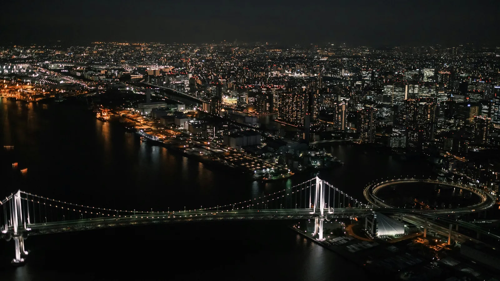
DSJ's take:Rainbow Bridge at night is a different thing from Rainbow Bridge by day. The row of Odaiba buildings straight ahead is the part I like most.
The expressway (Route 11 Daiba Route) uses the upper deck. The bridge is lit from about 30 minutes after sunset until midnight.
2. Haneda Airport
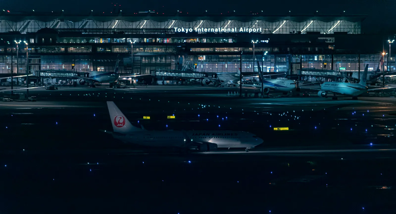
DSJ's take:around Haneda you pass under the airport in a tunnel, with the airport lights before and after it.
Here the Bayshore Route is a semi-underground road built into the airport. Past it, the factory and port lights of Kawasaki spread out on both sides.
3. Yokohama Bay Bridge
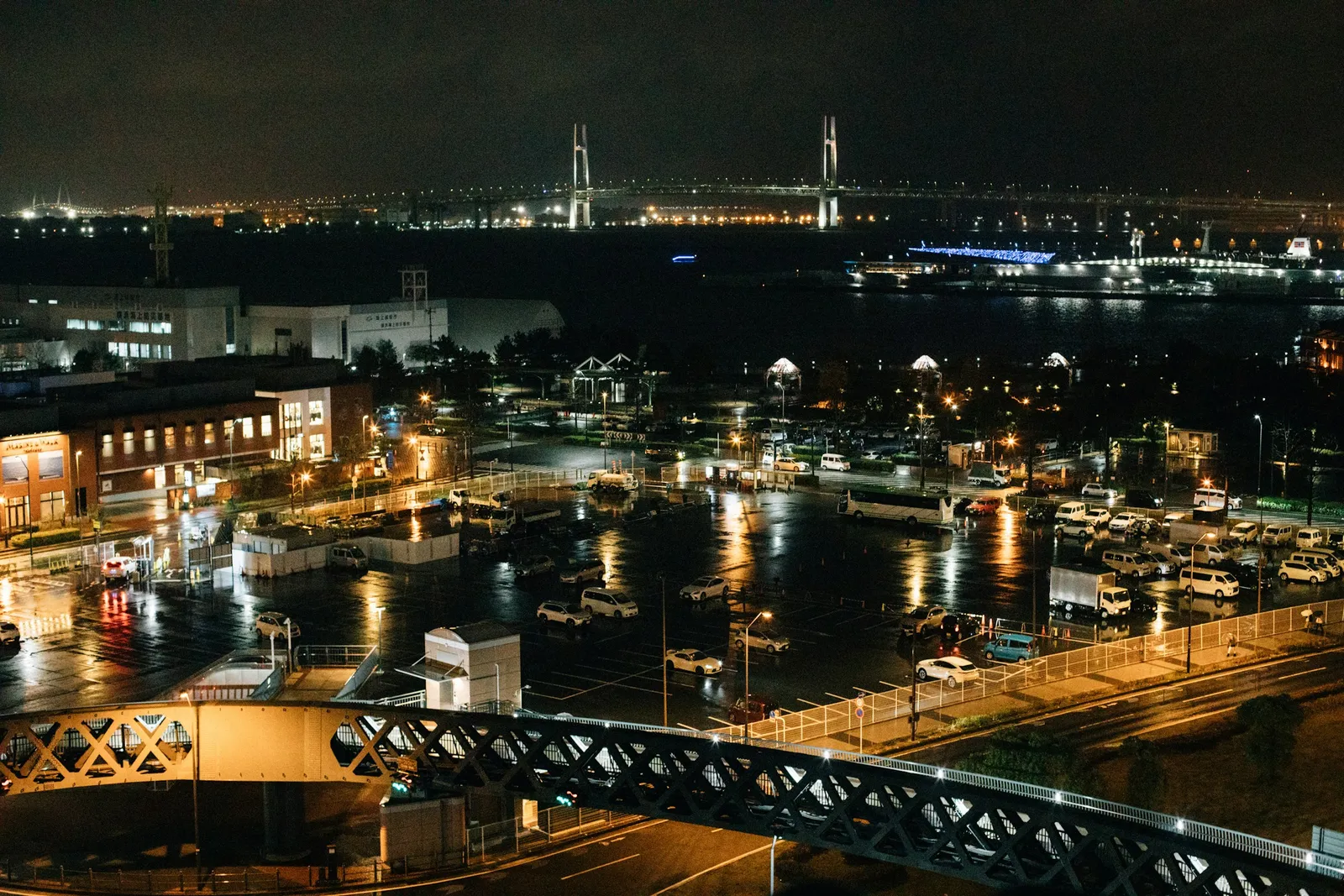
DSJ's take:the Bay Bridge is far more beautiful at night. Just before it, Tsurumi Tsubasa Bridge is every bit as good, its white towers floating in the night sky.
You cross Tsurumi Tsubasa Bridge, then Yokohama Bay Bridge, which is normally lit from sunset until midnight. After that you circle central Yokohama and stop at Daikoku PA.
4. Tokyo Skytree
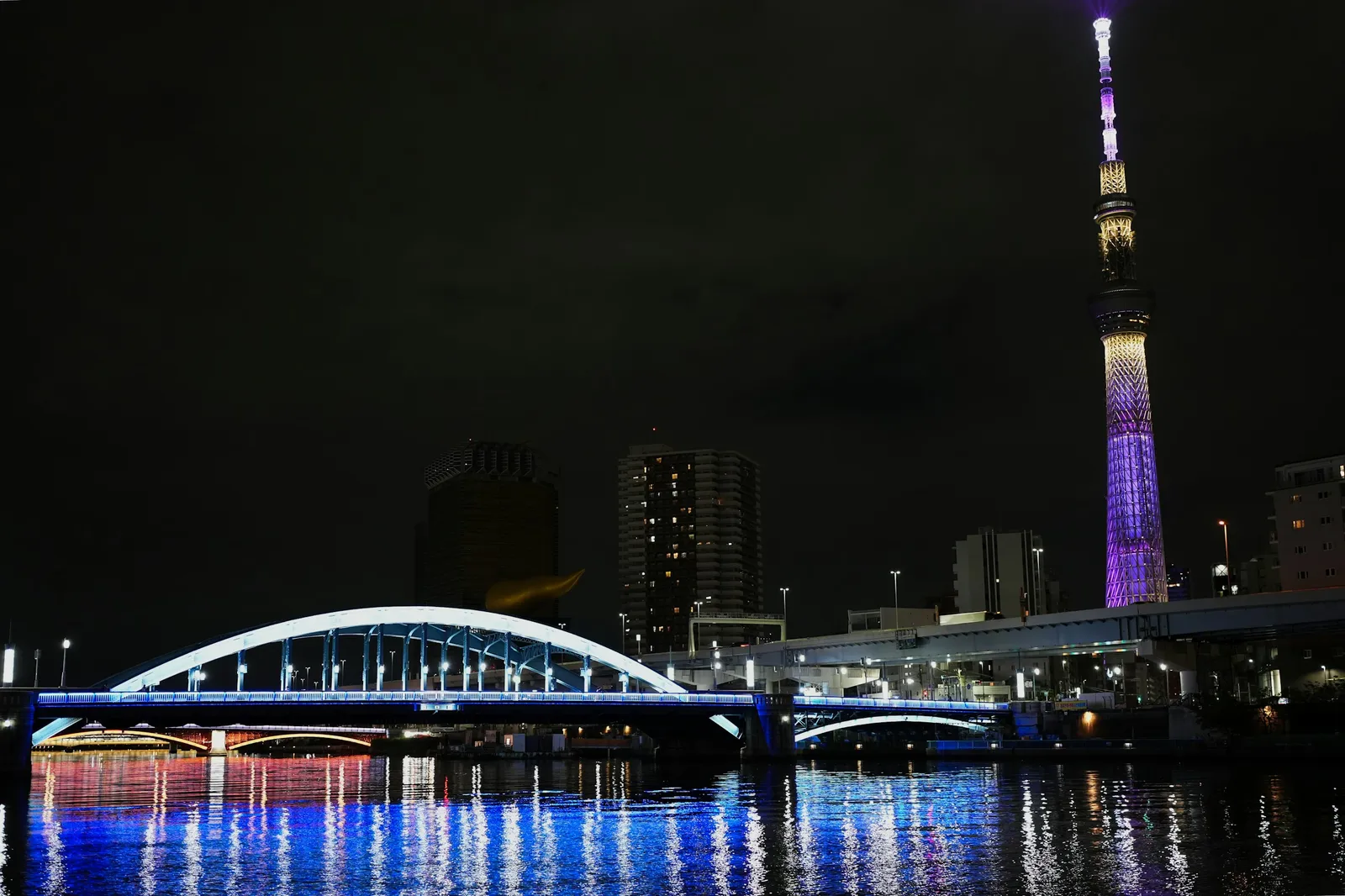
DSJ's take:heading north along the Sumida, the lit-up Skytree keeps getting bigger across the river.
On the way back you follow the Sumida river on Route 6. Skytree's lighting runs until midnight. Then you turn south along the Arakawa river on the Central Circular Route.
DSJ's take:from Horikiri toward Kasai, the city opens out across the whole view along the Arakawa. The end nearest Horikiri is my favourite.
5. Tokyo Tower
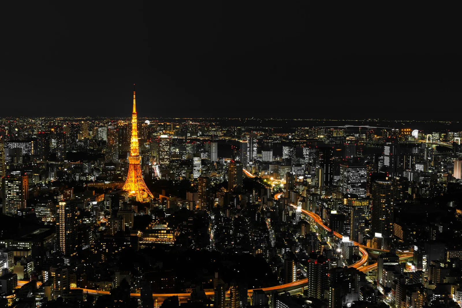
DSJ's take:I really like this spot, where Tokyo Tower appears from the expressway.
The loop ends with almost a full lap of the Inner Circular Route. Near Shiba-koen, Tokyo Tower is on your left. It is lit from sunset until midnight.
Directions, junction by junction
The destinations are the ones shown on the signs in Shutoko's junction diagrams, each with the Japanese text so you can match it. On the road, follow the signs and your navigation.
Ueno to Rainbow Bridge
- Get on at the Ueno entrance (Route 1 Ueno Route)
- Edobashi Junction: you merge onto the outer loop of the Inner Circular Route, toward Takaracho and Ginza (宝町・銀座)
- Hamazakibashi Junction: straight on for "Bayshore Route" (湾岸線) and "Yokohama" (横浜). Not the right-hand branch for "Shiba-koen" (芝公園)
- Shibaura Junction: follow "Bayshore Route" (湾岸線) onto Route 11 and cross Rainbow Bridge
DSJ's take:the Inner Circular Route threads past the sides of buildings and through one tunnel after another. It feels like driving inside a video game.
Take care:at Hamazakibashi Junction a split and a merge follow each other closely. Pick your lane early.
The Bayshore Route to Yokohama and Daikoku PA
- Ariake Junction: follow "Yokohama" (横浜) and "Kuko-chuo" (空港中央) onto the Bayshore Route, westbound
- Oi, Tokai and Kawasaki-Ukishima junctions: straight on for "Kuko-chuo" (空港中央) and "Yokohama" (横浜) at each
- Daikoku Junction, first pass: do not enter the PA yet. Straight on for "Yokohama-koen" (横浜公園) and "Yokohama-Yokosuka Road" (横横道路), over Yokohama Bay Bridge
- Honmoku Junction: keep left for "Yokohama-koen" (横浜公園) and "Hodogaya Bypass" (保土ヶ谷バイパス), onto the K3 Kariba Route
- Ishikawacho Junction: keep right for "Haneda" (羽田), onto the K1 Yokohane Route
- Kinko Junction: straight on for "Haneda" (羽田)
- Namamugi Junction: first "Bayshore Route" (湾岸線) and "Tomei" (東名), then "Bayshore Route" (湾岸線) and "Kuko-chuo" (空港中央), onto the K5 Daikoku Route
- Daikoku Junction, second pass: from the left lane follow "Daikoku-futo exit" (大黒ふ頭 出口) and "P Daikoku" (P 大黒), then enter the PA from the right lane marked "P"
Take care:the limit on the Bayshore Route is 80 km/h, which is about 22 m every second. Keep a long gap. Kanagawa Prefectural Police treat the Bayshore, Yokohane and Kariba routes as priority routes for speed enforcement.
At Daikoku PA, the only outlet open after 21:00 is the Lawson convenience store (24 hours). The food court and shops open 7:00 to 21:00. If you took your ETC card out, put it back before you leave.
Daikoku PA to Tokyo Skytree and the Arakawa
- Leave Daikoku PA and take the Bayshore Route eastbound toward Tokyo
- Oi and Ariake junctions: straight on for "Higashi-Kanto Expressway" (東関東道)
- Shinonome to Tatsumi Junction: move into the lane for "Hakozaki" (箱崎), then keep left for "Hakozaki" onto the Route 9 Fukagawa Route
- Hakozaki Junction: keep right for "Tohoku Expressway" (東北道) and "Keiyo Road" (京葉道路), onto the Route 6 Mukojima Route. Not left for "Inner Circular" (都心環状) and "Ginza" (銀座)
- Ryogoku Junction: straight on for "Tohoku Expressway" (東北道) and "Joban Expressway" (常磐道). Skytree comes into view along the Sumida
- Horikiri Junction: take the right-hand branch for "Bayshore Route" (湾岸線) and "Keiyo Road" (京葉道路), onto the outer loop of the Central Circular Route, south along the Arakawa
- Komatsugawa Junction: straight on for "Bayshore Route" (湾岸線)
- Kasai Junction: follow "Yokohama" (横浜) onto the Bayshore Route, westbound
DSJ's take:at Hakozaki and Edobashi junctions the next split comes right after the merge, so changing lanes there was the tensest part of the loop.
Take care:at Hakozaki Junction, move right early. If you miss the right-hand branch at Horikiri Junction, you carry on toward Kosuge and the Tohoku Expressway.
Past Tokyo Tower and back to Ueno
- Tatsumi Junction: keep left for "Hakozaki" (箱崎) and "Ginza" (銀座), onto the Route 9 Fukagawa Route
- Hakozaki Junction: keep left for "Inner Circular" (都心環状) and "Ginza" (銀座)
- Edobashi Junction: straight on for "Kandabashi" (神田橋) and "Kita-Ikebukuro" (北池袋), onto the inner loop. Not left for "Ginza" (銀座) and "Yokohama" (横浜)
- Takebashi and Miyakezaka junctions: follow "Kasumigaseki" (霞が関)
- Tanimachi and Ichinohashi junctions: follow "Shiba-koen" (芝公園) and "Bayshore Route" (湾岸線). Tokyo Tower is on your left near Shiba-koen
- Hamazakibashi and Shiodome junctions: follow "Ginza" (銀座) and "Hakozaki" (箱崎)
- Edobashi Junction: follow "Ueno" (上野) and leave at the Ueno exit
Take care:you can reach the Ueno exit only from the inner loop, by following "Ueno" at Edobashi Junction. That is why the loop ends with almost a full lap. Around the Kitanomaru tunnel, rear-end crashes are common at the tail of queues just inside the tunnel entrance. Keep your distance.
From 23:00 on 18 October 2026, the Shintomicho exit is removed and the Ginza entrance (inner loop) closes for about three years. You can still drive this loop as described.
Shortening the loop, and when Daikoku PA is closed
A shorter way back
After you join the Bayshore Route westbound at Kasai Junction, go straight on toward "Yokohama" (横浜) at Tatsumi Junction and follow "Ginza" (銀座) at Ariake Junction. You cross Rainbow Bridge toward the city, follow "Ginza" (銀座) and "Hakozaki" (箱崎) at Hamazakibashi Junction, then "Ueno" (上野) at Edobashi Junction. This skips most of the last lap, so it is shorter, but you do not pass Tokyo Tower.
If Daikoku PA is closed
Shutoko closes Daikoku PA whenever the situation requires, and on some nights for construction. If it is closed, go straight on at Daikoku Junction toward "Bayshore Route" (湾岸線) and "Kuko-chuo" (空港中央) and join the Bayshore Route eastbound. The next parking area is Oi PA. Our Daikoku PA guide explains the closures.
Summary
Get on at Ueno and get off at Ueno about two hours later, having passed Rainbow Bridge, Haneda Airport, Yokohama Bay Bridge, Tokyo Skytree and Tokyo Tower in turn. The bridges and towers switch off at midnight, so set off in time to finish before then.
DSJ's take:Shutoko at night is nothing like Shutoko by day. No complaints.
Before you set off
- A license valid in Japan. Most visitors need their home license plus an International Driving Permit issued under the 1949 Geneva Convention. See driving in Japan with an IDP.
- An ETC card in the car. The Ueno entrance has been ETC-only since 23 December 2025. ETC is Japan's electronic toll system: the car has a reader, and you insert a card into it. When you rent, ask for the card as well as the reader.
- Navigation. There are many junctions, and until you know them the signs are hard to follow. Set it up while parked.
- A toilet stop first. There are no parking areas on the Inner Circular Route or the Central Circular Route.
- Roadworks and closures. Check Shutoko's roadworks and traffic restrictions page (in Japanese), including Daikoku PA.
- The toll. Shutoko charges by the shortest route between your entrance and exit, not the road you drive. A standard car with ETC pays ¥32.472 per kilometre, with a minimum of ¥300 and a maximum of ¥2,130 (since 1 October 2026). Check Ueno to Ueno with Shutoko's toll search.
- A dry night. Injury crashes are about four times as frequent per hour in rain, and crashes into walls about six times (Shutoko).
- Wrong turns. Leave at the next exit, or carry on and come back round. Shutoko is one-way: you cannot reverse or make a U-turn.
- Your rental contract and return time. Check the mileage allowance and anything it prohibits, and work back from the time you have to return the car. Our guide to JDM car rental in Tokyo compares the conditions company by company.
DSJ's take:on the night we drove it, roadworks had closed lanes in places.
Related articles
- Daikoku PA: how to get there and why it closes: the ways in, closures and etiquette
- JDM car rental in Tokyo: companies, conditions and prices compared
- Driving in Japan with an IDP: which documents your license needs
- JDM tours in Tokyo: if you would rather ride than drive
Sources & verification
Last verified: 2026-10-14
All sources (33)
- Shutoko: Ueno ramps (Route 1 Ueno Route; inbound entrance, outbound exit; ETC-only toll gate) (Japanese) · 2026-09-27
- Shutoko: expansion of ETC-only entrances (Ueno inbound has been ETC-only since 23 December 2025) (Japanese) · 2026-09-27
- Shutoko: routes and ramps (junction diagrams with the destinations shown on signs) (Japanese) · 2026-09-27
- Shutoko: guide to the section between Edobashi and Hakozaki junctions (Japanese) · 2026-09-27
- Metropolitan Expressway Company: route data (Route 11 on the upper deck of Rainbow Bridge, the semi-underground Bayshore Route at Haneda Airport, the upper deck of Yokohama Bay Bridge) (Japanese) · 2026-09-27
- Metropolitan Expressway Company: Rainbow Bridge (lit from about 30 minutes after sunset until midnight) (Japanese) · 2026-10-14
- Metropolitan Expressway Company: Yokohama Bay Bridge (normally lit from sunset until midnight) (Japanese) · 2026-10-14
- Metropolitan Expressway Company: Tsurumi Tsubasa Bridge (1,020 m long, towers 183 m above the sea, lighting) (Japanese) · 2026-09-27
- Tokyo Skytree: lighting information (lighting runs until 24:00; the start time changes by date) (Japanese) · 2026-10-14
- Tokyo Tower: light-up (sunset to 24:00) (Japanese) · 2026-10-14
- Shutoko Service: Daikoku PA (approach routes, shop hours, next parking areas) (Japanese) · 2026-09-27
- Shutoko Service: Tatsumi No.1 PA (Route 9 inbound; ad hoc closures) (Japanese) · 2026-09-27
- Shutoko: parking areas (list; closures for construction or security) (Japanese) · 2026-09-27
- Shutoko: parking area FAQ (ad hoc closures at Daikoku, Tatsumi No.1 and others) (Japanese) · 2026-09-27
- Shutoko: toll distance (the shortest Shutoko-only route between entrance and exit, whatever route you drive) (Japanese) · 2026-09-27
- Metropolitan Expressway Company: toll revision from 1 October 2026 (standard car ¥32.472 per km, minimum ¥300) (Japanese) · 2026-09-27
- Shutoko: toll revision FAQ (standard-car maximum ¥2,130; other discounts unchanged) (Japanese) · 2026-09-27
- Shutoko: using ETC (same card from entrance to exit; re-insert it after a parking-area stop) (Japanese) · 2026-09-27
- Shutoko: late-night discount (20% for ETC cars entering between 0:00 and 4:00) (Japanese) · 2026-09-27
- Shutoko: toll FAQ (wrong exits, no U-turns or reversing, no refunds) (Japanese) · 2026-09-27
- Metropolitan Expressway Company: Shintomicho exit removed and Ginza entrance (inner loop) closed long-term from 23:00 on 18 October 2026 (Japanese) · 2026-09-27
- Shutoko: roadworks and traffic restrictions (Japanese) · 2026-09-27
- Shutoko: how roadworks are carried out (as a rule, at times of light traffic) (Japanese) · 2026-09-27
- Shutoko: accident black-spot map, fiscal 2025 (Japanese) · 2026-09-27
- Shutoko: driving tips for the section between Horikiri and Kosuge junctions (Japanese) · 2026-09-27
- Shutoko: traffic safety measures (where rear-end and side-swipe crashes happen) (Japanese) · 2026-09-27
- Shutoko: crashes on rainy days (9,540 crashes in fiscal 2025; injury crashes about four times as frequent in rain, wall strikes about six times) (Japanese) · 2026-09-27
- Shutoko: safe driving basics (merges and exits on both sides; do not stare at the navigation screen) (Japanese) · 2026-09-27
- Shutoko: avoiding rear-end crashes (about 22 m per second at 80 km/h) (Japanese) · 2026-09-27
- Kanagawa Prefectural Police: expressway enforcement (Bayshore, Yokohane and Kariba routes are priority routes) (Japanese) · 2026-09-25
- National Police Agency: driving in Japan with a foreign license or international driving permit · 2026-09-23
- GAZOO: Shutoko staff on the best routes for views (18 June 2018, secondary source; Tokyo Tower on the left near Shiba-koen on the inner loop) (Japanese) · 2026-09-25
- OpenStreetMap: road data for the route map (Shutoko routes, ODbL) · 2026-10-14