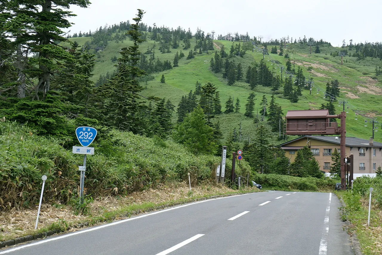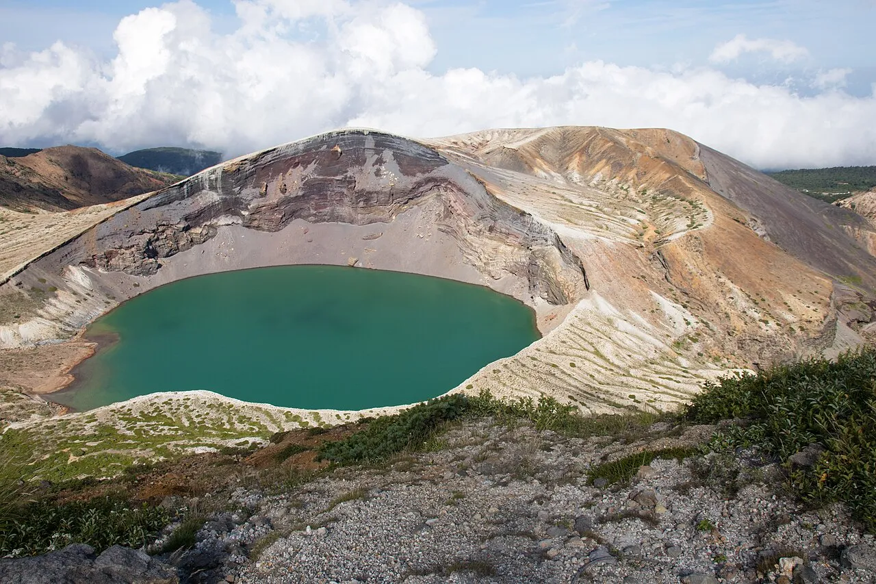
This day course starts at Murata IC or Shiroishi IC on the Tohoku Expressway, climbs the Zao Echo Line and stops at Takimidai and Komakusadaira. At Katta Pass it turns onto the Zao Highline for the viewpoint over Okama crater lake. The road crosses the mountains between Miyagi and Yamagata prefectures, with the crater lake, waterfalls and autumn colour all within one day.
In 2026 the winter closure is scheduled from 17:00 on 4 November, and until then the road closes every night from 17:00 to 08:00. This page gives the map and distances, tolls, opening times, return routes and fuel.
Basic route and timing
- 1Takimidai
- 2Komakusadaira
- 3Katta Pass (Zao Highline)
- 4Summit car park / Okama viewpoint
Murata IC → 1 Takimidai → 2 Komakusadaira → 3 Katta Pass → 4 summit car park and Okama, then back the same way or down via Bodaira, Kaminoyama and Yamagata-Zao IC
The map could not be loaded. Use the junction-by-junction directions below.
Murata IC to the summit car park is about 38 km. Murata IC to the Otorii gate, the entrance on the Miyagi side, is about 19 km and about 25 minutes. The mountain road from the gate to the summit car park is about 19 km. The calculated time for the mountain road is about 20 minutes. It is an uphill road full of bends, with traffic jams in the autumn-colour season, so allow an hour.
With time at Takimidai, Komakusadaira and Okama, it takes about 3 hours to leave the summit, and 4–5 hours including the return. Go back the same way to Murata IC (about 38 km), or descend on the Yamagata side and take the Yamagata Expressway from Kaminoyama.
| Map no. | Section or stop | Distance and time | Time at stop |
|---|---|---|---|
| S→1 | Murata IC → Otorii gate → Takimidai | About 24 km (to the gate: about 19 km, about 25 minutes) | — |
| 1 | Takimidai | — | 10–15 minutes |
| 1→2 | Takimidai → Sumikawa Snow Park entrance → Sainokawara → Komakusadaira | About 9 km | — |
| 2 | Komakusadaira | — | 15–20 minutes |
| 2→3 | Komakusadaira → Katta Pass (Zao Highline toll gate) | About 3 km | — |
| 3→4 | Katta Pass → Zao Highline → summit car park | 2.5 km (ordinary cars ¥600) | — |
| 4 | Okama viewpoint and Zao Summit Rest House | 3 minutes on foot from the car park | 45–60 minutes |
| 4→return | Summit car park → Katta Pass → Bodaira Kogen → Kaminoyama → Yamagata-Zao IC | About 46 km (about 31 km to central Kaminoyama) | — |
Distances are calculated from map data. Times are published estimates where they exist and calculated values elsewhere. They exclude traffic and breaks. Shiroishi IC to the Otorii gate is also about 18 km and about 25 minutes, so the distance is almost the same from either IC.
The Zao Echo Line is the section of Main Local Road Shiroishi–Kaminoyama Line (Prefectural Route 12) that crosses the Zao range between Zao Town in Miyagi and Kaminoyama in Yamagata. There is no toll. The Miyagi-side entrance is the Otorii gate, beyond Togatta Onsen. The height difference from there to the summit area around Okama is about 1,400 m.
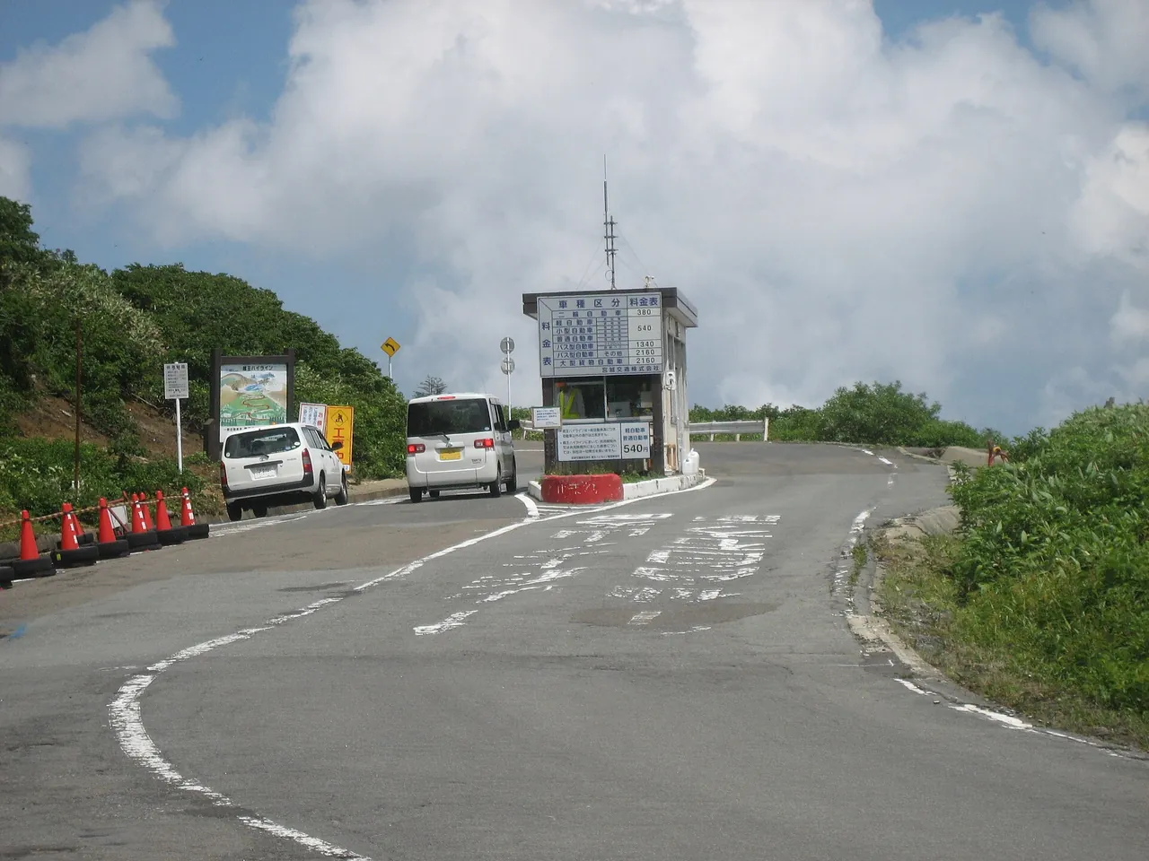
To reach Okama, take the toll Zao Highline (2.5 km, ordinary cars ¥600, cash only), which branches off at Katta Pass, the highest point of the Echo Line.
Plan the day backwards from the Highline's hours and the Echo Line's night closure. From mid-October until the winter closure, the Highline operates 08:00–16:00, with last entry at 16:00. The Echo Line gate at Sainokawara closes at 17:00, so see Okama and come down the mountain before then.
Stops, in route order
Takimidai has about 10 parking spaces; stay behind the fence
Takimidai is a lookout about 5 km above the Otorii gate, at about 700 m above sea level. From one spot you can see Fudo Falls, Jizo Falls above it (42 m high), and Sankai Falls, which drops in three steps into the Sumikawa River (181 m high, 7 m wide; one of Japan's 100 best waterfalls).
Parking is free, with about 10 spaces for ordinary vehicles. Large buses cannot stop here, and you cannot visit when there is snow. Going beyond the fence is dangerous.
Because the car park is small, do not plan on waiting for a space on the shoulder. Decide in advance: stop on the way back if you return the same way, or skip it this time if you continue to Yamagata. As of 29 October 2026 the colours at Takimidai were at their peak, and around Fudo Falls below they were at their peak to starting to fall.
Komakusadaira looks across to Kaerazu Falls
About 9 km above Takimidai is Komakusadaira, at 1,383 m. On the way you pass the Sumikawa Snow Park entrance (1,112 m), the winter-closure gate, and Sainokawara (1,246 m), the night-closure gate. From the lookout at Komakusadaira, which has a car park, you can see Kaerazu Falls (97.5 m high, 14 m wide) and Furiko Falls to the west. To the east the view reaches across the Ou Mountains to the Pacific. Furiko Falls flows while snow remains around it and after rain.
The area has large patches of komakusa, a small alpine flower, which blooms from mid-June through July. Picking alpine plants is banned. Sainokawara to the Summit Rest House car park is about 7 km.
The Zao Highline costs ¥600 for ordinary cars, cash only
To reach the Okama viewpoint, take the Zao Highline, which branches off at Katta Pass, the highest point of the Echo Line. Run by Miyagi Kotsu, this toll mountain road climbs 2.5 km to the top at 1,750 m. Tolls are ¥600 for kei, small and ordinary cars, ¥450 for motorcycles over 125 cc, ¥1,500 for microbuses and ¥2,400 for large buses, paid in cash only. Motorcycles of 125 cc or less, bicycles and pedestrians cannot use it.
Hours are 07:30–17:00. From opening day until early May, and from mid-October until the winter closure, hours are 08:00–16:00, with last entry at 16:00. During night-closure periods, leave by 16:20; the road closes at 16:30. In 2026 it opened on 24 April, and its last day is 4 November, until 16:00.
From the summit car park to the Okama viewpoint
The summit car park at the end of the Highline is free. It has about 300 spaces for ordinary cars (No. 1: 135, No. 2: 107, No. 3: 30, No. 4: 15) and 20 for large vehicles. Car park No. 1 closes from 17:00 on the day before weekends and public holidays until 07:30 the next morning.
A flat path from the car park reaches the viewpoint over Okama in 3 minutes, and wheelchair users can use it. The Miyagi Prefectural Zao Summit Rest House next door has a souvenir shop, light meals, a free rest area and toilets. Hours change with the season and weather, and it closes in winter.
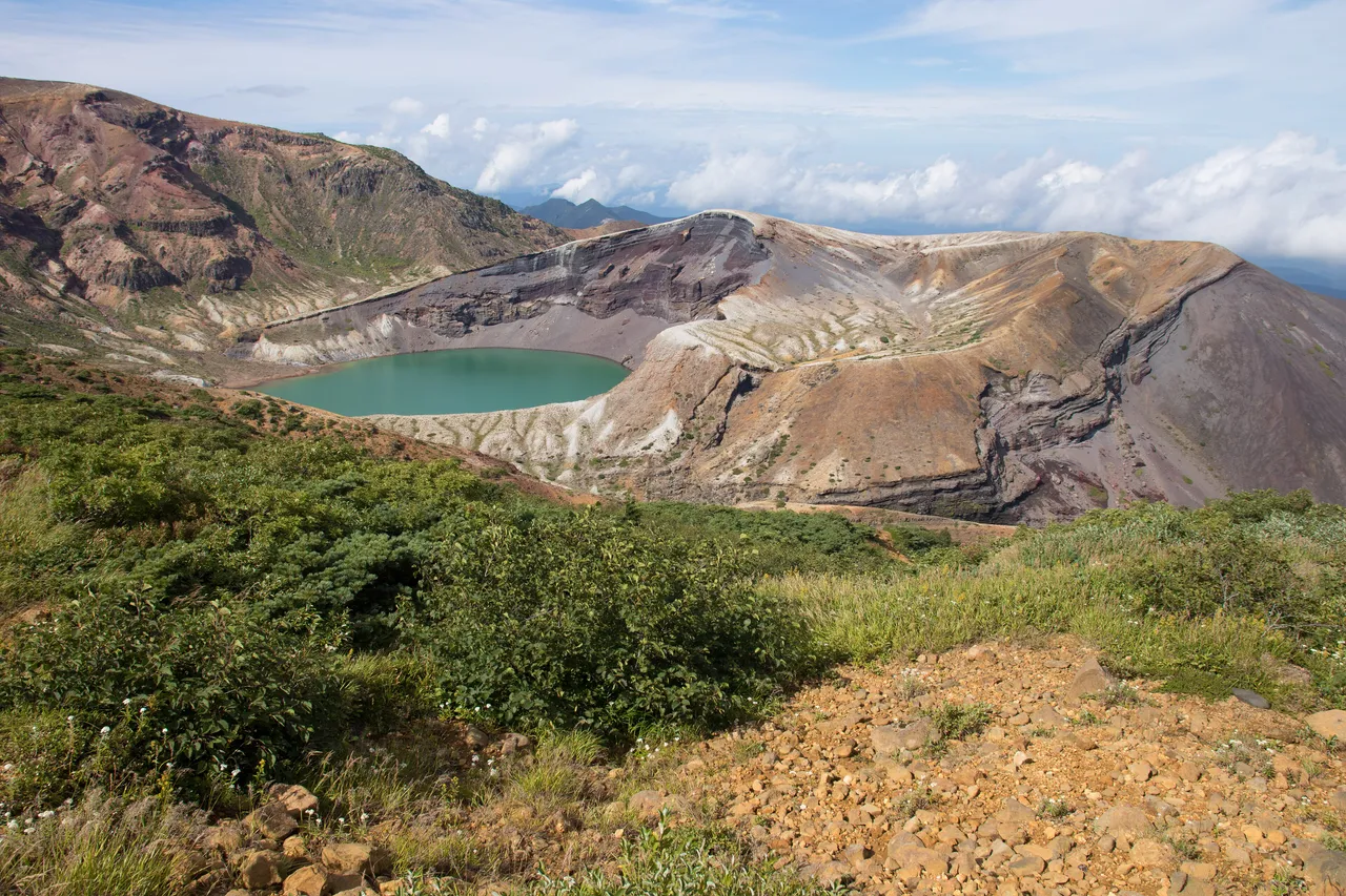
Okama is a round crater lake surrounded by three peaks, Mt Katta, Mt Kumano and Mt Goshiki, and its colour changes with the light. The Umanose caldera, the area of expected craters, is closed for the time being, and part of the Sainokawara trail is also closed. View Okama from the viewpoint and stay out of the restricted area. The summit is colder and windier than the lowlands, so bring warm layers and comfortable shoes.
From the Katta Pass car park you can also take the Katta lift
About 1.7 km below Katta Pass on the Yamagata side is the Katta Pass car park (Katta car park), with the boarding station of the Zao Katta Lift, run by Zao Liza World. It is a way up to Okama without the Highline and suits visitors coming from the Yamagata side.
The lift runs 09:00–16:00 (until 16:30 from 18 July to 30 August). The last ride up is 45 minutes before closing. Fares are ¥1,000 return or ¥600 one way. Children aged 6 and over pay, and children under 6 pay if they ride alone rather than with an adult. It may stop in bad weather. In 2026 it opened on 25 April. When the Echo Line is closed, you cannot reach this car park either.
Open season and road restrictions
The winter closure runs from 17:00 on 4 November to 23 April
The 2026 winter closure is scheduled from 17:00 on 4 November 2026 to 11:00 on 23 April 2027. The closed section runs from the gate at the Sumikawa Snow Park entrance on the Miyagi side, over the prefectural border, to the gate at Bodaira Kogen on the Yamagata side, and includes the Zao Highline. During the closure you cannot visit Okama or drive through between Miyagi and Yamagata. To drive between the two prefectures, use Route 113 or the Yamagata Expressway. The Aone–Zao Line is also closed for the same period between Aone Onsen and Gaga Onsen in Kawasaki Town.
In 2026 the road opened at 11:00 on 24 April. Miyagi and Yamagata prefectures announce the opening date each year.
In autumn and spring the road closes 17:00–08:00
From 13 October until 4 November, the road closes every day from 17:00 to 08:00 the next morning. The closed section runs from the Bodaira Kogen gate on the Yamagata side, past the prefectural border and the Highline junction, to the Sainokawara gate on the Miyagi side. The Highline is closed from 16:00 to 08:00 from 13 October to 3 November. In spring the same night closure applies from opening day until after the early-May holidays (in 2026, until the morning of 7 May).
During the night closure you cannot visit Okama or cross the prefectural border. The gate closes at 17:00, so leave the restricted section before then.
Rime ice and freezing can close the road in daytime
Even in the open season, the road closes temporarily for bad weather, snowfall or lying snow, frozen roads and events. Cars with studless winter tyres cannot pass either. During the night-closure period, the decision on morning access is made by 08:00 that day, but temporary closures can still follow. On 22 October 2026 rime ice near the summit closed the Echo Line from 12:00 and the Highline from 11:00 for the rest of the day. After snow, 29 October 2026 was closed all day at the Kuraishidake gate at the Gaga Onsen junction. The road can also go straight from a temporary closure into the winter closure.
From early October to early May, snow or ice is possible, so have studless tyres or chains. The 12.2 km from the Echo Line junction to the Yamagata border is an abnormal-weather restriction section, closed at 30 mm of rain per hour, 150 mm of continuous rain, 70 cm of snow, or an earthquake of lower 6 or above on Japan's intensity scale.
Volcanic alert level 1; the Umanose caldera is closed
Mt Zao is under an eruption forecast (volcanic alert level 1, "be mindful that this is an active volcano") as of 2 November 2026. At level 2, the area within about 1.2 km of the Umanose caldera, the area of expected craters, closes. At level 3, the alert area becomes about 3.5 km from the centre of Okama. Although the level is now 1, entry to the Umanose caldera is banned for the time being. If the level rises, municipalities send emergency alert messages to mobile phones.
Check the Japan Meteorological Agency's announcements the day before and on the day. If the level has risen, change your destination.
Best seasons and crowds
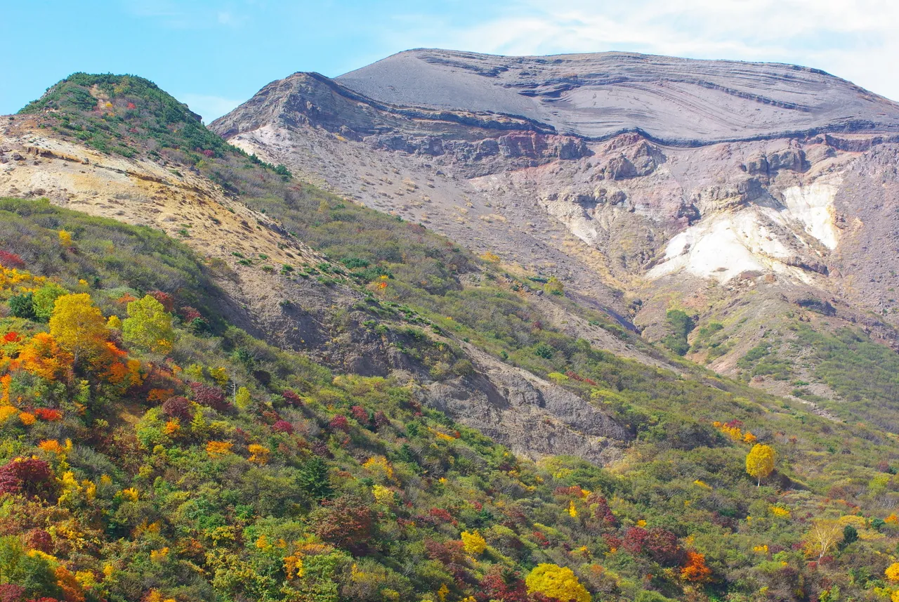
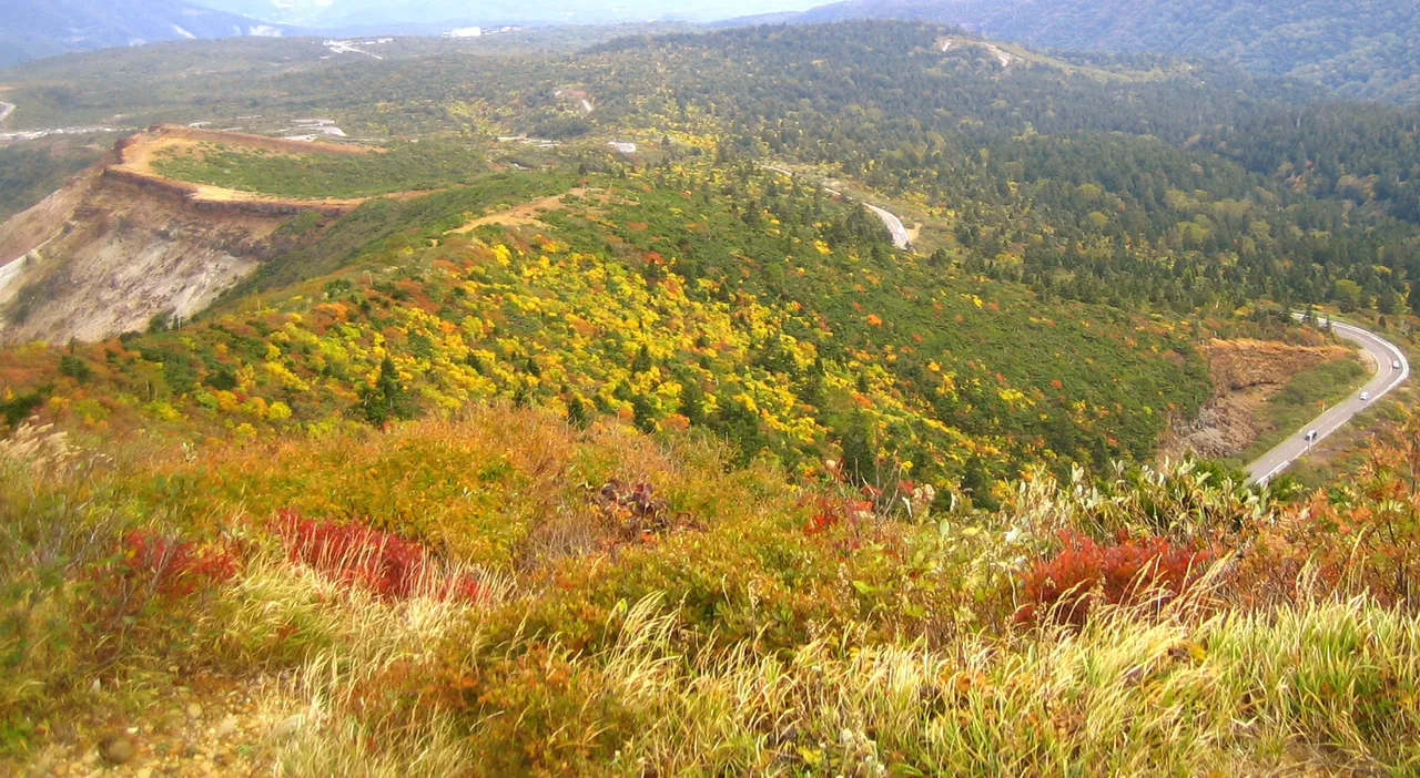
Autumn colour begins near the summit in late September and descends the 1,400 m height difference over about two months, reaching the foothills towards late October.
As of 15 October 2026, leaves had fallen from Okama down to around Daikokuten (1,432 m and above), Komakusadaira was starting to lose its leaves, and Sainokawara was between peak and fallen. As of 29 October, Takimidai was at its peak, and the Otorii gate and Togatta Onsen were just starting to turn. From the end of October the colour at the summit has finished, and the colours are on the mid-slopes and below. The first snow on Zao was recorded on 28 October 2026.
In spring, walls of snow line the road from the opening in late April until about mid-May, and Okama is frozen just after opening. Komakusa blooms at Komakusadaira from mid-June through July.
The busiest times are fine weekends and public holidays during the May holidays, the summer holidays, the autumn-colour season and just before the winter closure. Queues start at the Highline toll gate and at the Summit Rest House car park when it is full. On the fine day of 15 October, car park No. 1 was full but cars kept moving, and the queue did not reach the Highline.
If traffic stops you passing the Highline toll gate by 16:00, you will not see Okama. On autumn-colour weekends, leave early and aim to reach the summit before noon. The temperature difference between the lowlands and the mountains is large, so bring an extra layer in any season.
From the Yamagata side, and in rain or fog
From Yamagata City or Kaminoyama, take Route 13 from Yamagata-Zao IC to Kaminoyama, then climb Prefectural Route 12 (Zao Echo Line) past Bodaira Kogen and the Katta Pass car park to Katta Pass. Central Kaminoyama to Katta Pass is about 29 km. From Sendai to the Yamagata side, join the Yamagata Expressway at Murata JCT on the Tohoku Expressway, leave at Yamagata-Zao IC and take Route 13 to Kaminoyama. Taking the Katta lift from the Katta Pass car park avoids the Highline.
In rain or fog, check the area around Okama before you leave on the Ministry of Land, Infrastructure, Transport and Tourism's Okama live camera, linked from the Zao Town website. In thick fog, turn on your lights, keep well back from the car ahead, and do not stop on the road for the view. If Okama is hidden, decide in advance how long to wait, and leave when that time is up. When rime ice or freezing has closed the road near the summit, check which section is closed. If the road is open as far as Takimidai and there is no snow, stay on the lower road; if not, switch to spending the time at Togatta Onsen.
Return routes and fuel
There are two ways back. Returning the same way to Murata IC or Shiroishi IC is about 38 km from the summit car park. To cross to Yamagata, descend from Katta Pass past Bodaira Kogen to Kaminoyama (about 31 km), take Route 13 to Yamagata-Zao IC (about 15 km), then the Yamagata and Tohoku expressways towards Sendai (Yamagata-Zao IC to Murata IC is about 41 km).
Your choice depends on when you leave Okama and how long remains before the night closure. In spring and autumn the gate closes at 17:00, so leave the summit car park in time to meet the Highline's exit time. On the way down, do not rely too much on the foot brake; use a low gear and engine braking.
Check your fuel before entering the mountains. Fill up by Togatta Onsen on the Miyagi side, or in central Kaminoyama on the Yamagata side. The Highline takes cash only, so carry cash too.
Without a car: rent in Sendai
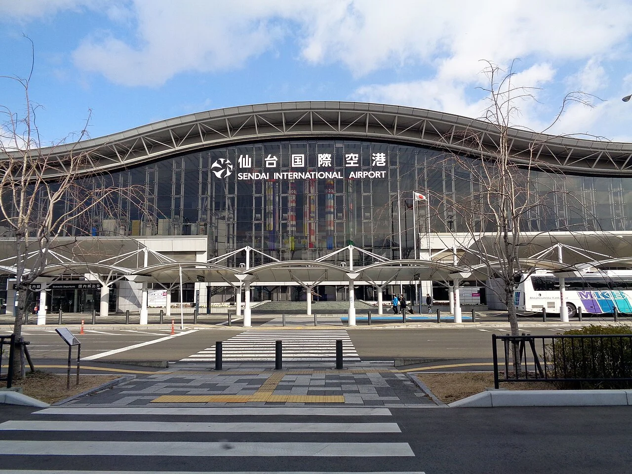
Sendai has car rental branches at the station and the airport, and you need an International Driving Permit or other accepted licence; the airport pickup guide explains the process. If you return to the same branch, going back the way you came from the summit is simplest. Crossing to Yamagata and returning at a branch in Yamagata City is a one-way rental. When booking, check whether you can return to a different branch and how much it costs. If you rent from early October to early May, also check whether studless tyres are included.
Work out when to leave Okama from your return time. For example, to return at Sendai Station at 18:00, allow 2 hours from the summit to the branch, 30 minutes for refuelling and paperwork, and 60 minutes spare, and leave the summit car park at 14:30. If your contract requires a full tank, look up a fuel station near the branch. The steps are in refuelling before returning a rental car.
Without renting, you can reach Okama by Miyagi Kotsu bus from Shiroishi-Zao Station. In 2026 it runs on weekends and public holidays from 25 April to 3 November, one return trip a day: Shiroishi-Zao Station 09:38 to Zao Katta Sancho 11:11, returning from the summit at 13:00 to reach Shiroishi-Zao Station at 14:35. The fare is ¥2,100, and transport IC cards are accepted. The bus may be cancelled because of road conditions.
Frequently asked questions
How long does the whole route take?
Murata IC to the summit car park is about 38 km. Allow about 25 minutes to the Otorii gate, then about an hour on the mountain road beyond it. With time at Takimidai, Komakusadaira and Okama, the trip takes 4–5 hours including the return. A loop down the Yamagata side and back to Murata IC by the Yamagata Expressway is about 125 km.
Are there any charges?
The Zao Echo Line is free. The Zao Highline up to Okama costs ¥600 for ordinary cars, cash only. Takimidai and the summit car park are free, and the Katta lift is ¥1,000 return. On the lift, children aged 6 and over pay, and children under 6 pay if they ride alone.
How late in the year can I drive it?
In 2026 the winter closure is scheduled from 17:00 on 4 November, reopening at 11:00 on 23 April 2027. The Highline's last day is 4 November, until 16:00. Until the closure, the road closes every night from 17:00 to 08:00, and rime ice or freezing can also close it temporarily in daytime.
What if I can't see Okama?
Check the Okama live camera before you leave, and in fog decide in advance how long to wait. If the road near the summit is closed, check which section. If the road is open to Takimidai and there is no snow, go to the lower areas; if not, switch to Togatta Onsen.
Can I use ordinary summer tyres?
From early October to early May, you need studless tyres or chains. When rime ice or freezing closes the road, even cars with studless tyres cannot pass.
Can I do it as a day trip from Sendai?
Yes. Take the Tohoku Expressway to Murata IC or Shiroishi IC; from there it is about 38 km to the summit car park. In spring and autumn the Highline's last entry is 16:00, so plan to enter the mountains in the morning.
Related guides
Sources & verification
Last verified: 2026-11-02
Updates and corrections
- English day-drive guide to the Zao Echo Line and Okama, with the 2026–27 winter closure, night closures and return routes.
All sources (21)
- Zao Town Tourism and Products Association (official page, in Japanese) · 2026-11-02
- Kaminoyama Tourism and Products Association (official page, in Japanese) · 2026-10-28
- Miyagi Kotsu (official page, in Japanese) · 2026-11-02
- Miyagi Kotsu (official page, in Japanese) · 2026-11-02
- Miyagi Kotsu (official page, in Japanese) · 2026-11-02
- Miyagi Prefecture, Ogawara Civil Engineering Office (official page, in Japanese) · 2026-10-28
- Miyagi Prefecture (official page, in Japanese) · 2026-10-28
- Zao Town Tourism and Products Association (official page, in Japanese) · 2026-10-28
- Zao Town Tourism and Products Association (official page, in Japanese) · 2026-10-28
- Zao Town Tourism and Products Association (official page, in Japanese) · 2026-10-28
- Zao Town Tourism and Products Association (official page, in Japanese) · 2026-10-28
- Zao Town Tourism and Products Association (official page, in Japanese) · 2026-10-28
- Zao Town Tourism and Products Association (official page, in Japanese) · 2026-10-28
- Zao Town Tourism and Products Association (official page, in Japanese) · 2026-11-02
- Zao Liza World (official page, in Japanese) · 2026-10-28
- Zao Liza World (official page, in Japanese) · 2026-10-28
- Zao Town (official page, in Japanese) · 2026-10-28
- Japan Meteorological Agency (official page, in Japanese) · 2026-11-02
- Yamagata Prefecture (official page, in Japanese) · 2026-10-28
- OpenStreetMap (map positions and route; © OpenStreetMap contributors, ODbL; route calculated with OSRM) · 2026-10-25
- Miyagi Prefecture (official page, in Japanese) · 2026-10-28