The Yatsugatake–Kiyosato area stretches across the southern foothills of the Yatsugatake mountains: Kiyosato, Oizumi, Nagasaka and Kobuchizawa in Hokuto, Yamanashi, and Fujimi, Hara and the Nobeyama area of Minamimaki in Nagano. From Sutama, Nagasaka or Kobuchizawa interchanges on the Chuo Expressway, roads climb into a landscape of farms, springs and viewpoints beside high bridges. This guide follows a day from Kobuchizawa up to Kiyosato and Nobeyama, then back down the valley, with roads and stops listed below.
Map of the Yatsugatake and Kiyosato area
- Views and nature
- Roadside stations
- 1Michi-no-Eki Kobuchisawa
- 2Sanbuichi spring
- 3Yatsugatake Kogen Bridge
- 4Higashizawa Bridge
- 5Utsukushimori
- 6Seisenryo
- 7Moegi no Mura
- 8Highest point of JR lines
- 9Nobeyama Radio Observatory
- 10Michi-no-Eki Minami-Kiyosato
- 11Doryu Falls
- 12Fujimi Panorama Resort
- 13Yatsugatake Nature and Culture Park
- 14Michi-no-Eki Hakushu
- 15Michi-no-Eki Shinshu Tsutakijuku
Line: 1 → 2 → 3 → 4 → 5 → 6 → 7 → 8 → 9 → 10
The map could not be loaded. Use the junction-by-junction directions below.
The line follows the full-day Kobuchizawa–Kiyosato–Nobeyama route below. Numbers mark the stops: green for scenery and nature, blue for roadside stations. Tap a marker to see its name.
Recommended drives
First visit: Kobuchizawa, Kiyosato and Nobeyama in one day
Start at Michi-no-Eki Kobuchizawa and stop at Sanbuichi Yusui springs. Take Prefectural Route 28 over the yellow Yatsugatake Kogen Bridge, then climb to the red Higashizawa Bridge on the Yatsugatake Kogen Line and Utsukushimori. Visit Seisenryo and Moegi no Mura before following Route 141 to JR's highest railway point and Nobeyama Radio Observatory. Finish by descending Route 141 to Michi-no-Eki Minami Kiyosato. The drive is about 57 km, taking roughly 1 hour 45 minutes before stops. Distance and time are calculated from map data and exclude congestion.
For the return journey, Michi-no-Eki Minami Kiyosato to Sutama Interchange is about 15 minutes, or 11 km.
Autumn colours at Higashizawa Bridge and Doryu Falls
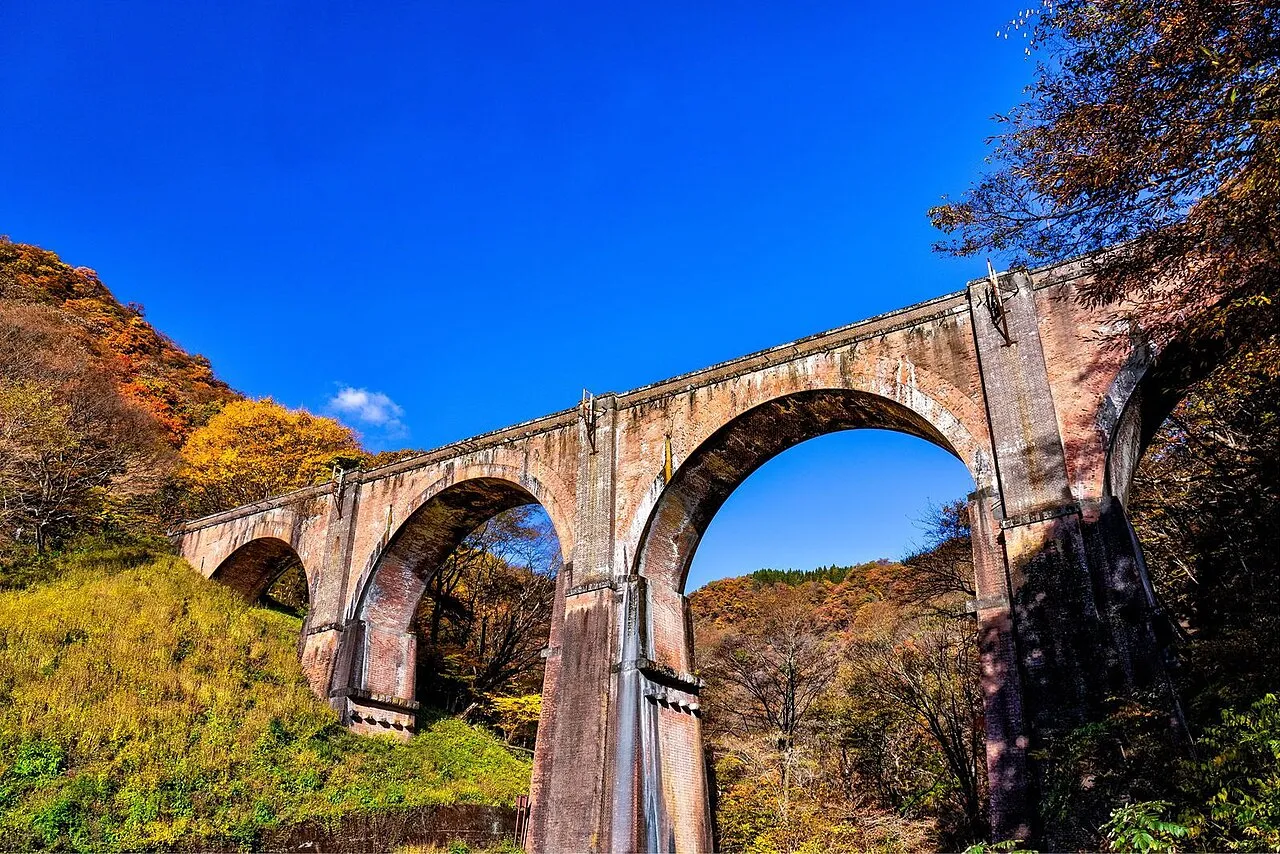
Hokuto's tourism association reported peak colour at Higashizawa Bridge and Doryu Falls on 27 October 2026. This is a dated observation, not a forecast for your visit. Bridge repairs are scheduled through 10 August 2027, with alternating traffic and sheeting covering half of the bridge's exterior.
Doryu Falls is about a 15-minute walk from its car park, which holds roughly 15 cars. The access road after leaving Prefectural Route 28 is narrow; the tourism association asks visitors not to bring vehicles larger than ordinary passenger cars. Parts of the longer gorge walking trail are closed, so follow the indicated detour towards Seisenryo if continuing beyond the falls.
Winter: check the Sutama–Nagasaka chain-control section
The 8.7 km stretch of the Chuo Expressway between Sutama and Nagasaka interchanges is a designated chain-control section. During exceptional snowfall, when chain controls are activated, winter tyres alone are insufficient: chains are required, including on four-wheel-drive vehicles.
Route 141 from Sutama is another approach to Kiyosato, but it is not a guaranteed escape from snow restrictions. Check expressway and local-road information before deciding whether to travel. The main routes differ from the seasonally closed branches to Kannon-daira and Tennyozan; snow, ice and temporary restrictions still affect winter journeys. See the winter road-closure guide.
Roads you can drive
| Road | What to expect | Length and cost | Hours and restrictions |
|---|---|---|---|
| Chuo Expressway | Sutama, Nagasaka, Kobuchizawa and Suwa-Minami interchanges are gateways to the area | Tolled | Sutama–Nagasaka is a designated chain-control section |
| Yatsugatake Kogen Line, including Prefectural Route 11 Hokuto–Fujimi Line | Kobuchizawa towards Tennyozan junction, Utsukushimori, Higashizawa Bridge and Kiyosato | Free | Alternating traffic for Higashizawa Bridge repairs, scheduled through 10 August 2027. The Utsukushimori–Kobuchizawa section has a closure threshold of 100 mm continuous rain |
| Prefectural Route 28, Hokuto Yatsugatake Park Line | Via Yatsugatake Kogen Bridge towards the Doryu Falls turn-off and Kiyosato | Free | The road branching off Route 28 towards Doryu Falls is narrow; avoid vehicles larger than ordinary passenger cars |
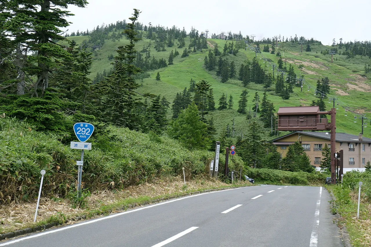
| National Route 141 | Sutama IC via Michi-no-Eki Minami Kiyosato and Kiyosato to JR's highest railway point and Nobeyama | Free | The Nagasawa–Nenba-hara section in Takane has a closure threshold of 80 mm continuous rain |
| Yatsugatake Echo Line | Agricultural road along the western foothills, linking Chino, Hara and Fujimi | Free | Included in Chino's winter diversion guidance; check conditions before using it |
| National Route 20 | Nirasaki via Hokuto's Hakushu area to Fujimi and Michi-no-Eki Shinshu Tsutakijuku | Free | Preventive closures may be imposed during heavy snow, including the Fujimi approach. Do not assume it remains open when the expressway closes |
Places to stop
Views and nature
Numbers match the map.
| No. | Place | Parking | What to know |
|---|---|---|---|
| 2 | Sanbuichi Yusui springs | 80 regular cars | About ten minutes from Nagasaka IC |
| 3 | Yatsugatake Kogen Bridge, the yellow bridge | 15 regular cars; free, on the Kiyosato side; no large vehicles | Usual autumn colours: late October to early November |
| 4 | Higashizawa Bridge, the red bridge | 20 regular cars at the Kiyosato-side viewpoint | Usual colours: mid-October to early November. Repair sheeting covers part of the bridge through 10 August 2027, scheduled |
| 5 | Utsukushimori | About 50 regular cars; free | About a 15-minute walk to the viewpoint. Information center 09:00–17:00; closed Wednesdays, with holiday variations, and December–March |
| 6 | Seisenryo | 200 spaces for visitors; 150 at the Farm Shop | Jersey Hut 09:00–17:00 with no regular closing day; its bakery has separate weekly closures |
| 7 | Moegi no Mura | About 330 spaces | Near Seisenryo; opening hours vary by shop |
| 8 | JR's highest railway point | No confirmed official parking information | 1,375 m above sea level, at a level crossing between Kiyosato and Nobeyama stations |
| 9 | Nobeyama Radio Observatory | 50 free spaces at the village observatory car park; special arrangements on 14–15 November 2026 | Free self-guided visits 08:30–17:00. Closed 29 December–3 January and when weather warnings are issued. See the event parking note below |
| 11 | Doryu Falls | About 15 cars | A 15-minute walk from the car park; usual autumn colours late October to mid-November |
| 12 | Fujimi Panorama Resort | 1,300 spaces; free | Adult return gondola fare ¥2,600. November hours 08:30–15:30, last descent 16:00; green season through 15 November 2026, weather permitting |
| 13 | Yatsugatake Natural and Culture Park, Hara | Parking only during opening hours | 09:00–17:00, extended to 18:00 in late July–August. Closed Tuesdays except holidays, the next weekday after a holiday, New Year and after Golden Week; open daily in summer, with other calendar exceptions. Adult planetarium admission ¥800 |
Roadside stations
| No. | Roadside station | Parking | What to know |
|---|---|---|---|
| 1 | Michi-no-Eki Kobuchizawa | Official listings differ: 65 or 75 regular-car spaces | Five minutes from Kobuchizawa IC. October–April 09:00–18:00; EV rapid charging available. Scheduled closures include the first Thursday in June and Monday–Tuesday of the second week in February |
| 10 | Michi-no-Eki Minami Kiyosato | 312 regular cars | On Route 141. Produce and souvenir shops 08:30–17:00; closed Tuesdays in January and February |
| 14 | Michi-no-Eki Hakushu | 85 regular cars | On Route 20, with a spring-water collection point. Farmers' market 09:00–18:00; closed Wednesdays except March–November, and over New Year |
| 15 | Michi-no-Eki Shinshu Tsutakijuku | 83 regular cars | Six minutes from Kobuchizawa IC. Hot spring 10:00–21:00, last admission 20:30; regular Tuesday closure. Toilets, parking and EV charging available at all hours |
Best seasons and crowds
| Season | Highlights and cautions |
|---|---|
| June | Japanese azaleas at Utsukushimori |
| Mid-October to mid-November | Autumn colours around Higashizawa Bridge, Yatsugatake Kogen Bridge and Doryu Falls |
| Through 15 November 2026 | Fujimi Panorama's green-season gondola. Special early services start at 05:30 on weekends and holidays from 3 October to 15 November; cloud-sea views depend on weather |
| December–March | Utsukushimori information center closes. Chain controls may be activated on the Sutama–Nagasaka expressway section during exceptional snowfall |
Road and visitor restrictions checked on 1 November 2026
- Higashizawa Bridge repairs are scheduled through 10 August 2027, with alternating traffic and work hours of 08:00–17:00. Check current road information and follow site controls; this schedule is not a live guarantee of passage.
- Chuo Expressway lane restrictions and contraflow between Okaya Junction and Suwa Interchange continue through 30 November 2026. This affects approaches from Nagoya and Matsumoto.
- Prefectural Routes 618 to Kannon-daira and 620 to Tennyozan, branching from the Yatsugatake Kogen Line, have winter closures. The exact 2026–27 dates are not confirmed here; check Yamanashi Prefecture's road information.
- On 14–15 November 2026, the observatory's festival uses temporary parking and a shuttle bus. Allow extra time to reach the site. General visiting hours remain 08:30–17:00.
Getting there and fuel
| Starting point | Approximate drive |
|---|---|
| Shinjuku | Hokuto Tourism Association’s access diagram gives about 1 hour 20 minutes on the Chuo Expressway to Sutama IC; allow extra time for city traffic and congestion |
| Nagasaka IC | Sanbuichi Yusui: ten minutes; Yatsugatake Kogen Bridge: 15 minutes; Utsukushimori: 15 minutes; Seisenryo: 20 minutes; Higashizawa Bridge: 25 minutes |
| Sutama IC | Michi-no-Eki Minami Kiyosato: 15 minutes, or 11 km; Moegi no Mura: 20 minutes |
| Kobuchizawa IC | Michi-no-Eki Kobuchizawa: five minutes; Shinshu Tsutakijuku: six minutes |
| Suwa-Minami IC | Fujimi Panorama Resort: seven minutes; Yatsugatake Natural and Culture Park: 15 minutes |
Refuel in the built-up areas around Sutama, Nagasaka or Kobuchizawa interchanges before climbing into the highlands. EV charging is available at Michi-no-Eki Kobuchizawa and Shinshu Tsutakijuku.
If you don't have a car
Use the Yamanashi rental-car listings to look for a pickup location. Check the driving-permit requirements and, if collecting a car on arrival, the airport pickup guide.
Frequently asked questions
Where should I drive with one day in Yatsugatake and Kiyosato?
Head from Kobuchizawa via Yatsugatake Kogen Bridge, Higashizawa Bridge and Utsukushimori to Kiyosato. Stop at Seisenryo and Moegi no Mura, continue to Nobeyama, then descend to Michi-no-Eki Minami Kiyosato. The route is about 57 km with roughly 1 hour 45 minutes of driving before stops and congestion.
Can I drive to Kiyosato in winter?
Check the main approaches and weather before travelling; seasonal mountain branches and temporary snow closures have different rules. On the Chuo Expressway's Sutama–Nagasaka section, activated chain controls require chains even with winter tyres or four-wheel drive. Do not treat another road as automatically open or suitable during the same snowstorm.
Can I cross Higashizawa Bridge?
The published repair arrangement allows alternating traffic, with work scheduled through 10 August 2027. Sheeting covers half of the bridge's exterior. Follow current restrictions and on-site controls.
Can I visit Nobeyama Radio Observatory?
Self-guided visits are free, 08:30–17:00, except 29 December–3 January and during weather warnings. The village car park normally has 50 free spaces, with temporary parking and a shuttle on 14–15 November 2026. The observatory also provides visitor information in English.
Where should I refuel before Kiyosato?
Fill up in the towns around Sutama, Nagasaka or Kobuchizawa interchanges before heading into the highlands.
Nearby areas and guides
Sources & verification
Last verified: 2026-11-01
- Hokuto City Tourism Association (official page, in Japanese) · 2026-11-01
- Fujimi Panorama Resort (official page, in Japanese) · 2026-10-26
- Yatsugatake Natural and Culture Park (official page, in Japanese) · 2026-10-26
- Ministry of Land, Infrastructure, Transport and Tourism (MLIT) (official page, in Japanese) · 2026-11-01
- NEXCO Central Japan (official page, in Japanese) · 2026-10-26
- Seisenryo, KEEP Association (official page, in Japanese) · 2026-11-01
- NEXCO Central Japan (official page, in Japanese) · 2026-10-26
- NEXCO Central Japan (official page, in Japanese) · 2026-11-01
- Hokuto City Tourism Association (official page, in Japanese) · 2026-11-01
- Hokuto City Tourism Association (official page, in Japanese) · 2026-11-01
- Yamanashi Prefecture (official page, in Japanese) · 2026-10-26
- Yamanashi Prefecture (official page, in Japanese) · 2026-11-01
- Hokuto City Tourism Association (official page, in Japanese) · 2026-10-26
- Hokuto City Tourism Association (official page, in Japanese) · 2026-11-01
- Yamanashi Prefecture (official page, in Japanese) · 2026-10-26
- Hokuto City Tourism Association (official page, in Japanese) · 2026-11-01
- Hokuto City Tourism Association (official page, in Japanese) · 2026-11-01
- Yamanashi Prefecture (official page, in Japanese) · 2026-10-26
- Yamanashi Prefecture (official page, in Japanese) · 2026-11-01
- Hokuto City Tourism Association (official page, in Japanese) · 2026-11-01
- Hokuto City Tourism Association (official page, in Japanese) · 2026-10-26
- Kanto Michi-no-Eki Association (official page, in Japanese) · 2026-11-01
- Minamimaki Village Tourism Association (official page, in Japanese) · 2026-10-26
- Nobeyama Radio Observatory (official page, in Japanese) · 2026-11-01
- Nagano Prefecture (official page, in Japanese) · 2026-10-26
- Nagano Prefecture (official page, in Japanese) · 2026-10-26
- Minamimaki Village (official page, in Japanese) · 2026-10-26
- Hokuto City Tourism Association (official page, in Japanese) · 2026-10-26
- Fujimi Town (official page, in Japanese) · 2026-10-26
- Chino City (official page, in Japanese) · 2026-10-26
- Hara Village (official page, in Japanese) · 2026-10-26
- MLIT Kanto Regional Development Bureau (official page, in Japanese) · 2026-10-26
- MLIT Kanto Regional Development Bureau (official page, in Japanese) · 2026-10-26
- Kanto Michi-no-Eki Association (official page, in Japanese) · 2026-10-26
- Kanto Michi-no-Eki Association (official page, in Japanese) · 2026-10-26
- Michi-no-Eki Shinshu Tsutakijuku (official page, in Japanese) · 2026-10-26
- Nagano Prefecture (official page, in Japanese) · 2026-11-01
- MLIT Kanto Regional Development Bureau (official page, in Japanese) · 2026-10-26
- Nagano Prefecture (official page, in Japanese) · 2026-10-26
- Hokuto City Tourism Association (official page, in Japanese) · 2026-10-26
- Seisenryo, KEEP Association (official page, in Japanese) · 2026-10-26
- Seisenryo, KEEP Association (official page, in Japanese) · 2026-11-01
- Seisenryo, KEEP Association (official page, in Japanese) · 2026-10-26
- Yamanashi Tourism Organization (official page, in Japanese) · 2026-10-26
- Hokuto City Tourism Association (official page, in Japanese) · 2026-11-01
- Minamimaki Village (official page, in Japanese) · 2026-10-26
- Moegi no Mura (official page, in Japanese) · 2026-10-26
- Hokuto City Tourism Association (official page, in Japanese) · 2026-10-26
- Moegi no Mura (official page, in Japanese) · 2026-10-26
- Hokuto City Tourism Association (official page, in Japanese) · 2026-10-26
- Fujimi Panorama Resort (official page, in Japanese) · 2026-10-26
- Fujimi Panorama Resort (official page, in Japanese) · 2026-11-01
- Fujimi Panorama Resort (official page, in Japanese) · 2026-11-01
- Yatsugatake Natural and Culture Park (official page, in Japanese) · 2026-11-01
- Hara Village (official page, in Japanese) · 2026-10-26
- Michi-no-Eki Minami Kiyosato (official page, in Japanese) · 2026-11-01
- Kanto Michi-no-Eki Association (official page, in Japanese) · 2026-11-01
- Hokuto City Tourism Association (official page, in Japanese) · 2026-11-01
- Hokuto City Tourism Association (official page, in Japanese) · 2026-10-26
- Michi-no-Eki Hakushu (official page, in Japanese) · 2026-11-01
- Hokuto City Tourism Association (official page, in Japanese) · 2026-10-26
- Michi-no-Eki Shinshu Tsutakijuku (official page, in Japanese) · 2026-11-01
- Hokuto City (official page, in Japanese) · 2026-10-26
- Nagano Prefecture (official page, in Japanese) · 2026-10-26
- Japan Meteorological Agency (official page, in Japanese) · 2026-10-26
- Hokuto City Tourism Association (official page, in Japanese) · 2026-10-26
- Japan Meteorological Agency (official page, in Japanese) · 2026-10-26
- Japan Meteorological Agency (official page, in Japanese) · 2026-10-26
- National Astronomical Observatory of Japan (official page, in Japanese) · 2026-10-26
- National Astronomical Observatory of Japan (official page, in Japanese) · 2026-10-26
- National Astronomical Observatory of Japan (official page, in Japanese) · 2026-10-26
- OpenStreetMap (map positions and route; © OpenStreetMap contributors, ODbL; route calculated with OSRM) · 2026-10-26
- Hokuto City Tourism Association (official page, in Japanese) · 2026-11-01
- Nobeyama Radio Observatory: visitor information (English) · 2026-11-01
- Yatsugatake Natural and Culture Park (official page, in Japanese) · 2026-11-01
- Fujimi Panorama Resort (official page, in Japanese) · 2026-11-01