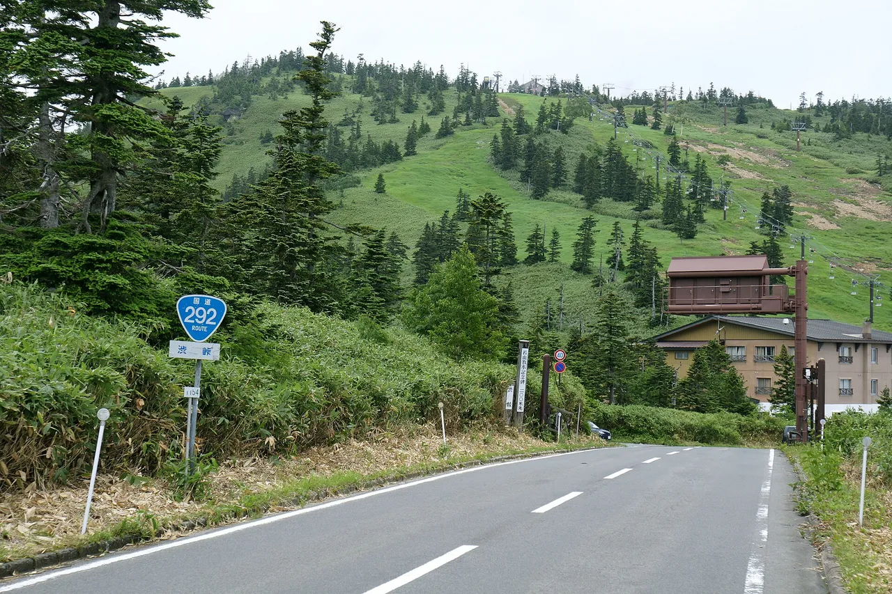
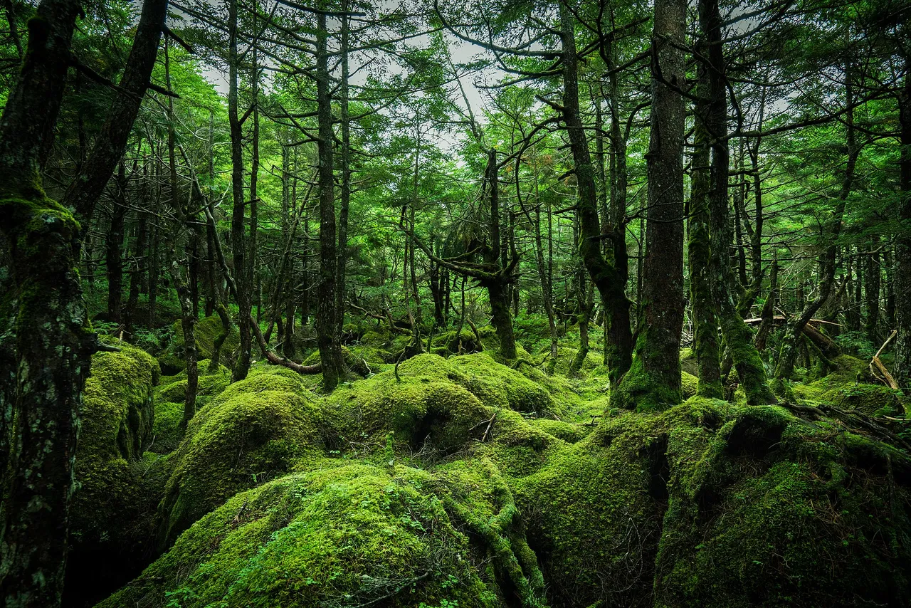
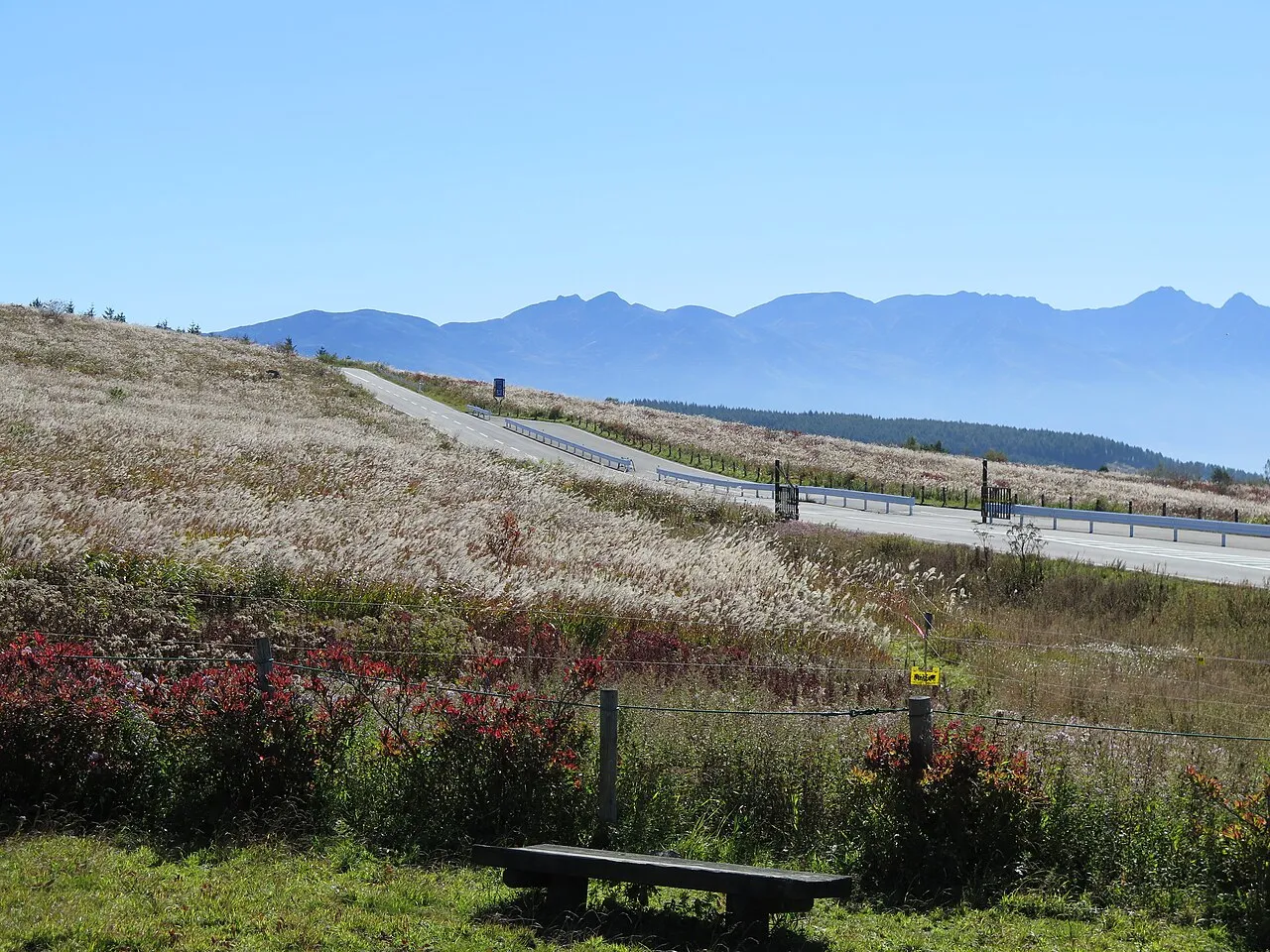
The Suwa area covers six municipalities: Okaya, Suwa, Chino, Shimosuwa, Fujimi and Hara. Roads climb from the towns around Lake Suwa to Kirigamine, Kurumayama and Lake Shirakaba, or into Tateshina and Oku-Tateshina at the foot of the Yatsugatake mountains. Use this guide to choose a full day in the highlands or a half day around the lake, with roads and stops listed below.
Map of the Suwa area
- Views and nature
- Roadside stations
- 1Lake Shirakaba
- 2Kurumayama
- 3Yashimagahara Marsh
- 4Kirigamine
- 5Mishaka Pond
- 6Yokoya Gorge
- 7Tateishi Park
- 8Suwa lakeside park
- 9Fujimi Panorama
- 10Yatsugatake Nature Park
- 11Michi-no-eki Tateshina Lake
- 12Michi-no-eki Tsutakijuku
Line: Kami-Suwa → 11 → 1 → 2 → 3 → 4 → Kami-Suwa
The map could not be loaded. Use the junction-by-junction directions below.
The line follows the full-day Venus Line circuit described below. Numbers mark the stops: green for scenery and nature, blue for roadside stations. Tap a marker to see its name.
Recommended drives
First visit: a full-day circuit of the Venus Line highlands
Start at Kami-Suwa Station and drive via Michi-no-Eki Venus Line Tateshinako, Lake Shirakaba, Kurumayama, Yashimagahara Marsh and Kirigamine's Kowashimizu area, then return to Kami-Suwa. The circuit is about 73 km with around 1 hour 40 minutes of driving. These are map-based estimates excluding traffic and stops. Allow a day to spend time at the lakes and in the highlands.
Half a day: Lake Suwa and Tateishi Park
Begin at Suwa Lakeside Park, which has 170 free parking spaces, then visit Suwa Taisha's shrines. Finish at Tateishi Park for an evening view over the lake and town. Its car park has only 23 spaces and cannot accommodate large buses. Check the November park-and-bus-ride restrictions below before driving up.
Autumn: Mishaka Pond and Yokoya Gorge in Oku-Tateshina
Drive up from Chino to Mishaka Pond and Yokoya Gorge. Yokoya's usual autumn-colour season is mid-October. You can continue across Mugikusa Pass on the Marchen Kaido while the road is open; the pass route closes in winter.
Roads you can drive
| Road | What to expect | Length and cost | Winter and restrictions |
|---|---|---|---|
| Venus Line | Highland roads from Chino through Lake Shirakaba, Kurumayama and Kirigamine towards Utsukushigahara | 75.2 km in total; toll-free | Yashima Kogen car park–Wada Pass scheduled to close from 18 November 2026 at 11:00 to 20 April 2027 at 11:00. Winter access to Yashima Marsh is via Prefectural Route 40, subject to conditions |
| Marchen Kaido, National Route 299 | Crosses the Yatsugatake mountains from Chino towards Sakuho; Mugikusa Pass is 2,127 m above sea level | — | Sendakari–Mugikusa Pass scheduled to close from 19 November 2026 at 11:00 to 15 April 2027 at 11:00 |
| Tsuetsuki Pass | Mountain pass in Chino | Parking for 20 cars | — |
| Yashima Kogen Line, Prefectural Route 199 | Climbs from Odaira in Shimosuwa to Yashima | — | Scheduled closure from 18 November 2026 at 10:00 to 20 April 2027 at 10:00 |
Places to stop
Views and nature
Numbers match the map. A dash means the detail has not been established, not that parking is free or unavailable.
| No. | Place | Parking | What to know |
|---|---|---|---|
| 1 | Lake Shirakaba | 1,000 regular cars | Lake beside the Venus Line |
| 2 | Kurumayama Kogen | Parking available; free during the green season | Japanese azaleas in June; day lilies in mid-to-late July. Scenic lifts operate through 3 November 2026 and again on 21–23 November, weather permitting |
| 3 | Yashimagahara Marsh | Parking available; follow attendants’ directions | Japanese azaleas in June and day lilies in July |
| 4 | Kirigamine, Kowashimizu | About 300 spaces; available year-round | Day lilies usually flower around the July three-day holiday weekend |
| 5 | Mishaka Pond | Car parking and five large-bus spaces | Larch woods turn gold in autumn |
| 6 | Yokoya Gorge | 30 regular cars and five large vehicles | Autumn colours in mid-October; icefalls in deep winter. The path from Otaki Falls towards Meiji Onsen is closed because of trail and bridge damage |
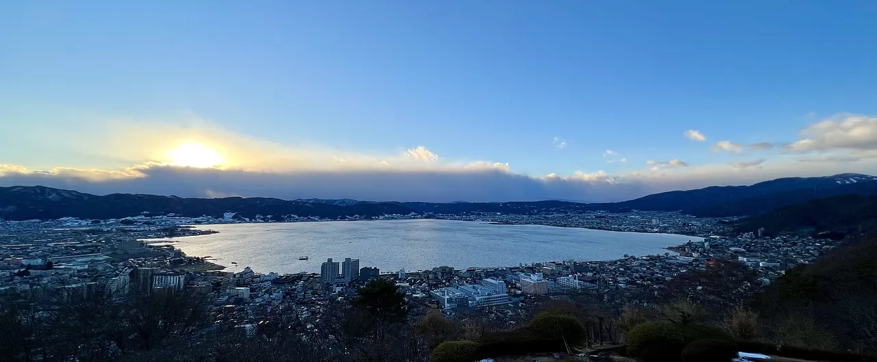
| 7 | Tateishi Park | 23 cars; no large buses | Sunset and night views over Lake Suwa and the town. Car parking is restricted during the park-and-bus-ride trial on 21–22 November 2026; details below |
| 8 | Suwa Lakeside Park and Geyser Center | 170 spaces; free | Cherry blossoms in spring, fireworks in summer and autumn colours; the lake's winter ice ridges, known as Omiwatari, depend on freezing conditions |
| 9 | Fujimi Panorama Resort, Mount Nyukasa | 1,300 spaces; free | Green season runs through 15 November 2026, subject to weather |
| 10 | Yatsugatake Natural and Culture Park | 300 regular cars | Open year-round |
| — | Suwa Taisha | Kamisha Maemiya 20 spaces, Shimosha Akimiya 80, Shimosha Harumiya 20 | Four shrines spread across Suwa, Chino and Shimosuwa |
Roadside stations
| No. | Roadside station | Parking | What to know |
|---|---|---|---|
| 11 | Michi-no-Eki Venus Line Tateshinako | 99 regular cars and seven large vehicles | At the entrance to the Venus Line |
| 12 | Michi-no-Eki Shinshu Tsutakijuku | 83 regular cars and 18 large vehicles | In Fujimi; parking available at all hours and EV charging provided |
Best seasons and crowds
| Season | Highlights |
|---|---|
| June | Japanese azaleas at Kurumayama and Yashimagahara Marsh |
| July | Day lilies: usually mid-to-late July at Kurumayama and around the three-day July holiday weekend at Kirigamine |
| October | Autumn colours, generally early-to-mid October along the Venus Line and mid-October in Yokoya Gorge |
| Winter | Lake Suwa's Omiwatari ice ridges when conditions allow, and Yokoya Gorge's icefalls. Some highland roads close |
Road closures and restrictions checked on 1 November 2026
- The Venus Line between Yashima Kogen car park and Wada Pass is scheduled to close from 18 November 2026 at 11:00 until 20 April 2027 at 11:00. You cannot drive through from the Suwa side to Utsukushigahara in winter.
- The Marchen Kaido between Sendakari and Mugikusa Pass is scheduled to close from 19 November 2026 at 11:00 until 15 April 2027 at 11:00. Snow can bring closures forward or delay reopening. See the guide to winter road closures.
- Renewal work between Okaya Junction and Suwa Interchange on the Chuo Expressway continues day and night through 30 November 2026. Traffic between Suwako Smart Interchange and Suwa Interchange shares one carriageway. Work between Okaya Interchange and Okaya Junction on the Nagano Expressway continues through 4 December. Allow for queues; work schedules can change.
- Mount Nyukasa's private-car restriction runs through 15 November 2026, 08:00–15:00, on the 7 km section from Sawa-iri trailhead to Hanabatake. Access needed for work or accommodation requires permission.
- Tateishi Park's car park is restricted for the park-and-bus-ride trial on 21–22 November 2026, starting around 09:00. Use the temporary car park at Suwako Event Square and the free shuttle, running 10:00–18:30 with about 20 minutes each way. People unable to use the shuttle, including wheelchair users, can obtain a parking permit at Event Square. Follow staff directions rather than parking on the approach road.
Getting there and fuel
| Starting point | Approximate drive to Suwa Interchange |
|---|---|
| Takaido Interchange, Tokyo side of the Chuo Expressway | 2 hours 30 minutes |
| Komaki Interchange, Nagoya side of the Chuo Expressway | 2 hours 10 minutes |
| Nagano Interchange on the Nagano Expressway | 1 hour |
The area's four expressway access points are Suwa, Suwa-Minami, Okaya and Suwako Smart interchanges. Suwako Smart Interchange is for vehicles with ETC, up to 12 m long. Kami-Suwa Station to the Kirigamine junction on the Venus Line takes about 30 minutes, depending on traffic and weather.
Chino's tourism directory lists three petrol stations in Yonezawa and Kitayama, below the Venus Line highlands. Fill up before climbing into the mountains; a directory listing does not establish that a station will be open when you arrive.
If you don't have a car
Chino's tourism office lists four rental-car companies near Chino Station. Before booking, check the driving-permit requirements for Japan. If you collect your car on arrival in Japan, the airport rental-car pickup guide explains the process.
Frequently asked questions
Where should I drive in Suwa with one day?
Try the Venus Line circuit from Kami-Suwa via Lake Tateshina, Lake Shirakaba, Kurumayama, Yashimagahara Marsh and Kirigamine. It is about 73 km with around 1 hour 40 minutes of driving before stops and congestion.
Can I reach Kirigamine in winter?
Winter access to Yashima Marsh is via Prefectural Route 40 and the Venus Line, subject to snow and temporary restrictions. The road beyond Yashima Kogen car park towards Wada Pass closes for winter. Check current road information before setting out.
Where can I see Lake Suwa at night?
Tateishi Park overlooks the lake and town. Parking is limited to 23 cars, and the approach can be congested. On 21–22 November 2026, follow the park-and-bus-ride arrangements above.
Is the Chuo Expressway congested?
Work between Okaya Junction and Suwa Interchange continues through 30 November 2026 and can cause queues. Check current traffic information when choosing your departure time.
When are the autumn colours?
Usually early-to-mid October along the Venus Line and mid-October in Yokoya Gorge. These are seasonal guides, not a report of conditions on your travel date.
Nearby areas and guides
Sources & verification
Last verified: 2026-11-01
- Nagano Prefecture (official page, in Japanese) · 2026-10-25
- Nagano Prefecture (official page, in Japanese) · 2026-10-25
- Suwa Regional Tourism Federation (official page, in Japanese) · 2026-11-01
- Nagano Prefecture (official page, in Japanese) · 2026-11-01
- Nagano Prefecture (official page, in Japanese) · 2026-10-25
- Chino City (official page, in Japanese) · 2026-10-25
- Suwa Tourism Association (official page, in Japanese) · 2026-10-25
- Nagano Prefecture (official page, in Japanese) · 2026-10-25
- Matsumoto City (official page, in Japanese) · 2026-10-25
- NEXCO Central Japan (official page, in Japanese) · 2026-11-01
- NEXCO Central Japan (official page, in Japanese) · 2026-11-01
- NEXCO Central Japan (official page, in Japanese) · 2026-10-25
- Hara Village (official page, in Japanese) · 2026-10-25
- NEXCO Central Japan (official page, in Japanese) · 2026-10-25
- Hara Village (official page, in Japanese) · 2026-10-25
- Suwa Tourism Association (official page, in Japanese) · 2026-10-25
- Suwa Tourism Association (official page, in Japanese) · 2026-11-01
- Fujimi Town (official page, in Japanese) · 2026-11-01
- Nagano Prefecture (official page, in Japanese) · 2026-10-25
- Suwa Tourism Association (official page, in Japanese) · 2026-10-25
- Nagano Prefecture (official page, in Japanese) · 2026-10-25
- MLIT Kanto Regional Development Bureau (official page, in Japanese) · 2026-10-25
- NEXCO Central Japan (official page, in Japanese) · 2026-10-25
- NEXCO Central Japan (official page, in Japanese) · 2026-10-25
- Japan Meteorological Agency (official page, in Japanese) · 2026-10-25
- Japan Meteorological Agency (official page, in Japanese) · 2026-10-25
- Suwa Tourism Association (official page, in Japanese) · 2026-10-25
- Suwa Tourism Association (official page, in Japanese) · 2026-10-25
- Kurumayama Kogen SKYPARK RESORT (official page, in Japanese) · 2026-10-25
- Chino Tourism Organization (official page, in Japanese) · 2026-11-01
- Suwa Regional Tourism Federation (official page, in Japanese) · 2026-11-01
- Chino Tourism Organization (official page, in Japanese) · 2026-11-01
- Nagano Prefecture (official page, in Japanese) · 2026-10-24
- Nagano Prefecture (official page, in Japanese) · 2026-10-24
- Nagano Tourism Organization (official page, in Japanese) · 2026-10-23
- Nagano Prefecture (official page, in Japanese) · 2026-10-24
- Nagano Prefecture (official page, in Japanese) · 2026-10-24
- Nagano Prefecture (official page, in Japanese) · 2026-10-24
- Nagano Tourism Organization (official page, in Japanese) · 2026-10-24
- Kurumayama Kogen SKYPARK RESORT (official page, in Japanese) · 2026-11-01
- Kurumayama Kogen SKYPARK RESORT (official page, in Japanese) · 2026-10-24
- Nagano Tourism Organization (official page, in Japanese) · 2026-10-24
- Kurumayama Kogen SKYPARK RESORT (official page, in Japanese) · 2026-11-01
- Kurumayama Kogen (official page, in Japanese) · 2026-10-24
- Chino Tourism Organization (official page, in Japanese) · 2026-11-01
- Chino City (official page, in Japanese) · 2026-11-01
- Nagano Tourism Organization (official page, in Japanese) · 2026-11-01
- Shiojiri Tourism Association (official page, in Japanese) · 2026-10-24
- Shiojiri City (official page, in Japanese) · 2026-10-24
- Nagano Tourism Organization (official page, in Japanese) · 2026-10-24
- Nagano Tourism Organization (official page, in Japanese) · 2026-10-24
- Nagano Tourism Organization (official page, in Japanese) · 2026-10-24
- Tateshina Chuo Kogen Tourism Association (official page, in Japanese) · 2026-11-01
- Tateshina Chuo Kogen Tourism Association (official page, in Japanese) · 2026-11-01
- Kanto Roadside Station Liaison Council (official page, in Japanese) · 2026-10-24
- Chino City (official page, in Japanese) · 2026-10-24
- Kanto Roadside Station Liaison Council (official page, in Japanese) · 2026-10-24
- Suwa City (official page, in Japanese) · 2026-11-01
- Suwa Tourism Association (official page, in Japanese) · 2026-10-25
- Suwa Tourism Association (official page, in Japanese) · 2026-10-25
- Suwa Tourism Association (official page, in Japanese) · 2026-10-25
- Suwa Tourism Association (official page, in Japanese) · 2026-10-25
- Suwa Tourism Association (official page, in Japanese) · 2026-10-25
- Nagano Tourism Organization (official page, in Japanese) · 2026-10-25
- Shimosuwa Tourism Association (official page, in Japanese) · 2026-10-25
- Nagano Tourism Organization (official page, in Japanese) · 2026-10-25
- Suwa City (official page, in Japanese) · 2026-10-25
- Suwa Tourism Association (official page, in Japanese) · 2026-10-25
- Nagano Tourism Organization (official page, in Japanese) · 2026-10-25
- Nagano Tourism Organization (official page, in Japanese) · 2026-10-25
- Nagano Tourism Organization (official page, in Japanese) · 2026-10-25
- Chino Tourism Organization (official page, in Japanese) · 2026-10-25
- Fujimi Panorama Resort (official page, in Japanese) · 2026-11-01
- Fujimi Panorama Resort (official page, in Japanese) · 2026-10-25
- Fujimi Panorama Resort (official page, in Japanese) · 2026-10-25
- Hara Village (official page, in Japanese) · 2026-10-25
- Nagano Tourism Organization (official page, in Japanese) · 2026-10-25
- OpenStreetMap (map positions and route; © OpenStreetMap contributors, ODbL; route calculated with OSRM) · 2026-10-25
- Yashima Visitor Center: parking access (official page, in Japanese) · 2026-11-01