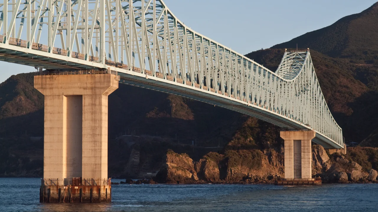
The Hirado and Sasebo area stretches across north-western Nagasaki Prefecture, linking the 208 islands of Sasebo's Kujukushima coast with Hirado Island via the vermilion Hirado Bridge and Ikitsuki Island via the light-blue truss spans of Ikitsuki Bridge. Along one continuous coastal drive sit the Kujukushima viewpoints at Tenkaiho and Yumiharidake, cruise boats at Kujukushima Pearl Sea Resort, Hirado Castle and the View of Temples and Churches, the sweeping grasslands of Kawachi Pass, and the cliffside Ikitsuki Sunset Way ending at Obae Lighthouse.
This guide follows a full-day drive from south Kujukushima (Tenkaiho) through central Hirado and Kawachi Pass to Obae Lighthouse at the northern tip of Ikitsuki Island, with every main road and stop listed below.
Map of the Hirado and Sasebo area
- Views and nature
- Roadside stations
- 1Tenkaiho
- 2Funakoshi Observatory
- 3Ishidake Observatory
- 4Kujukushima Pearl Sea Resort
- 5Yumiharidake Observatory
- 6Michi-no-Eki Sasebox 99
- 7Kosakibana Park
- 8Michi-no-Eki Konchu-no-Sato Tabira
- 9Tabira Tenshudo Church
- 10Hirado Castle
- 11Hirado Port Square (Temples & Churches View)
- 12Kawachi Pass
- 13Michi-no-Eki Ikitsuki Ohashi
- 14Ikitsuki Sunset Way
- 15Shiodawara Cliffs
- 16Obae Lighthouse
Line: 1 → 2 → 4 → 5 → 6 → 8 → 9 → 10 → 11 → 12 → 13 → 14 → 15 → 16
The map could not be loaded. Use the junction-by-junction directions below.
The line follows the full-day route below, "First visit: one day from Kujukushima via Hirado Bridge and the Ikitsuki Sunset Way to Obae Lighthouse". Numbers mark the stops: green for scenery and nature, blue for roadside stations. Tap a marker to see its name.
Recommended drives
First visit: one day from Kujukushima via Hirado Bridge and the Ikitsuki Sunset Way to Obae Lighthouse
Start at Tenkaiho (free parking for 88 cars), which looks across a 180-degree panorama of Southern Kujukushima, then visit low-lying Funakoshi Observatory, Kujukushima Pearl Sea Resort (for the Pearl Queen cruise ship and Umikirara Aquarium) and the 364 m Yumiharidake Observatory. Take Prefectural Route 11 to Michi-no-Eki Sasebox 99 beside Ainoura-Nakazato IC on the Nishi-Kyushu Expressway, then head north on Route 204 (or use the free Ainoura-Nakazato IC–Saza IC expressway section plus Route 204) to Michi-no-Eki Konchu-no-Sato Tabira and the red-brick Tabira Tenshudo Church, a National Important Cultural Property.
Cross the 665 m Hirado Bridge (toll-free) into Hirado Island for Hirado Castle and Hirado Port Exchange Square—walking to the Hirado Dutch Trading Post and the View of Temples and Churches—before climbing Prefectural Route 19 to the open grassland of Kawachi Pass. Continue west on Prefectural Routes 19 and 42 across the 960 m Ikitsuki Bridge (toll-free) to Michi-no-Eki Ikitsuki Ohashi, follow the west-coast Ikitsuki Sunset Way past the columnar basalt of Shiodawara Cliffs, and finish at Obae Lighthouse at the island's northern tip. Arriving from Fukuoka Airport or Imari via the Matsuura IC–Hirado IC free section, you can drive the same route in reverse from Ikitsuki and Hirado south to Sasebo.
The route is about 90 km, with around 2 hours 10 minutes of driving. Distance and time are calculated from map data and exclude traffic. Every road and bridge on the route is toll-free. To watch the sun sink into the East China Sea along the Ikitsuki Sunset Way or at Obae Lighthouse, cover Kujukushima and Hirado Town in the morning and cross to Ikitsuki Island in the afternoon.
Kujukushima Pearl Sea Resort parking and sat-nav setup for viewpoints
Kujukushima Pearl Sea Resort's car parks (668 ordinary cars and 18 large buses) have different free windows depending on the lot number. Car Parks No. 1 and No. 2 closest to the aquarium and pier are free for the first 30 minutes and cost ¥200 up to 4 hours (+¥100 per additional hour; No. 1 closes from 23:00 to 6:00), whereas Car Parks No. 3–5 slightly further away are free for the first 3 hours (¥200 up to 4 hours). Facility tickets and shops do not validate parking. On the water, the white sailing-style cruiser Pearl Queen runs ~50-minute cruises (¥2,200 for high-school age and over, ¥1,100 for ages 4 to junior high), while the pirate cruise ship Mirai is suspended until further notice.
Tenkaiho, Funakoshi Observatory, Ishidake Observatory and Yumiharidake Observatory have no on-site office telephone. The phone number shown on tourism listings (0956-22-6630) belongs to the Sasebo Tourist Information Center inside JR Sasebo Station, so entering it into a car sat-nav routes you to the station instead of the hills. Always set your destination by spot name or street address.
Central Hirado parking and high-wind bridge rules
Neither the "View of Temples and Churches" nor the Hirado Dutch Trading Post has general visitor parking on site. Park at the waterfront Hirado Port Exchange Square Car Park—about 5 minutes by car from Hirado Bridge, free for the first 2 hours and ¥100 per 30 minutes thereafter—to reach the Dutch Trading Post in about 5 minutes on foot and the View of Temples and Churches (and Hirado Xavier Memorial Church) in about 10 minutes. If you visit Hirado Castle first, Kameoka Park offers three free car parks (P1: 100 cars, P2: 20 cars, P3: 7 cars).
Both Hirado Bridge (Route 383) and Ikitsuki Bridge (Prefectural Route 42) have been toll-free since 1 April 2010, but both cross exposed straits with strict high-wind thresholds. Bridges close to two-wheelers at average wind speeds of 15 m/s or more, to pedestrians at 20 m/s or more, and to all four-wheeled ordinary and large vehicles at 25 m/s or more (as well as when snow or ice creates a skidding hazard). Check Hirado City's bridge traffic page before setting out on stormy or blustery days.
Roads you can drive
| Road | What to expect | Length and cost | Hours and restrictions |
|---|---|---|---|
| Nishi-Kyushu Expressway (Sasebo Road, Saza-Sasebo Road, Matsuura-Saza Road) | Motorway-standard approaches from Takeo JCT (Nagasaki Expressway) in the south-east and Fukuoka/Matsuura in the north-east | Driving strictly within Saza IC–Ainoura-Nakazato IC–Sasebo-Chuo IC (9.9 km) is free for both ETC and cash cars. Continuing through to Sasebo-Daito IC costs ordinary cars ETC ¥160 (cash ¥370) from Sasebo-Chuo or Sasebo-Minato IC, ETC ¥270 (cash ¥370) from Ainoura-Nakazato IC, and ¥370 from Saza IC. Matsuura IC–Hirado IC (7.5 km) is free | Saza IC–Hirado IC is still under construction, so use Route 204 between them. Daytime full closures run 9:00–16:00 on weekdays on Yamashiro-Kubara IC–Imafuku IC (30 November–4 December 2026) and Imafuku IC–Hirado IC (7–11 December 2026), excluding weekends; detour via Route 204 |
| National Route 204 | Mainland trunk road linking central Sasebo, Saza, Emukae, Tabira (Hirado Bridge approach) and Matsuura | Free | Main northward route from Saza IC past Michi-no-Eki Konchu-no-Sato Tabira (about 16 km) and Tabira Tenshudo Church to Hirado Bridge |
| National Route 383 and Hirado Bridge | Links Tabira on the mainland with Hirado Island via a 665 m vermilion truss suspension bridge 30 m above the sea | Free (toll-free since 1 April 2010) | Closes at wind speeds of 15 m/s+ for two-wheelers, 20 m/s+ for pedestrians, and 25 m/s+ for all cars and buses (also closes if snow or ice risks skidding) |
| Prefectural Route 42 (Hirado-Ikitsuki Line) and Ikitsuki Bridge | Crosses from north-west Hirado Island to Ikitsuki Island on a 960 m continuous truss bridge (31 m above the sea) and continues to Obae Lighthouse | Free (toll-free since 1 April 2010) | Same wind closure thresholds as Hirado Bridge. A 0.6 km section at Shiraishi in Shushi-cho closes preemptively at 60 mm/h, 120 mm/24h or 150 mm continuous rainfall |
| Ikitsuki Sunset Way (wide-area agricultural road) | About 10 km of open coastal road hugging western Ikitsuki Island's sea cliffs above the East China Sea | Free | Observation parking sits on the seaward side just north of Takanosu Tunnel; about 20 minutes from Ikitsuki Bridge, rejoining Prefectural Route 42 near Shiodawara Cliffs |
| Prefectural Route 19 (Hirado-Tabira Line) | Climbs from Hirado Port and town up to the Kawachi Pass grasslands and drops to north-western Hirado Island | Free | About 12–15 minutes by car from central Hirado to Kawachi Pass; descending west links directly to Prefectural Route 42 towards Ikitsuki Bridge without backtracking |
| Kujukushima viewpoint roads (SSK Bypass, Prefectural Route 11 and hill approaches) | Connects Sasebo-Chuo IC with Pearl Sea Resort, Funakoshi, Ishidake, Tenkaiho and Yumiharidake | Free | About 7 minutes from Sasebo-Chuo IC to Pearl Sea Resort and about 20 minutes to Tenkaiho; hill branches wind through bends, so keep speeds moderate |
Places to stop
Views and nature
Numbers match the map.
| No. | Place | Parking | What to know |
|---|---|---|---|
| 1 | Tenkaiho (beside Kujukushima Tourist Park) | Free parking: 88 ordinary cars (2 accessible), 8 buses | 180-degree view over Southern Kujukushima at 165 m elevation, open 24 hours. Around 150,000 rapeseed flowers bloom late March–early April and 150,000 cosmos mid–late October. Next-door Kujukushima Tourist Park (250 cars, 30 buses; free) opens 8:00–20:00 (until 19:00 in October–February) |
| 2 | Funakoshi Observatory | Free parking: 11 spaces | Lowest elevation of the Eight Views of Kujukushima, offering step-free barrier-free views right above the water and islands; about 18 minutes from Sasebo-Chuo IC |
| 3 | Ishidake Observatory | Free parking: 30 spaces | 191 m summit viewpoint filmed for the opening panorama of The Last Samurai; short walk up a footpath from the car park |
| 4 | Kujukushima Pearl Sea Resort | 668 ordinary cars, 18 buses (No. 1–2: 30 min free; No. 3–5: 3 h free; ¥200 up to 4 h) | About 7 minutes from Sasebo-Chuo IC. Pearl Queen cruises (~50 min) cost ¥2,200 high-school+ and ¥1,100 ages 4–junior high; pirate ship Mirai is suspended until further notice. Umikirara Aquarium opens 9:00–18:00 (until 17:00 in November–February, last entry 30 min prior), ¥1,470 high-school+ and ¥730 ages 4–junior high |
| 5 | Yumiharidake Observatory | Free parking: 77 ordinary cars, 8 buses | 364 m viewpoint overlooking Kujukushima and Goto Nada to the west and Sasebo Port and shipyards to the south-east; popular for sunset and night views |
| 7 | Kosakibana Park (westernmost mainland point) | Free parking | Westernmost point of mainland Japan (33°12'N, 129°33'E). Show a photo from the park at Michi-no-Eki Sasebox 99 Meihin-kan (9:00–18:00) or Sasebo Station Tourist Information to receive a free arrival certificate |
| 9 | Tabira Tenshudo Church | Free parking | Red-brick Catholic church built in 1918 by Tetsukawa Yosuke and designated a National Important Cultural Property; about 8 minutes by car towards Sasebo from Hirado Bridge (interior closed during Mass and ceremonies) |
| 10 | Hirado Castle (Kameoka Castle) | Free parking: P1 (100 cars), P2 (20 cars), P3 (7 cars) | About 5 minutes by car from Hirado Bridge, with strait and bridge views from the keep. Open 8:30–18:00 (until 17:00 in October–March; closed 30–31 December); adults ¥520, high school ¥310, elementary/junior high ¥200 |
| 11 | Hirado Port Exchange Square (Temples & Churches View and Dutch Trading Post) | First 2 hours free, then ¥100 per 30 min | Central waterfront base for walking Hirado (beside free hot-spring foot and hand baths). Hirado Dutch Trading Post is 5 minutes on foot (8:30–17:30, last entry 17:00, closed 3rd Tue–Thu of June; adults ¥310, students ¥210); the View of Temples and Churches (Komyozji, Zuiunji and Xavier Memorial Church) is 10 minutes up the slope |
| 12 | Kawachi Pass | Free parking and toilets | Roughly 30 ha of open hilltop grassland looking out over Kujukushima, the Genkai Sea, and on clear days Iki and Tsushima; about 15 minutes by car from central Hirado |
| 14 | Ikitsuki Sunset Way | Free observation parking | Roughly 10 km west-coast scenic road on Ikitsuki Island with seaward pull-offs north of Takanosu Tunnel facing East China Sea sunsets |
| 15 | Shiodawara Cliffs | Free parking | About 25 minutes by car from Ikitsuki Bridge; columnar basalt cliffs stretching 500 m north–south and rising about 20 m above the surf |
| 16 | Obae Lighthouse | Free parking and toilets | About 30 minutes by car from Ikitsuki Bridge on ~80 m cliffs at Ikitsuki's northern tip; an outside staircase climbs onto the white lighthouse's own observation deck for near-360-degree ocean views |
Roadside stations
| No. | Roadside station | Parking | What to know |
|---|---|---|---|
| 6 | Michi-no-Eki Sasebox 99 | 84 ordinary, 8 large; free | 1 minute by car from Ainoura-Nakazato IC on the Nishi-Kyushu Expressway. Meihin-kan shop around 9:00–18:00, Food-kan around 7:00–15:00 (varies by tenant). Toilets and rest/info corner open 24 hours; 2 EV chargers |
| 8 | Michi-no-Eki Konchu-no-Sato Tabira | 32 ordinary, 6 large; free | On Route 204 about 16 km north of Saza IC, marked by a giant rhinoceros-beetle monument. Shop and rest room 9:00–19:00 (closed 31 December–2 January); toilets open 24 hours |
| 13 | Michi-no-Eki Ikitsuki Ohashi | 46 ordinary, 4 large; free | Set in the waterfront park right across Ikitsuki Bridge. Shop and tourist desk 8:30–17:30 (until 18:00 in August; closed 31 December–1 January); toilets open 24 hours; 1 EV charger |
Best seasons and crowds
| Season | Highlights and cautions |
|---|---|
| Late March–early April | 150,000 rapeseed blossoms at Tenkaiho overlap with cherry blossoms around Hirado Castle, filling car parks near Kujukushima Pearl Sea Resort |
| April–October | Fresh green grass across Kawachi Pass and clear East China Sea sunsets along the Ikitsuki Sunset Way; Hirado Port Exchange Square Car Park often fills around midday on summer and holiday weekends |
| Mid-October–November | 150,000 cosmos at Tenkaiho (mid–late October) and silver grass on Kawachi Pass, with crisp visibility out towards Iki and Tsushima |
| 30 November–11 December 2026 (weekdays) | Daytime full closures (9:00–16:00 on weekdays) on the Nishi-Kyushu Expressway between Yamashiro-Kubara IC and Imafuku IC (30 November–4 December) and between Imafuku IC and Hirado IC (7–11 December); detour via Route 204 |
| December–February | North-westerly winter monsoons can push winds past bridge limits on Hirado Bridge and Ikitsuki Bridge (closed at 15 m/s+ for two-wheelers and 25 m/s+ for cars); controlled grass burning takes place at Kawachi Pass in early February |
Sunrise is at 6:49 and sunset at 17:20 on 14 November 2026, and sunrise is at 7:03 and sunset at 17:14 on 30 November (Nagasaki).
Roads and restrictions checked on 14 November 2026
- On the Nishi-Kyushu Expressway (Matsuura-Saza Road), the 7.5 km free section between Matsuura IC and Hirado IC opened on 14 December 2025, while Saza IC–Hirado IC remains under construction (use Route 204).
- Daytime weekday closures (9:00–16:00, excluding weekends) are scheduled on the Nishi-Kyushu Expressway from Yamashiro-Kubara IC to Imafuku IC on 30 November–4 December 2026 (reserve days 7–9 December) and from Imafuku IC to Hirado IC on 7–11 December 2026 (reserve days 14–18 December), with signed detours on Route 204.
- Both Hirado Bridge and Ikitsuki Bridge are open normally as of 14 November 2026. In strong winds they close at 15 m/s+ for two-wheelers, 20 m/s+ for pedestrians and 25 m/s+ for four-wheeled vehicles; the 0.6 km Shiraishi cliff section on Prefectural Route 42 closes preemptively in heavy rain.
- At Kujukushima Pearl Sea Resort, the pirate cruise ship Mirai is suspended until further notice; cruises operate aboard the Pearl Queen.
Getting there and fuel
| Starting point | Approximate drive |
|---|---|
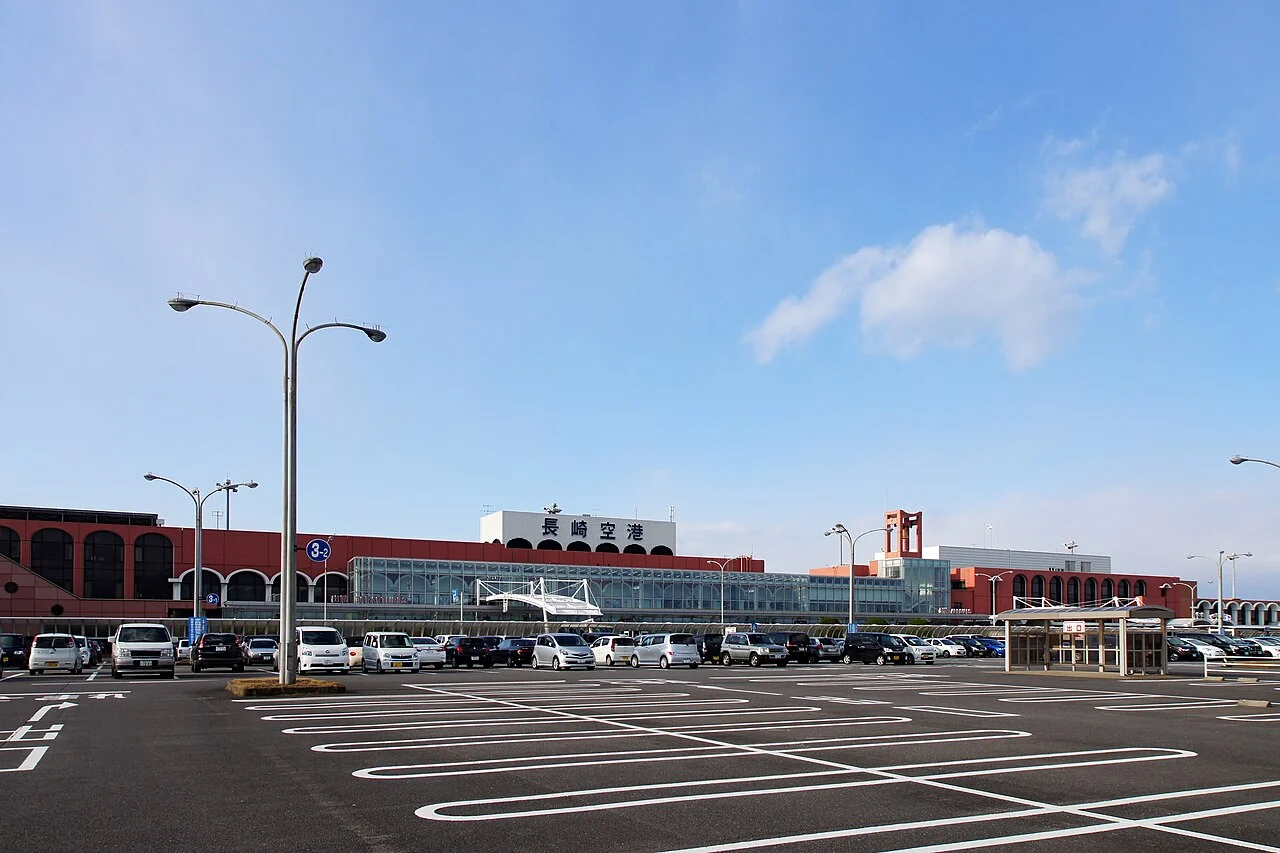
| Nagasaki Airport | About 57 km and 1 hour 20 minutes to Kujukushima Pearl Sea Resort via Route 205 and the Nishi-Kyushu Expressway; about 61 km and 1 hour 25 minutes to Tenkaiho |
| Fukuoka Airport / Hakata Station | About 123 km and 2 hours to Hirado Port Exchange Square via the Nishi-Kyushu Expressway (Karatsu, Imari and the free Matsuura IC–Hirado IC section); about 131 km and 2 hours 5 minutes to Pearl Sea Resort via the Kyushu, Nagasaki and Nishi-Kyushu Expressways |
| Kyushu Saga International Airport | About 93 km and 1 hour 30 minutes to Kujukushima Pearl Sea Resort via the Nagasaki and Nishi-Kyushu Expressways |
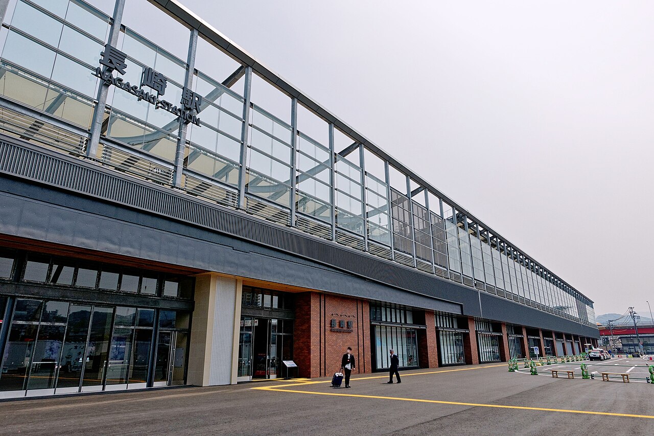
| Nagasaki Station | About 70 km and 1 hour 10 minutes to Kujukushima Pearl Sea Resort via the Nagasaki and Nishi-Kyushu Expressways |
| Nishi-Kyushu Expressway, Sasebo-Chuo IC | About 7 minutes to Pearl Sea Resort, about 18 minutes to Funakoshi Observatory, about 20 minutes to Tenkaiho, and about 25 minutes to Yumiharidake Observatory |
| Hirado Bridge | About 5 minutes to Hirado Castle and Hirado Port Exchange Square, about 15 minutes to Kawachi Pass, about 25 minutes to Ikitsuki Bridge, and about 50 minutes to Obae Lighthouse |
There are no service areas or petrol stations on the Nishi-Kyushu Expressway between Saza IC and Sasebo-Daito IC or between Matsuura IC and Hirado IC, and none of the 3 roadside stations has a fuel pump. Because there are no stations along the Ikitsuki Sunset Way or up at Kawachi Pass either, top up in central Sasebo, along Route 204 (Saza to Tabira) or in central Hirado near Hirado Bridge before crossing to Ikitsuki Island. EVs can charge at Michi-no-Eki Sasebox 99 (2 chargers) and Michi-no-Eki Ikitsuki Ohashi (1 charger).
If you don't have a car
Drivers enter Hirado and Sasebo easily from Nagasaki Airport, Nagasaki Station, Fukuoka Airport or Saga Airport. For pickups inside Nagasaki Prefecture, compare branches in the Nagasaki Airport car rental comparison, the Nagasaki Station car rental comparison and the Nagasaki car rental guide. Coming from northern Kyushu, check the Fukuoka Airport car rental comparison, the Hakata Station car rental comparison and the Saga Airport car rental comparison. To save on the tolled Sasebo-Daito IC–Sasebo-Chuo IC expressway link, read how to rent an ETC card, and if you plan to fly into Fukuoka and out of Nagasaki, check one-way car rental fees and rules.
Frequently asked questions
Where should I drive with one day in Hirado, Sasebo and Ikitsuki?
Start at Tenkaiho and work north through Funakoshi Observatory, Kujukushima Pearl Sea Resort and Yumiharidake Observatory, stop at Michi-no-Eki Sasebox 99, Michi-no-Eki Konchu-no-Sato Tabira and Tabira Tenshudo Church, cross Hirado Bridge for Hirado Castle, Hirado Port Exchange Square (the Dutch Trading Post and View of Temples and Churches) and Kawachi Pass, then cross Ikitsuki Bridge for the Ikitsuki Sunset Way, Shiodawara Cliffs and Obae Lighthouse. The drive is about 90 km and around 2 hours 10 minutes before stops. From Fukuoka Airport or Imari, follow the same route in reverse from Ikitsuki and Hirado.
Are Hirado Bridge, Ikitsuki Bridge and the Nishi-Kyushu Expressway free?
Both Hirado Bridge (Route 383) and Ikitsuki Bridge (Prefectural Route 42) have been toll-free since 1 April 2010. On the Nishi-Kyushu Expressway, driving strictly within Saza IC–Ainoura-Nakazato IC–Sasebo-Chuo IC (9.9 km) and on the northern Matsuura IC–Hirado IC section (7.5 km) is free. Tolls apply only when driving south through Sasebo-Chuo IC to or from Sasebo-Daito IC: ordinary cars pay ETC ¥160 (cash ¥370) from Sasebo-Chuo or Sasebo-Minato IC, ETC ¥270 (cash ¥370) from Ainoura-Nakazato IC, and ¥370 from Saza IC.
Where is the best place to park at Kujukushima Pearl Sea Resort and in central Hirado?
At Kujukushima Pearl Sea Resort (668 ordinary spaces), Car Parks No. 1–2 give 30 minutes free whereas Car Parks No. 3–5 give 3 hours free (all ¥200 up to 4 hours), making No. 3–5 better value if you combine a cruise and the aquarium. In central Hirado, neither the View of Temples and Churches nor the Dutch Trading Post has general parking, so use Hirado Port Exchange Square Car Park (first 2 hours free, then ¥100 per 30 minutes) or the free Hirado Castle car parks (100 spaces in P1).
What should I watch out for when entering Kujukushima viewpoints into a car sat-nav?
Tenkaiho, Funakoshi Observatory, Ishidake Observatory and Yumiharidake Observatory do not have on-site telephone numbers; the listed contact number (0956-22-6630) is for the Sasebo Tourist Information Center inside JR Sasebo Station. Do not search by phone number on your sat-nav—enter the viewpoint name or street address instead.
Can I cross Hirado Bridge and Ikitsuki Bridge in strong winds or winter?
Both bridges stay open year-round under normal weather, but they close at average wind speeds of 15 m/s or more for two-wheelers, 20 m/s or more for pedestrians, and 25 m/s or more for all four-wheeled cars and buses (and whenever snow or ice risks skidding). Check Hirado City's bridge traffic page before driving on days with strong winter monsoons or approaching typhoons.
Nearby areas and guides
Sources & photo creditsLast verified 2026-11-14
- NEXCO West Japan (official page, in Japanese) · 2026-11-14
- MLIT Kyushu Regional Development Bureau (official page, in Japanese) · 2026-11-14
- MLIT Kyushu Regional Development Bureau (official page, in Japanese) · 2026-11-14
- NEXCO West Japan (official page, in Japanese) · 2026-11-14
- MLIT Kyushu Regional Development Bureau (official page, in Japanese) · 2026-11-14
- MLIT Kyushu Regional Development Bureau (official page, in Japanese) · 2026-11-14
- MLIT Kyushu Regional Development Bureau (official page, in Japanese) · 2026-11-14
- Nagasaki Prefecture Road Traffic Information (official page, in Japanese) · 2026-11-14
- Hirado Tourist Association (official page, in Japanese) · 2026-11-14
- Nagasaki Prefecture (official page, in Japanese) · 2026-11-14
- Hirado City (official page, in Japanese) · 2026-11-14
- Hirado Tourist Association (official page, in Japanese) · 2026-11-14
- Hirado City (official page, in Japanese) · 2026-11-14
- Hirado Tourist Association (official page, in Japanese) · 2026-11-14
- Nagasaki Tabinet (Nagasaki Prefectural Tourism Federation) (official page, in Japanese) · 2026-11-14
- Hirado Tourist Association (official page, in Japanese) · 2026-11-14
- Nagasaki Tabinet (Nagasaki Prefectural Tourism Federation) (official page, in Japanese) · 2026-11-14
- Kujukushima Pearl Sea Resort (official page, in Japanese) · 2026-11-14
- Sasebo Tourist Information Center (official page, in Japanese) · 2026-11-14
- Sasebo Tourist Information Center (official page, in Japanese) · 2026-11-14
- Sasebo Tourist Information Center (official page, in Japanese) · 2026-11-14
- Sasebo Tourist Information Center (official page, in Japanese) · 2026-11-14
- Sasebo Tourist Information Center (official page, in Japanese) · 2026-11-14
- Sasebo Tourist Information Center (official page, in Japanese) · 2026-11-14
- Kujukushima Cruising (official page, in Japanese) · 2026-11-14
- Kujukushima Aquarium Umikirara (official page, in Japanese) · 2026-11-14
- Kujukushima Cruising (official page, in Japanese) · 2026-11-14
- Kujukushima Aquarium Umikirara (official page, in Japanese) · 2026-11-14
- Sasebo Tourist Information Center (official page, in Japanese) · 2026-11-14
- Hirado Tourist Association (official page, in Japanese) · 2026-11-14
- Hirado Castle (official page, in Japanese) · 2026-11-14
- Nagasaki Tabinet (Nagasaki Prefectural Tourism Federation) (official page, in Japanese) · 2026-11-14
- Hirado Castle (official page, in Japanese) · 2026-11-14
- Hirado Tourist Association (official page, in Japanese) · 2026-11-14
- Hirado Dutch Trading Post (official page, in Japanese) · 2026-11-14
- Hirado Tourist Association (official page, in Japanese) · 2026-11-14
- Nagasaki Tabinet (Nagasaki Prefectural Tourism Federation) (official page, in Japanese) · 2026-11-14
- Hirado Tourist Association (official page, in Japanese) · 2026-11-14
- Nagasaki Tabinet (Nagasaki Prefectural Tourism Federation) (official page, in Japanese) · 2026-11-14
- Hirado Tourist Association (official page, in Japanese) · 2026-11-14
- Nagasaki Tabinet (Nagasaki Prefectural Tourism Federation) (official page, in Japanese) · 2026-11-14
- MLIT Kyushu Regional Development Bureau (official page, in Japanese) · 2026-11-14
- Michi-no-Eki Sasebox 99 (official page, in Japanese) · 2026-11-14
- Sasebo Tourist Information Center (official page, in Japanese) · 2026-11-14
- MLIT Kyushu Regional Development Bureau (official page, in Japanese) · 2026-11-14
- MLIT Kyushu Regional Development Bureau (official page, in Japanese) · 2026-11-14
- MLIT Kyushu Regional Development Bureau (official page, in Japanese) · 2026-11-14
- Hirado Tourist Association (official page, in Japanese) · 2026-11-14
- National Astronomical Observatory of Japan (official page, in Japanese) · 2026-11-14
- Japan Meteorological Agency (official page, in Japanese) · 2026-11-14
- Japan Meteorological Agency (official page, in Japanese) · 2026-11-14
- OpenStreetMap (map positions and route; © OpenStreetMap contributors, ODbL; route calculated with OSRM) · 2026-11-14